MyTopo
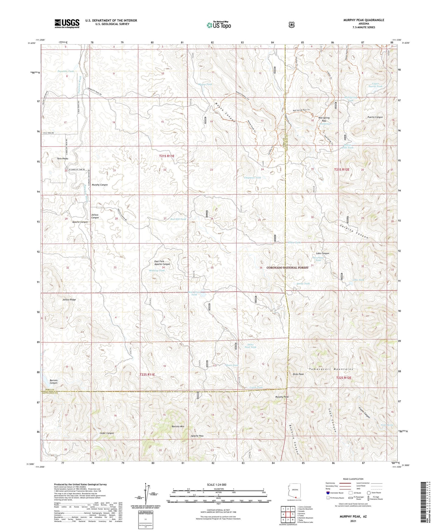
Murphy Peak Arizona US Topo Map
Couldn't load pickup availability
Also explore the Murphy Peak Forest Service Topo of this same quad for updated USFS data
2021 topographic map quadrangle Murphy Peak in the state of Arizona. Scale: 1:24000. Based on the newly updated USGS 7.5' US Topo map series, this map is in the following counties: Pima, Santa Cruz. The map contains contour data, water features, and other items you are used to seeing on USGS maps, but also has updated roads and other features. This is the next generation of topographic maps. Printed on high-quality waterproof paper with UV fade-resistant inks.
Quads adjacent to this one:
West: Arivaca
Northwest: Cerro Colorado
North: Saucito Mountain
Northeast: Amado
East: Tubac
Southeast: Pena Blanca Lake
South: Ruby
Southwest: Bartlett Mountain
This map covers the same area as the classic USGS quad with code o31111e2.
Contains the following named places: Amole Tank, Apache Canyon, Apache Pass, Apache Pass Dam, Apache Well, Bartolo Canyon, Bartolo Mountain, Bear Grass Tank, Beehive Dam, Cajon Tank, Cedar Dam, Cedar Well, Cedar Windmill, Chapman Tank, Clifford Well, Dicks Peak, Dicks Peak Tank, Diversion Tank, Dry Dam, East Fork Apache Canyon, Indian Hills Tank, Jalisco Canyon, Jalisco Dam, Jalisco Ridge, Jalisco Well, Lobo Canyon, Lobo Tank, Lower Sardina Well, Middle Sardina Dam, Midway Tank, Midway Well, Moyza Tank, Moyza Well, Murphy Canyon, Murphy Peak, Murphy Well, Noon Tank, Papalote Tank, Papalote Well, Red Hill Tank, Red Spring, Red Spring Pass, Red Spring Tank, Sardina Dam, Sardina Well, Turtle Spring, Twin Peaks, Upper Puerto Tank, White Tank