MyTopo
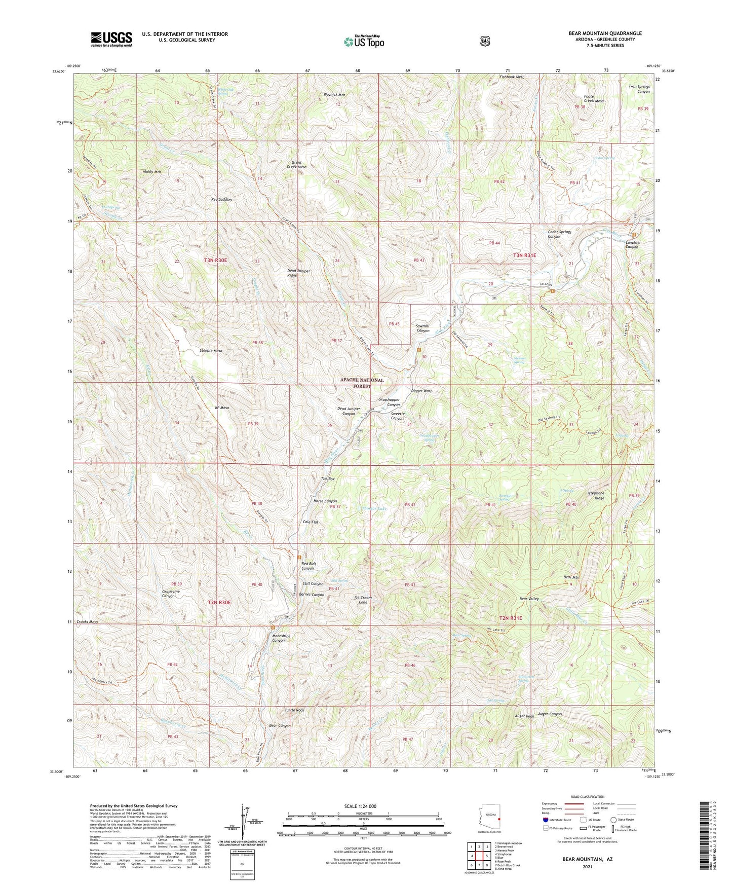
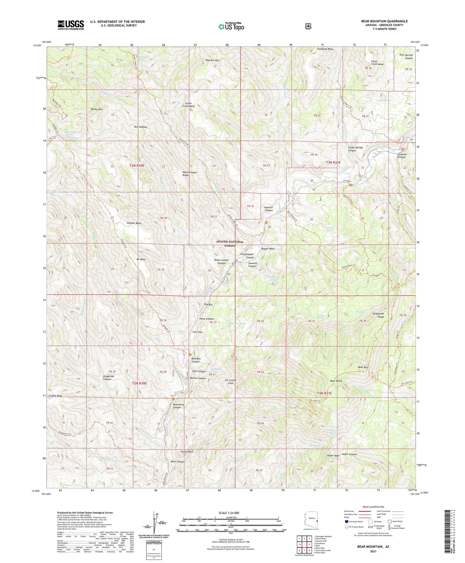
Bear Mountain Arizona US Topo Map
Couldn't load pickup availability
Also explore the Bear Mountain Forest Service Topo of this same quad for updated USFS data
2021 topographic map quadrangle Bear Mountain in the state of Arizona. Scale: 1:24000. Based on the newly updated USGS 7.5' US Topo map series, this map is in the following counties: Greenlee. The map contains contour data, water features, and other items you are used to seeing on USGS maps, but also has updated roads and other features. This is the next generation of topographic maps. Printed on high-quality waterproof paper with UV fade-resistant inks.
Quads adjacent to this one:
West: Strayhorse
Northwest: Hannagan Meadow
North: Beaverhead
Northeast: Maness Peak
East: Blue
Southeast: Alma Mesa
South: Dutch Blue Creek
Southwest: Rose Peak
This map covers the same area as the classic USGS quad with code o33109e2.
Contains the following named places: A Spring, Auger Peak, Balke Crossing, Barnes Canyon, Bear Canyon, Bear Mountain, Bear Mountain Lookout, Bear Spring, Blue Camp Administrative Site, Blue Range Primitive Area, Blue Ranger Station, Cedar Spring, Cedar Springs Canyon, Cole Flat, Coleman Ranch, Cosper, Dead Juniper Canyon, Dead Juniper Ridge, Diaper Wash, Downs Cabin, Fishhook Creek, Fishhook Mesa, Foote Creek, Grant Creek, Grant Creek Mesa, Grapevine Canyon, Grasshopper Canyon, Grasshopper Spring, Horse Canyon, Ice Cream Cone, K Bar K Ranch, KP Creek, KP Mesa, Lanphier Canyon, Largo Creek, Lee Cabin, Mangrum Spring, McKittrick Creek, Moonshine Canyon, Mud Spring, Muhly Mountain, Open Flat Corral, Owl Spring, Panther Creek, Raspberry Creek, Red Bull Canyon, Red Saddles, Reynolds Ranch, Richardson Cabin, Robart Ranch, Sawmill Canyon, Steeple Creek, Steeple Mesa, Steeple Mesa Seventy-Three Trail, Stevens Spring, Still Canyon, Still Spring, Sweetie Canyon, Sweetie Spring, Telephone Ridge, The Box, Thomas Lake, Tolbert Cabin, Turtle Rock, Waynick Mountain, White Oak Spring