MyTopo
Chrome Butte Arizona US Topo Map
Couldn't load pickup availability
Also explore the Chrome Butte Forest Service Topo of this same quad for updated USFS data
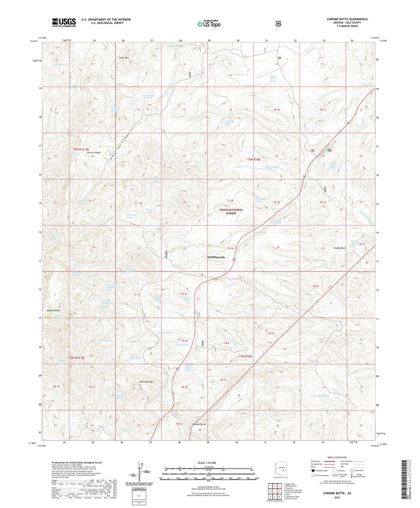
2021 topographic map quadrangle Chrome Butte in the state of Arizona. Scale: 1:24000. Based on the newly updated USGS 7.5' US Topo map series, this map is in the following counties: Gila. The map contains contour data, water features, and other items you are used to seeing on USGS maps, but also has updated roads and other features. This is the next generation of topographic maps. Printed on high-quality waterproof paper with UV fade-resistant inks.
Quads adjacent to this one:
West: Rockinstraw Mountain
Northwest: Dagger Peak
North: Haystack Butte
Northeast: Chrysotile
East: Sevenmile Mountains
Southeast: Dourine Canyon
South: Cammerman Wash
Southwest: Globe
This map covers the same area as the classic USGS quad with code o33110e6.
Contains the following named places: Apache Peaks, Bixby Well Number Two, Bootleg Spring, Butte Tank, Chalky Butte, Chalky Butte Well, Chrome Butte, Coburn Spring, Coburn Spring Number Two, Coburn Tank, Coburn Well, Corral Canyon Spring, Cottonwood Well, Double Corral Spring, Dry Mesa Dam, Dry Mesa Tank, Griffin Ranch, Hudson Spring, Indian Garden Spring, Indian Garden Well, Jones Water Campground, Last Chance Spring, Left Fork Honeysuckle Spring, Little Buttes Well, Little Pipe Spring, Little Richmond Tank, Little Woodcamp Spring, Lower Wood Camp Spring, McMillanville Town Well, McMillianville, Montes Spring, Mud Spring, Oak Spring, Oakie Spring, Old Owen McMillan Mine, Richmond Mountain, Richmond Spring, Right Fork Honeysuckle Spring, Rock Hole Spring, Rock Spring, Saint John Tank, Seven Mile Well, Slinkard Spring, Steer Mountain, Storm Canyon Spring, Stutter Spring, Surveyor Spring, Sycamore Spring, Trap Mesa Spring, Upper Cox Canyon Spring, Upper Yankee Joe Spring, Walnut Spring, Willow Spring, Winters Ranch, Winters Well, Woodcamp Spring, Yankee Joe Spring