MyTopo
Inspiration Arizona US Topo Map
Couldn't load pickup availability
Also explore the Inspiration Forest Service Topo of this same quad for updated USFS data
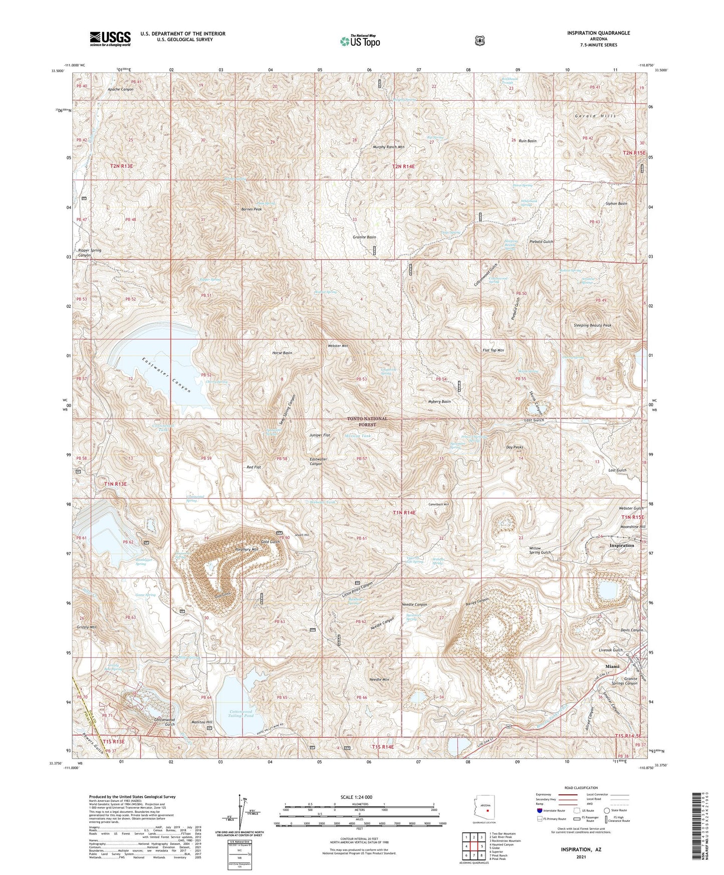
2021 topographic map quadrangle Inspiration in the state of Arizona. Scale: 1:24000. Based on the newly updated USGS 7.5' US Topo map series, this map is in the following counties: Gila, Pinal. The map contains contour data, water features, and other items you are used to seeing on USGS maps, but also has updated roads and other features. This is the next generation of topographic maps. Printed on high-quality waterproof paper with UV fade-resistant inks.
Quads adjacent to this one:
West: Haunted Canyon
Northwest: Two Bar Mountain
North: Salt River Peak
Northeast: Rockinstraw Mountain
East: Globe
Southeast: Pinal Peak
South: Pinal Ranch
Southwest: Superior
This map covers the same area as the classic USGS quad with code o33110d8.
Contains the following named places: Allred Canyon, Amateur Spring, Apache Canyon, Barnes Peak, Barnes Spring, Barney Canyon, Benjamin Franklin School, Black Bess Shaft, Black Tunnel, Bloody Tanks, Blue Bird Mine Open Pit, Bohme Ranch, Bohme Spring, Bonanza Tunnel, Bootlegger Spring, Bubbling Well, Buckhorn Spring, Bullion Plaza Cultural Center and Museum, Camelback Mountain, Carlota Mine, Carlota Tank, Castle Dome Concentrator, Castle Dome Mine, Cherry Spring, Continental Spring, Continental Tank, Continental Tunnel, Copper Cities Tailings Dam Number Nine, Copper Cities Tailings Dam Number Ten, Copper City Mine Open Pit, Cottonwood Gulch, Cottonwood Spring, Cottonwood Tailings Pond, Cottonwood Wash Dam, Dago Spring, Davis Canyon, Day Peaks, Dixon Camp, Dixon Spring, Duquesne Spring, Eastwater Spring, Flat Top Mountain, Fly Ranch, Giacoma Camp, Gold Gulch Dam, Goose Spring, Granite Basin, Granite Springs Canyon, Grapevine Spring, Grizzly Bear Spring, Grizzly Mountain, Hamilton Shaft, Horrel Ranch, Horse Basin, Horse Tank, Inspiration, Inspiration Main Shafts, Inspiration Post Office, Inspiration Tunnel, Jewell Hill, Juniper Flat, Juniper Flat Tank, Little Pinto Canyon, Liveoak Gulch, Liveoak Mine, Liveoak Shaft, Lost Gulch, Manitou Hill, Mexican Tank, Miami Division, Miller Spring, Money Metal Shaft, Moonshine Hill, Murphy Ranch Mountain, Murphy Spring, Murphy Wash, Myberg Basin, Needle Canyon, Needle Mountain, Peak Spring, Piebald Gulch, Piebald Well, Pinto Shaft, Pinto Valley Mine, Pinto Valley Mine Open Pit, Pinto Valley Tailings Dam Number One, Pinto Valley Tailings Dam Number Three, Pinto Valley Tailings Dam Number Two, Porphyry Mountain, Potato Patch, Prince Charming Spring, Red Flat, Rip Spring, Ripper Spring, Ripper Spring Canyon, Rockhouse Trough, Ruin Basin, Scanlon Tunnel, Scanlon Wash, Seep Spring Canyon, Silver Belt Shaft, Siphon Basin, Skunk Canyon, Skunk Spring, Sleeping Beauty Peak, Sleeping Beauty Spring, Smelter Canyon, Sulphide Tunnels, Sycamore Spring, Vigor of Life Spring, Walnut Spring, Webster Gulch, Webster Mountain, Webster Spring, Webster Tank, Whitebank Spring, Williams Dairy, Willow Spring Gulch, Yo Tambien Tunnel