
MyTopo
Colorado City Arizona US Topo Map
Couldn't load pickup availability
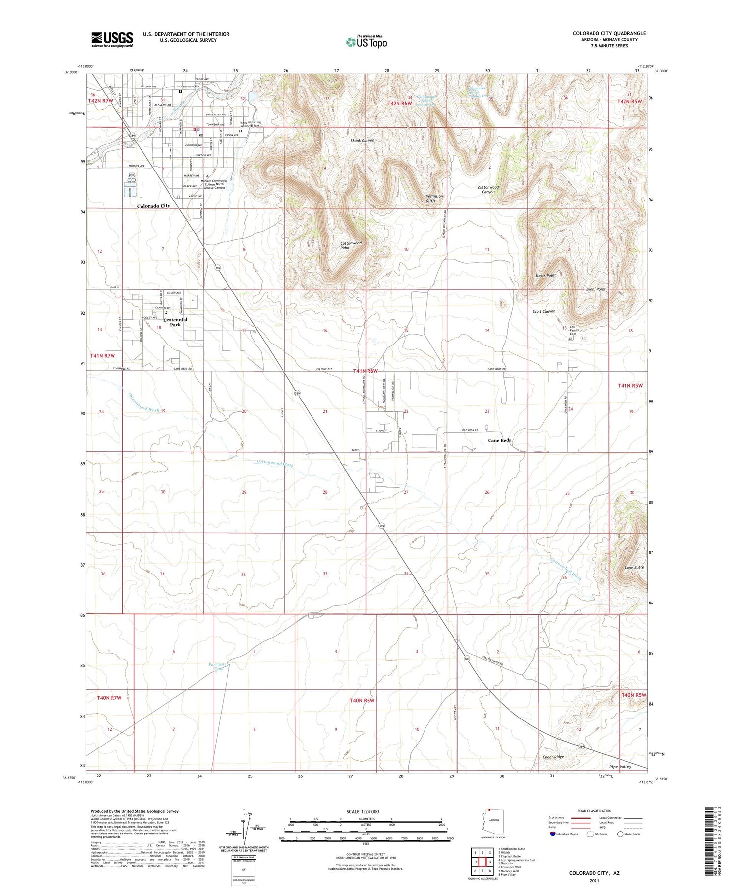
2021 topographic map quadrangle Colorado City in the state of Arizona. Scale: 1:24000. Based on the newly updated USGS 7.5' US Topo map series, this map is in the following counties: Mohave. The map contains contour data, water features, and other items you are used to seeing on USGS maps, but also has updated roads and other features. This is the next generation of topographic maps. Printed on high-quality waterproof paper with UV fade-resistant inks.
Quads adjacent to this one:
West: Lost Spring Mountain East
Northwest: Smithsonian Butte
North: Hildale
Northeast: Elephant Butte
East: Moccasin
Southeast: Pipe Valley
South: Maroney Well
Southwest: Formaster Well
This map covers the same area as the classic USGS quad with code o36112h8.
Contains the following named places: Cane Beds, Cane Beds Census Designated Place, Centennial Park Census Designated Place, Colorado City, Colorado City Elementary School, Colorado City Fire Department, Colorado City Police Department, Colorado City Post Office, Cottonwood Canyon, Cottonwood Point, Cottonwood Point Wilderness, Cottonwood Spring Number One, Cottonwood Spring Number Three, Cottonwood Wash, Cox Family Cemetery, Formaster Tank, Isaac Carling Memorial Park, Lone Butte, Lyons Point, Masada Charter School, Mohave Community College North Mohave Campus, Scott Canyon, Scotts Point, Short Creek Reservoir Number Two, Short Creek Reservoir Number Two Dam, Short Creek Southside Number Two, Short Creek Southside Number Two Dam, Sungabi Creek, Town of Colorado City


