MyTopo
Samaniego Peak Arizona US Topo Map
Couldn't load pickup availability
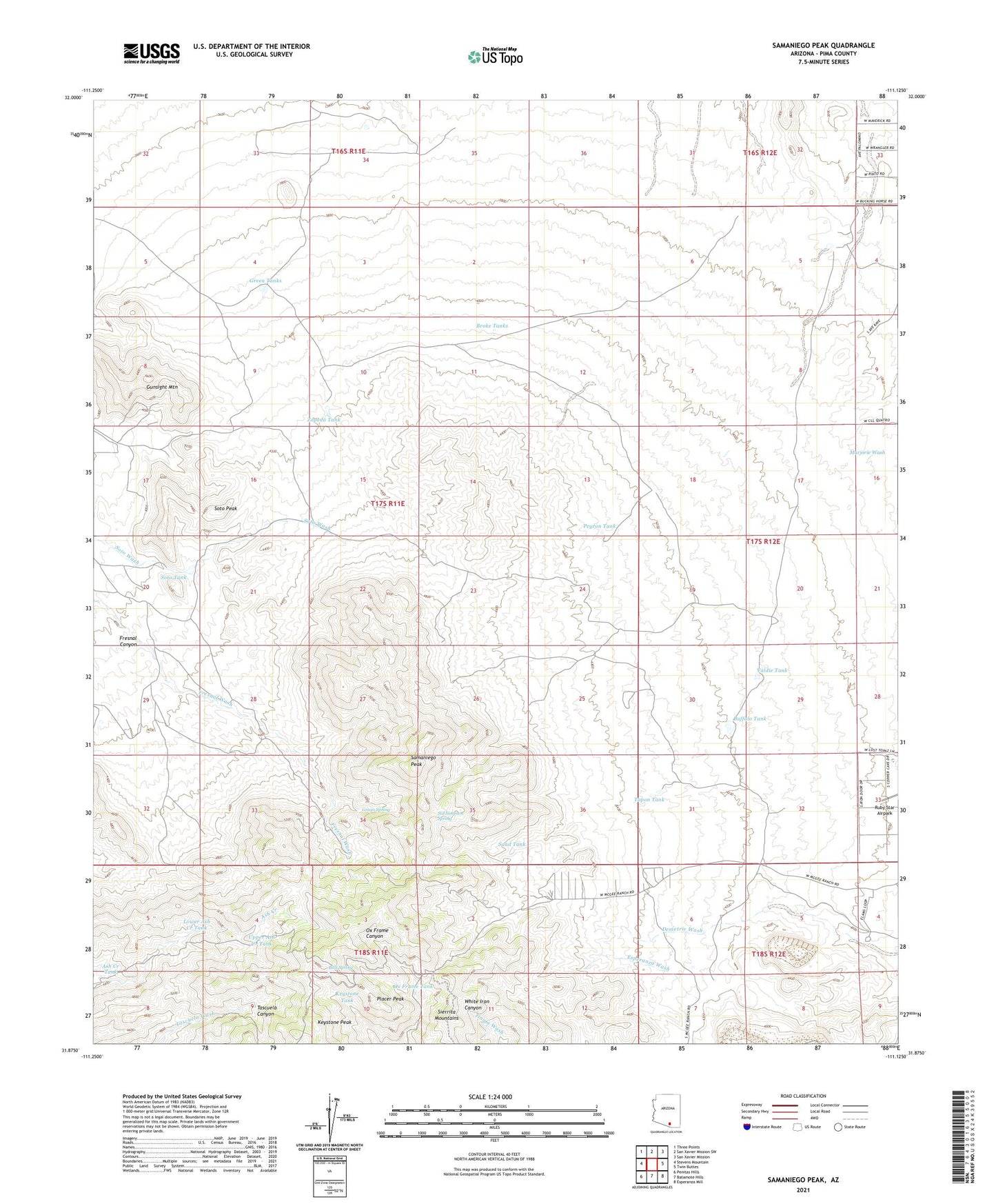
2021 topographic map quadrangle Samaniego Peak in the state of Arizona. Scale: 1:24000. Based on the newly updated USGS 7.5' US Topo map series, this map is in the following counties: Pima. The map contains contour data, water features, and other items you are used to seeing on USGS maps, but also has updated roads and other features. This is the next generation of topographic maps. Printed on high-quality waterproof paper with UV fade-resistant inks.
Quads adjacent to this one:
West: Stevens Mountain
Northwest: Three Points
North: San Xavier Mission SW
Northeast: San Xavier Mission
East: Twin Buttes
Southeast: Esperanza Mill
South: Batamote Hills
Southwest: Penitas Hills
This map covers the same area as the classic USGS quad with code o31111h2.
Contains the following named places: Ash Creek Tank, Bills Spring, Broke Tanks, Buffalo Tank, Fortuna Mine, Fresnal Canyon, Grays Spring, Green Tanks, Gunsight Mountain, Gunsight Ranch, Keystone Peak, Keystone Tank, La Canada Ranch, Lower Ash Creek Tank, Lower Sierrita Well, McGee Ranch, McGee School, Mickey Rye Well, Ox Frame Tank, Peyron Tank, Pino Blanco Ranch, Placer Peak, Ranch Tank, Samaniego Peak, Sand Tank, Shloh Well, Sid Simpson Spring, Sierrita Mine West Pit, Sierrita Mountains, Soto Peak, Soto Tank, Tapon Tank, Upper Ash Creek Tank, Valdie Tank, Zapeda Tank, Zapeda Well