MyTopo
Meddler Wash Arizona US Topo Map
Couldn't load pickup availability
Also explore the Meddler Wash Forest Service Topo of this same quad for updated USFS data
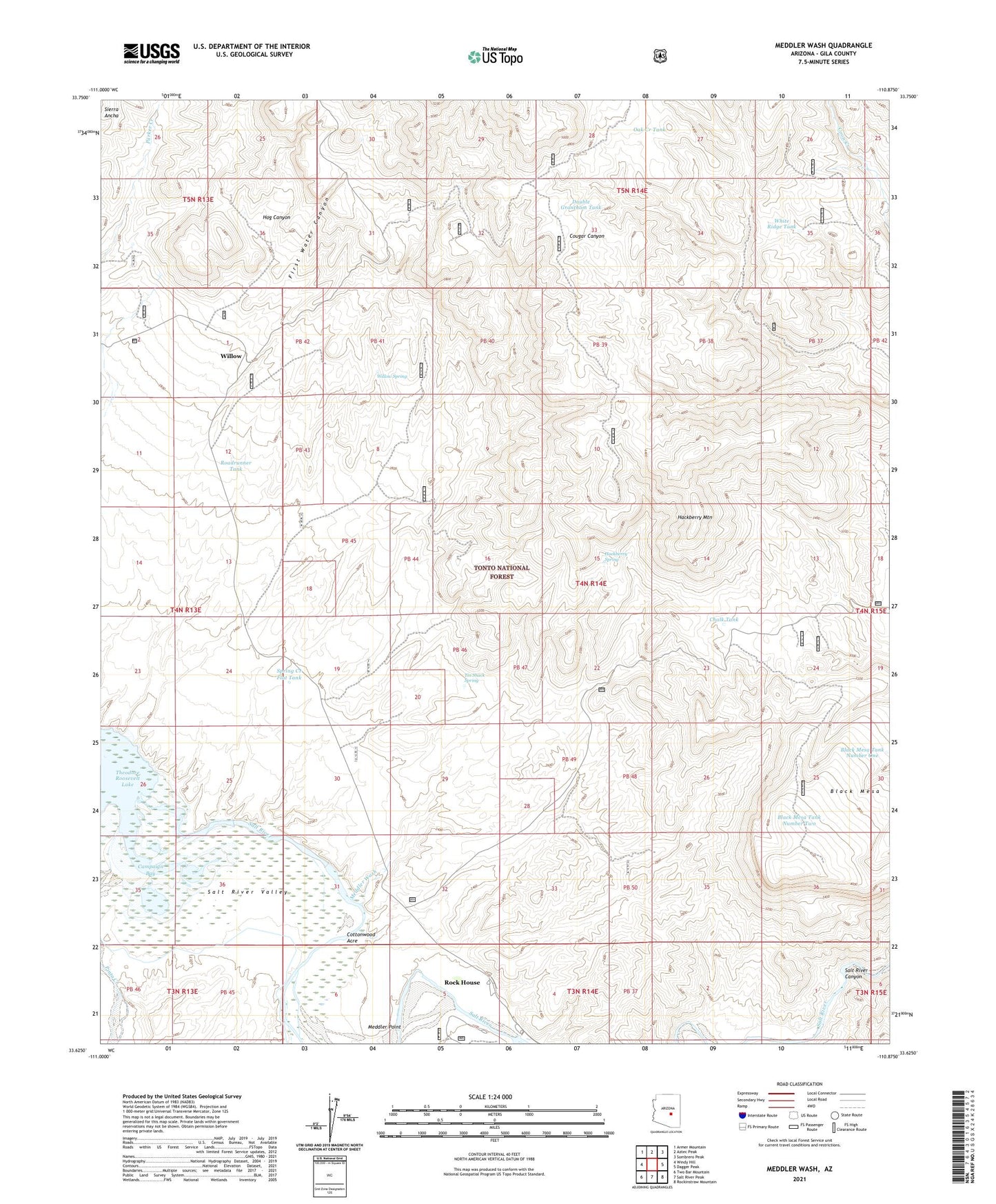
2021 topographic map quadrangle Meddler Wash in the state of Arizona. Scale: 1:24000. Based on the newly updated USGS 7.5' US Topo map series, this map is in the following counties: Gila. The map contains contour data, water features, and other items you are used to seeing on USGS maps, but also has updated roads and other features. This is the next generation of topographic maps. Printed on high-quality waterproof paper with UV fade-resistant inks.
Quads adjacent to this one:
West: Windy Hill
Northwest: Armer Mountain
North: Aztec Peak
Northeast: Sombrero Peak
East: Dagger Peak
Southeast: Rockinstraw Mountain
South: Salt River Peak
Southwest: Two Bar Mountain
This map covers the same area as the classic USGS quad with code o33110f8.
Contains the following named places: A-Cross Adminstrative Site, Bar Eleven Ranch, Bar Eleven Well, Black Mesa, Black Mesa Tank Number One, Black Mesa Tank Number Two, Braddock Creek, Campaign Bay, Chalk Creek Tank, Chalk Creek Well, Chalk Tank, Cholla Ridge Tank, Cottonwood Acre, Double Grantham Tank, First Water Canyon, Griffin Wash, Hackberry Mountain, Hackberry Spring, Hackberry Wash Well, Hog Canyon, Jackson Well, Meddler Point, Meddler Wash, Meddler Wash Well, Nail Creek, Nash Creek Reservoir, Oak Creek, Oak Creek Tank, Pinto Creek, Roadrunner Tank, Rock House Census Designated Place, Spring Creek Flat Tank, Tin Shack Spring, Walnut Creek, Warm Creek, White Ridge Tank, Willow, Willow Spring