MyTopo
Barber Arkansas US Topo Map
Couldn't load pickup availability
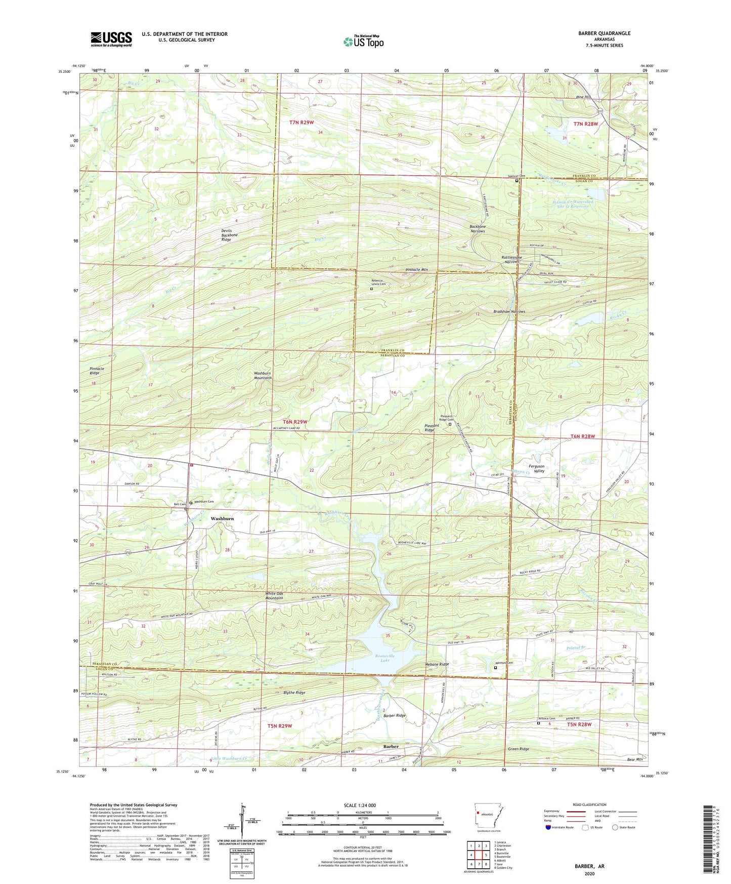
2024 topographic map quadrangle Barber in the state of Arkansas. Scale: 1:24000. Based on the newly updated USGS 7.5' US Topo map series, this map is in the following counties: Sebastian, Logan, Franklin. The map contains contour data, water features, and other items you are used to seeing on USGS maps, but also has updated roads and other features. This is the next generation of topographic maps. Printed on high-quality waterproof paper with UV fade-resistant inks.
Quads adjacent to this one:
West: Burnville
Northwest: Lavaca
North: Charleston
Northeast: Branch
East: Booneville
Southeast: Golden City
South: Ione
Southwest: Abbott
This map covers the same area as the classic USGS quad with code o35094b1.
Contains the following named places: Antioca Cemetery, Antioch Church, Backbone Narrows, Barber, Barber Post Office, Barber Ridge, Bell Cemetery, Blythe Ridge, Booneville Gas Field, Booneville Lake, Bradshaw Narrows, Gin Creek, Glendale, Green Ridge, KOLX-FM (Barling), Leon, Little Washburn Creek, Mannuis Cemetery, Mebane Ridge, Milltown Washburn Fire Department Station 2, Molly Gap Creek, Pigeon Creek, Pine Hill, Pinnacle Mountain, Pleasant Ridge, Pleasant Ridge Cemetery, Polecat Branch, Rattlesnake Narrows, Rebecca Lewis Cemetery, Sixmile Creek Watershed Site 12 Dam, Sixmile Creek Watershed Site 12 Reservoir, Spencer Cemetery, Township of Washburn, Upper Petit Jean Site Number Nine Dam, Upper Petit Jean Site Number Nine Reservoir, Washburn, Washburn Cemetery