MyTopo
Burnville Arkansas US Topo Map
Couldn't load pickup availability
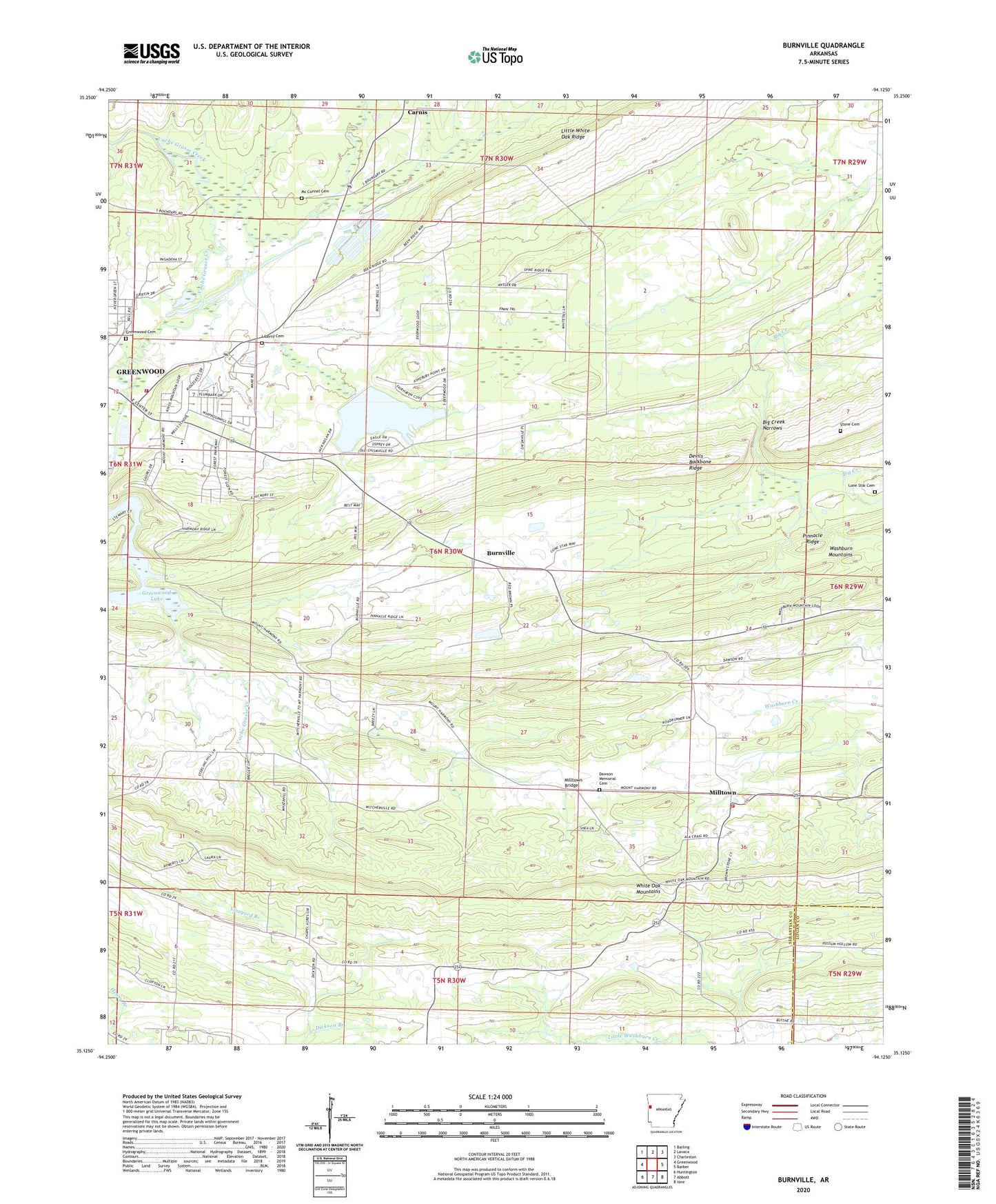
2024 topographic map quadrangle Burnville in the state of Arkansas. Scale: 1:24000. Based on the newly updated USGS 7.5' US Topo map series, this map is in the following counties: Sebastian, Logan. The map contains contour data, water features, and other items you are used to seeing on USGS maps, but also has updated roads and other features. This is the next generation of topographic maps. Printed on high-quality waterproof paper with UV fade-resistant inks.
Quads adjacent to this one:
West: Greenwood
Northwest: Barling
North: Lavaca
Northeast: Charleston
East: Barber
Southeast: Ione
South: Abbott
Southwest: Huntington
This map covers the same area as the classic USGS quad with code o35094b2.
Contains the following named places: Arkansas Noname 212 Dam, Big Creek Narrows, Bragg Gas Field, Burnville, Burnville Baptist Church, Burnville School, Carnis, City of Greenwood, Clarks Chapel, Dawson Memorial Cemetery, East Hills Middle School, East Pointe Elementary School, Fidelity, Greenwood Lake, Greenwood Memorial Cemetery, Greenwood Rural Fire Department, Heartsill Creek, KEZU-FM (Booneville), Liberty Cemetery, Liberty Church, Little White Oak Ridge, Lone Star Cemetery, Mc Connel Cemetery, Milltown, Milltown Bridge, Milltown Church, Milltown Washburn Fire Department, Mount Harmony Baptist Church, Oak View Farm, Pinnacle Ridge, Stone Cemetery, Township 2, Township of Bates, Township of Center, Township of Eagle, Township of White Oak, Vineyard Creek, Washburn Mountains, White Oak Mountains, ZIP Code: 72936