MyTopo
Gepp Arkansas US Topo Map
Couldn't load pickup availability
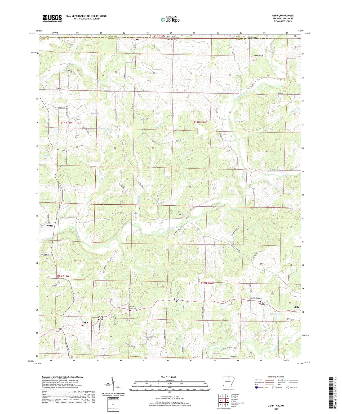
2024 topographic map quadrangle Gepp in the states of Arkansas, Missouri. Scale: 1:24000. Based on the newly updated USGS 7.5' US Topo map series, this map is in the following counties: Fulton, Howell, Ozark. The map contains contour data, water features, and other items you are used to seeing on USGS maps, but also has updated roads and other features. This is the next generation of topographic maps. Printed on high-quality waterproof paper with UV fade-resistant inks.
Quads adjacent to this one:
West: Gamaliel
Northwest: Bakersfield
North: Caulfield
Northeast: Moody
East: Viola
Southeast: Byron
South: Elizabeth
Southwest: Norfork Dam North
Contains the following named places: Argosy, Bailey Branch, Cooper Branch, Cotter Branch, Crossroads Church, East Arkansas Council Boy Scouts Lake, Enterprise Church, Flora Cemetery, Foster Branch, Gepp, Gepp Post Office, Gepp Volunteer Fire Department, Gobbler Trot Cemetery, Heldebrend Lake, Heldebrend Lake Dam, Hurst Cemetery, Lake Bertie, Lake Bertie Dam, Little Creek, Mashie Hollow, North Little Creek, Ott, Pickren Hall, Pickren Hall Cemetery, Pine Trail Reservation Lake Dam, Shipman Creek, Township of Bayou, Township of Bennett Bayou, Township of Vidette, Turkey Knob, Vidette, ZIP Code: 72538