MyTopo
Red Bluff Arkansas US Topo Map
Couldn't load pickup availability
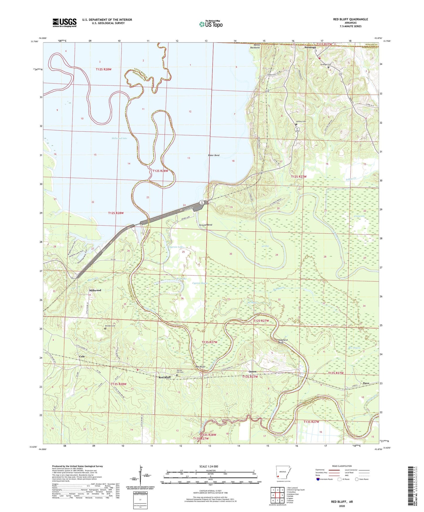
2024 topographic map quadrangle Red Bluff in the state of Arkansas. Scale: 1:24000. Based on the newly updated USGS 7.5' US Topo map series, this map is in the following counties: Hempstead, Little River, Howard. The map contains contour data, water features, and other items you are used to seeing on USGS maps, but also has updated roads and other features. This is the next generation of topographic maps. Printed on high-quality waterproof paper with UV fade-resistant inks.
Quads adjacent to this one:
West: Ashdown East
Northwest: Ben Lomond
North: Mineral Springs South
Northeast: Columbus
East: McNab
Southeast: Fulton
South: Homan
Southwest: Ogden
This map covers the same area as the classic USGS quad with code o33093f8.
Contains the following named places: Ash Flat, Baker Bend, Beard Lake, Beards Bluff Public Use Area, Bee Basin, Bee Bayou, Bois d'Arc Bayou, Buster Creek, Christian Church, Cole, Cypress Bayou, Cypress Lake, Cypress Slough Public Use Area, Dave, Dowden Cemetery, Ground Bend, Harmony Cemetery, Harmony Church, Hickory Slough, Hopewell Baptist Church, Hudson Creek, Millwood, Millwood Dam, Millwood Lake, Millwood State Park, Moore Camp, Mount Olive Church, Orton, Red Bluff, Red Lake, River Run East Public Use Area, River Run West Public Use Area, Saline River, Saratoga Cemetery, Saratoga Census Designated Place, Saratoga Elementary School, Saratoga Landing Public Use Area, Saratoga School, Saratoga Volunteer Fire Department, Shepherd Bluff, Spring Hill Cemetery, Stokers Ferry, Sweet Home School, Ward Ferry, Yarborough Fire Department Station 2, Yellow Creek, ZIP Code: 71859