MyTopo
Maumee Arkansas US Topo Map
Couldn't load pickup availability
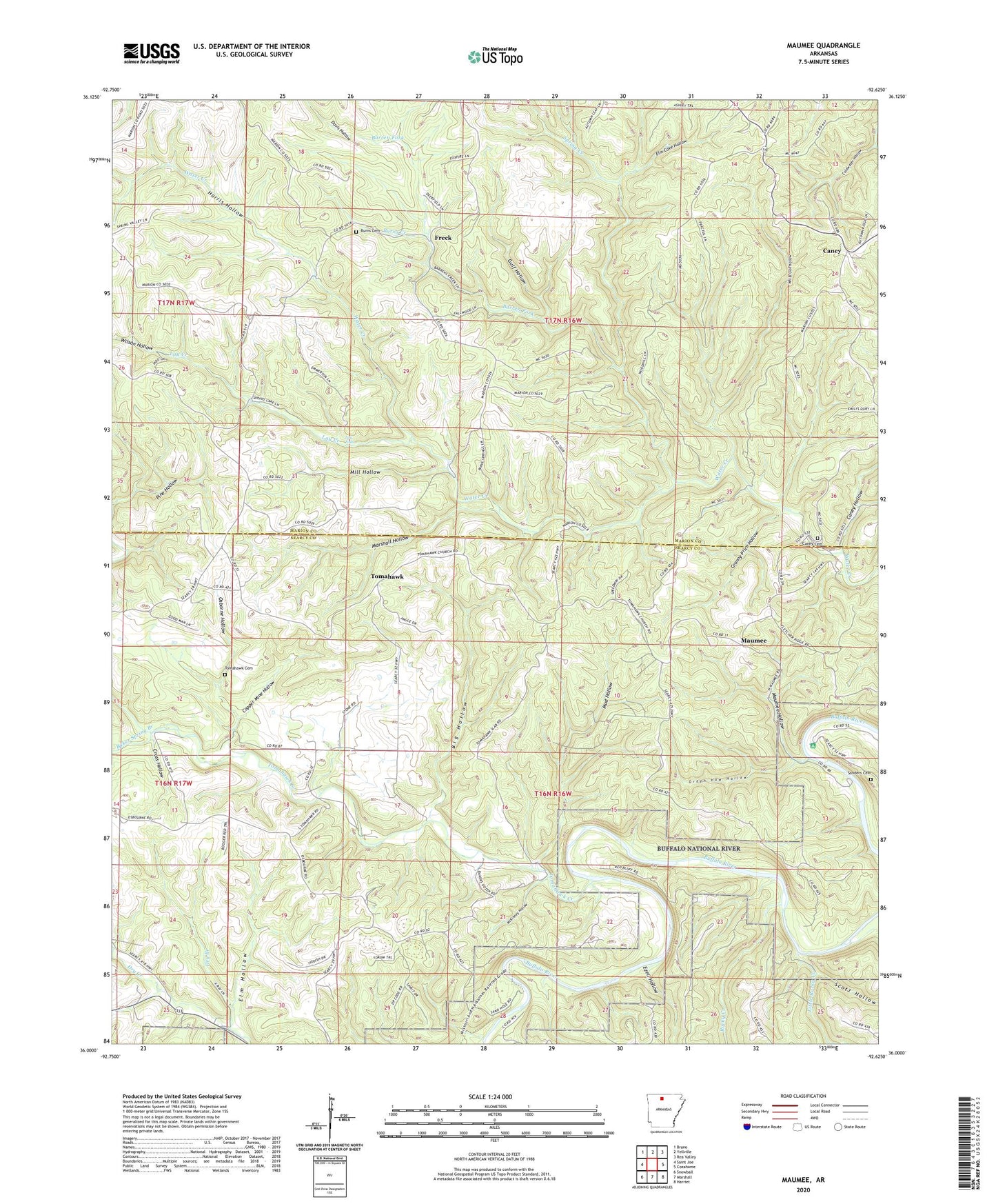
2024 topographic map quadrangle Maumee in the state of Arkansas. Scale: 1:24000. Based on the newly updated USGS 7.5' US Topo map series, this map is in the following counties: Searcy, Marion. The map contains contour data, water features, and other items you are used to seeing on USGS maps, but also has updated roads and other features. This is the next generation of topographic maps. Printed on high-quality waterproof paper with UV fade-resistant inks.
Quads adjacent to this one:
West: Saint Joe
Northwest: Bruno
North: Yellville
Northeast: Rea Valley
East: Cozahome
Southeast: Harriet
South: Marshall
Southwest: Snowball
This map covers the same area as the classic USGS quad with code o36092a6.
Contains the following named places: Baker Spring Branch, Barren Fork, Big Hollow, Burns Cemetery, Burns Creek, Caney, Caney Cemetery, Caney Church of Christ, Caney Hollow, Coldwater Hollow, Copper Mine Hollow, Cross Hollow, Davis Hollow, Dry Branch, Elm Cave Hollow, Elm Hollow, Ezell Hollow, Freck, Granny Price Hollow, Green Haw Hollow, Gulf Hollow, Harris Hollow, Lay Creek, Lay Falls, Little Rocky Creek, Marshall Hollow, Maumee, Maumee Crossing, Maumee Hollow, McKinney Hollow, Mill Hollow, Mud Hollow, Osborne Hollow, Rocky Creek, Sanders Cemetery, Scott Hollow, Spring Creek, Tomahawk, Tomahawk Baptist Church, Tomahawk Cemetery, Tomahawk Creek, Township of Liberty, Township of Tomahawk, White Oak Hollow, Wilson Hollow