MyTopo
Buffalo City Arkansas US Topo Map
Couldn't load pickup availability
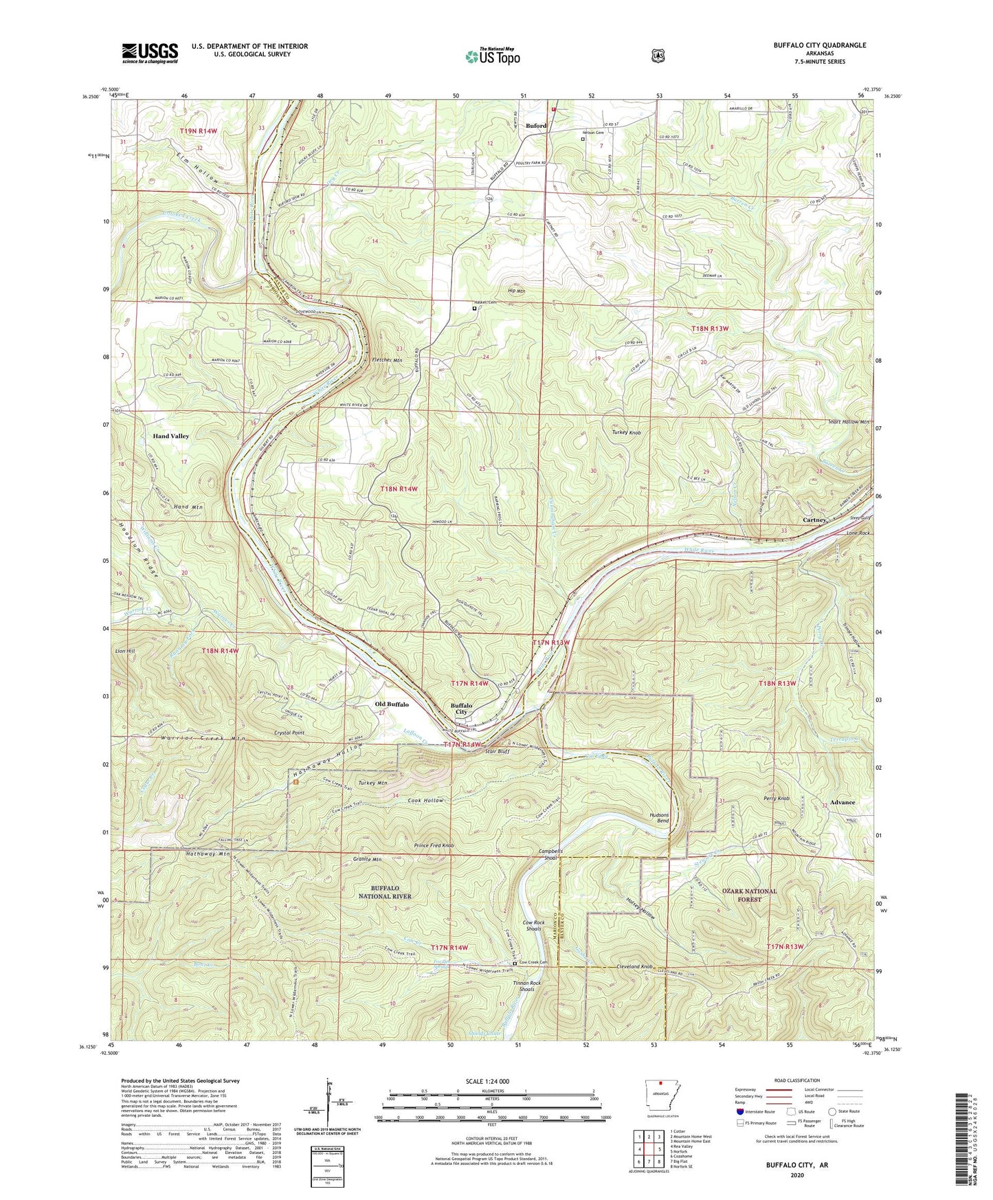
2024 topographic map quadrangle Buffalo City in the state of Arkansas. Scale: 1:24000. Based on the newly updated USGS 7.5' US Topo map series, this map is in the following counties: Baxter, Marion. The map contains contour data, water features, and other items you are used to seeing on USGS maps, but also has updated roads and other features. This is the next generation of topographic maps. Printed on high-quality waterproof paper with UV fade-resistant inks.
Quads adjacent to this one:
West: Rea Valley
Northwest: Cotter
North: Mountain Home West
Northeast: Mountain Home East
East: Norfork
Southeast: Norfork SE
South: Big Flat
Southwest: Cozahome
This map covers the same area as the classic USGS quad with code o36092b4.
Contains the following named places: Advance, Birds Ford, Brush Creek, Buffalo City, Buffalo City Census Designated Place, Buffalo Landing, Buffalo National River Wilderness, Buffalo River, Buford, Buford School, Buford Station, Buford Volunteer Fire Department, Campbells Shoal, Cartney, Cleveland Knob, Cockran Creek, Cook Hollow, Cow Creek, Cow Creek Cemetery, Cow Rock Shoals, Crooked Creek, Crystal Point, Cunningham Creek, Dry Creek, Elm Hollow, Fletcher Mountain, Fox Den Spring, Gin Eddy, Goodmans Ford, Gosha Creek, Granite Mountain, Hand Valley, Haskell Cemetery, Hathaway Hollow, Hathaway Mountain, Hip Mountain, Holsey Hollow, Hudsons Bend, Laffoon Creek, Laytonville, Lion Hill, Lone Rock, Mountain View Church, Nelson Cemetery, Nelson Creek, Nelsons Ferry, Old Buffalo, Perry Creek, Perry Knob, Prince Fred Knob, Running Fork, Shields Chute, Stair Bluff, Steep Gully, Stewart Creek, Terrapin Creek, Tinnan Rock Shoals, Township of Buffalo, Township of Buford, Township of Matney, Trimble Hollow, Turkey Knob, Turkey Mountain, Warner Creek, Warrior Creek, Warrior Creek Mountain, Williams Creek