MyTopo
Eagle Mills Arkansas US Topo Map
Couldn't load pickup availability
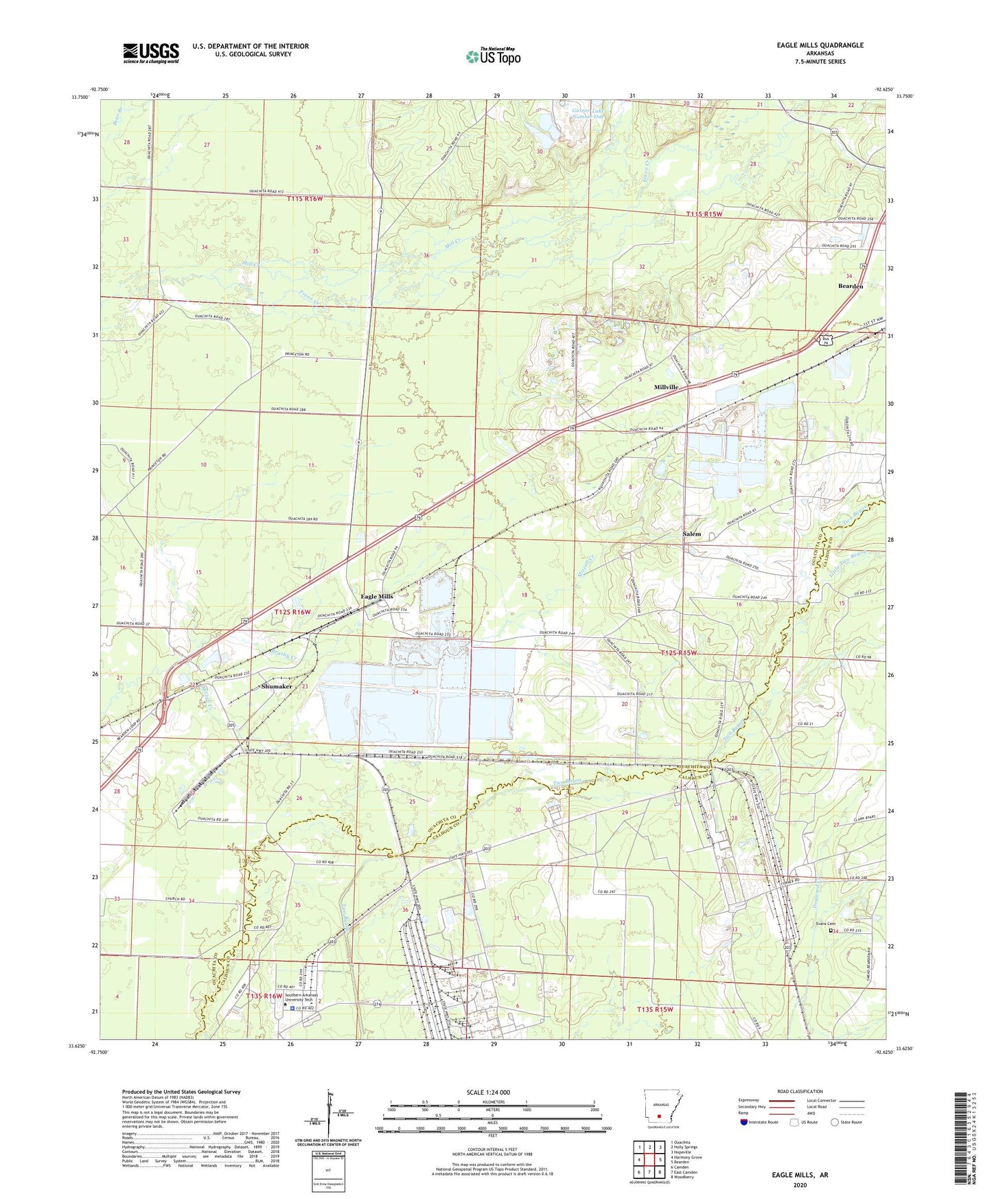
2024 topographic map quadrangle Eagle Mills in the state of Arkansas. Scale: 1:24000. Based on the newly updated USGS 7.5' US Topo map series, this map is in the following counties: Ouachita, Calhoun. The map contains contour data, water features, and other items you are used to seeing on USGS maps, but also has updated roads and other features. This is the next generation of topographic maps. Printed on high-quality waterproof paper with UV fade-resistant inks.
Quads adjacent to this one:
West: Harmony Grove
Northwest: Ouachita
North: Holly Springs
Northeast: Hopeville
East: Bearden
Southeast: Woodberry
South: East Camden
Southwest: Camden
This map covers the same area as the classic USGS quad with code o33092f6.
Contains the following named places: Brushy Creek, Eagle Mills, Evans Cemetery, Highland Industrial Park, Lilley, Little Two Bayou, Mill Creek, Millville, Onalaska, Ouachita County Ambulance Highland Basic Life Support, Salem, Shumaker, Shumaker Naval Ammunition Depot, Southern Arkansas University Tech Police Department, Southwest Technical Institute, State Fire Academy, State Police Academy, Steamboat Creek, Township of Cleveland, ZIP Code: 71711