MyTopo
Saint Joe Arkansas US Topo Map
Couldn't load pickup availability
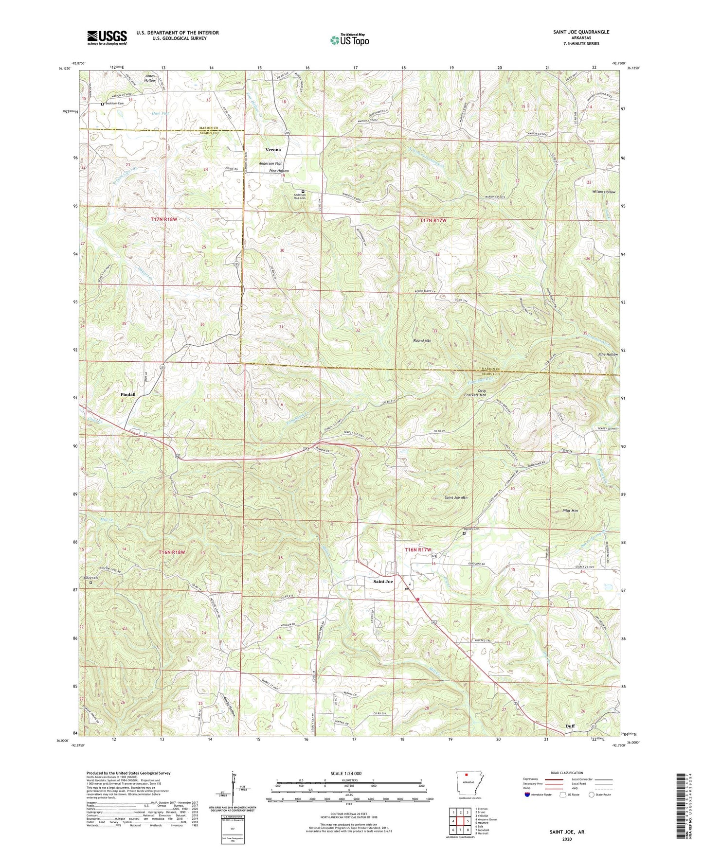
2024 topographic map quadrangle Saint Joe in the state of Arkansas. Scale: 1:24000. Based on the newly updated USGS 7.5' US Topo map series, this map is in the following counties: Searcy, Marion. The map contains contour data, water features, and other items you are used to seeing on USGS maps, but also has updated roads and other features. This is the next generation of topographic maps. Printed on high-quality waterproof paper with UV fade-resistant inks.
Quads adjacent to this one:
West: Western Grove
Northwest: Everton
North: Bruno
Northeast: Yellville
East: Maumee
Southeast: Marshall
South: Snowball
Southwest: Eula
This map covers the same area as the classic USGS quad with code o36092a7.
Contains the following named places: Anderson Flat, Anderson Flat Cemetery, Anderson Flat Church, Anderson Flat School, Beckham Cemetery, Beckham Church, Davy Crockett Mountain, Duff, Dugger, Dugget Creek, Excelsor Mine, Ham Flat, Henley Cemetery, North Fork Tomahawk Creek, Pilot Mountain, Pilot Mountain Church, Pindall Gilbert and Saint Joe Volunteer Fire Department, Pine Hollow, Push, Round Mountain, Saint Joe, Saint Joe High School, Saint Joe Mountain, Saint Joe Post Office, Saint Joe Schools, Town of Pindall, Town of Saint Joe, Township of Hampton, Township of Independence, Verona, ZIP Code: 72675