MyTopo
Felsenthal Dam Arkansas US Topo Map
Couldn't load pickup availability
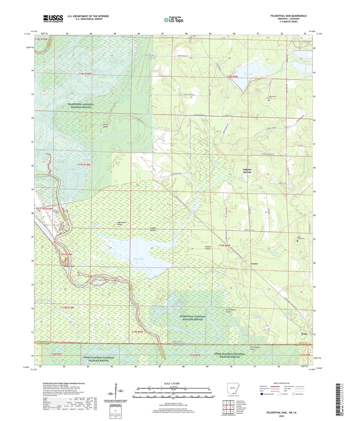
2024 topographic map quadrangle Felsenthal Dam in the state of Arkansas. Scale: 1:24000. Based on the newly updated USGS 7.5' US Topo map series, this map is in the following counties: Ashley, Union, Morehouse. The map contains contour data, water features, and other items you are used to seeing on USGS maps, but also has updated roads and other features. This is the next generation of topographic maps. Printed on high-quality waterproof paper with UV fade-resistant inks.
Quads adjacent to this one:
West: Huttig
Northwest: New Union
North: Marais Saline
Northeast: Crossett North
East: Crossett South
Southeast: Beekman
South: Fish Lake
Southwest: Marion East
Contains the following named places: Big Mound Ridge, Black Slough, Black Spring Slough, Boyd - Hedge Cemetery, Buckhorn Slough, Bull Brake, C D Siding, Clear Lake, Coffee Creek, Coffee Creek Relief, Coffee Prairie, Cooley Lake, Deadpecker Slough, Felsenthal Lock and Dam, Fish Slough, Gar Slough, Gilliam Slough, Halfway Bayou, Horseshoe Slough, Humphrey Slough, Indian Creek, Lock and Dam Number 6, Macedonian Cemetery, Macedonian Church, Mill Pond, Mill Pond Dam, Mossy Lake, Ouachita River Reservoir, Pine Island, Redeye Lake, Rolands Raft, Russell Island, Sulphur Spring, Sulphur Springs, Three Beech Prairie, Township of Marais Saline, Venice, Wildcat Lake