MyTopo
Huttig Arkansas US Topo Map
Couldn't load pickup availability
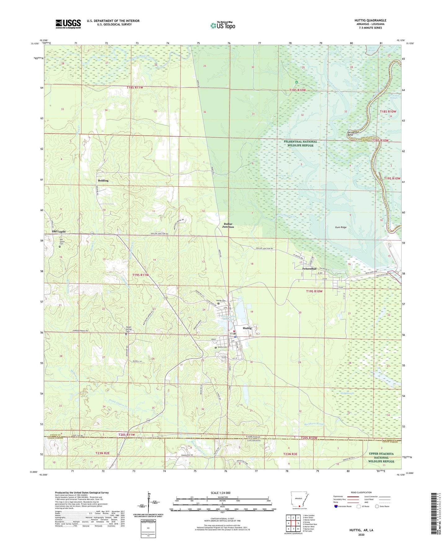
2024 topographic map quadrangle Huttig in the state of Arkansas. Scale: 1:24000. Based on the newly updated USGS 7.5' US Topo map series, this map is in the following counties: Union, Ashley. The map contains contour data, water features, and other items you are used to seeing on USGS maps, but also has updated roads and other features. This is the next generation of topographic maps. Printed on high-quality waterproof paper with UV fade-resistant inks.
Quads adjacent to this one:
West: Strong
Northwest: New London
North: New Union
Northeast: Marais Saline
East: Felsenthal Dam
Southeast: Fish Lake
South: Marion East
Southwest: Marion West
Contains the following named places: Arkansas Noname 55 Dam, Arkansas Noname 55 Reservoir, Arkansas Noname 56 Dam, Arkansas Noname 56 Reservoir, Bolding, Bolding Methodist Church, City of Huttig, Culpeper Branch, Dollar Junction, Felsenthal, Felsenthal Baptist Church, First Baptist Church, Forty Acre Millpond, Grand Marais, Grand Marais Recreation Site, Gum Ridge, Harper Springs Cemetery, Harper Springs Church, Henderson Bend, Hogg Creek, Huttig, Huttig Ambulance Department, Huttig Cemetery, Huttig Elementary School, Huttig Fire Department, Huttig High School, Huttig Lookout Tower, Huttig Police Department, Huttig Post Office, Kelly Spring Creek, KTVE-TV (El Dorado), Lawrence Branch, Little Lake, Mchenry Branch, McHenry Branch, Old Lapile, Old Lapile Cemetery, Simms Cemetery, Smith Chapel, South Lapile Creek, Town of Felsenthal, Twenty Acre Millpond, Wolf Slough, ZIP Code: 71747