MyTopo
Gamaliel Arkansas US Topo Map
Couldn't load pickup availability
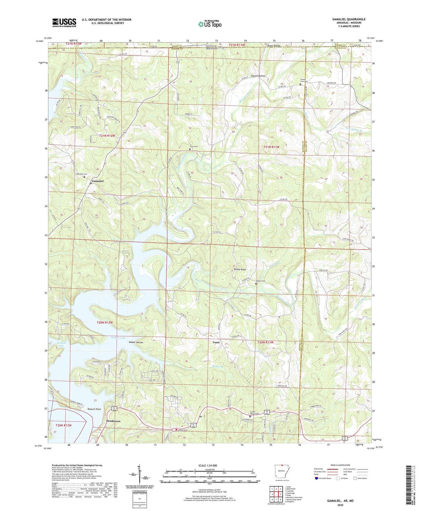
2024 topographic map quadrangle Gamaliel in the states of Arkansas, Missouri. Scale: 1:24000. Based on the newly updated USGS 7.5' US Topo map series, this map is in the following counties: Baxter, Fulton, Ozark. The map contains contour data, water features, and other items you are used to seeing on USGS maps, but also has updated roads and other features. This is the next generation of topographic maps. Printed on high-quality waterproof paper with UV fade-resistant inks.
Quads adjacent to this one:
West: Clarkridge
Northwest: Udall
North: Bakersfield
Northeast: Caulfield
East: Gepp
Southeast: Elizabeth
South: Norfork Dam North
Southwest: Mountain Home East
Contains the following named places: Athens Cemetery, Barren Creek, Bennetts, Bennetts Bayou, Bennetts River, Bidwell Point, Bidwell Point Use Area, Biven Hollow, County Line, County Line Cemetery, County Line Church, County Line School, Cumi, Custer, Custer - Herron Cemetery, Fluty Cemetery, Gamaliel, Gamaliel Cemetery, Gamaliel Census Designated Place, Gamaliel Landing, Gamaliel Post Office, Gamaliel School, Gamaliel Use Area, Henderson, Henderson Census Designated Place, Henderson Post Office, Henderson Volunteer Fire Department, Howard Cove, Howard Cove Use Area, Jenkins Branch, Lake Norfork Church, Little Creek, Norfork Lake Estates, Poor Hollow Branch, Powell Hollow, Talbert Landing, Talbert Use Area, Tanner Creek, Township of Bayou, Township of Mill, Turkey Knob, Walker Branch, Walker Hollow, ZIP Codes: 72537, 72544