MyTopo
Mountain Home East Arkansas US Topo Map
Couldn't load pickup availability
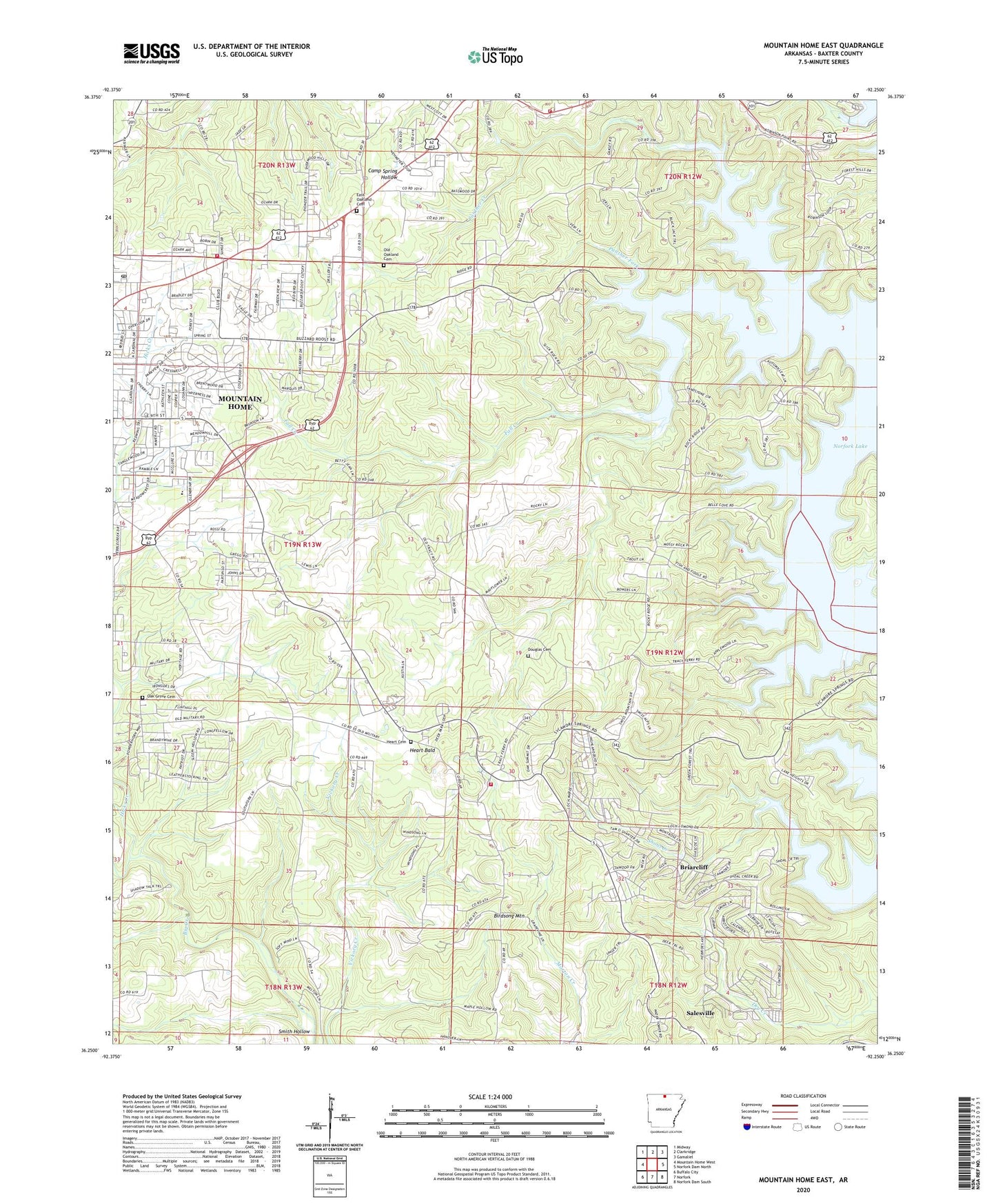
2024 topographic map quadrangle Mountain Home East in the state of Arkansas. Scale: 1:24000. Based on the newly updated USGS 7.5' US Topo map series, this map is in the following counties: Baxter. The map contains contour data, water features, and other items you are used to seeing on USGS maps, but also has updated roads and other features. This is the next generation of topographic maps. Printed on high-quality waterproof paper with UV fade-resistant inks.
Quads adjacent to this one:
West: Mountain Home West
Northwest: Midway
North: Clarkridge
Northeast: Gamaliel
East: Norfork Dam North
Southeast: Norfork Dam South
South: Norfork
Southwest: Buffalo City
This map covers the same area as the classic USGS quad with code o36092c3.
Contains the following named places: Baxter County, Birdsong Mountain, Briarcliff, Buzzard Roose Use Area, Buzzard Roost Landing, City of Briarcliff, Douglas Cemetery, East Oakland Baptist Church, East Oakland Cemetery, Fall Creek, Fellowship Cumberland Presbyterian Church, Heart Bald, Heart Cemetery, Heritage Estates, Hicks Creek, Mountain Home Fire Department Station 2, Mountain Home Post Office, Northeast Lakeside Fire Department, Oak Grove Cemetery, Oak Grove Church, Oakland School, Old Oakland Cemetery, Panther Bay Public Use Area, Panther Creek, Panther Fork, Shoal Creek, Smith Hollow, Sycamore Heights, Township of Mountain Home, Traceys Ferry, Traceys Ford, Traceys Landing, Tracy Area Volunteer Fire Department, Tracy Use Area, Village Mall Shopping Center