MyTopo
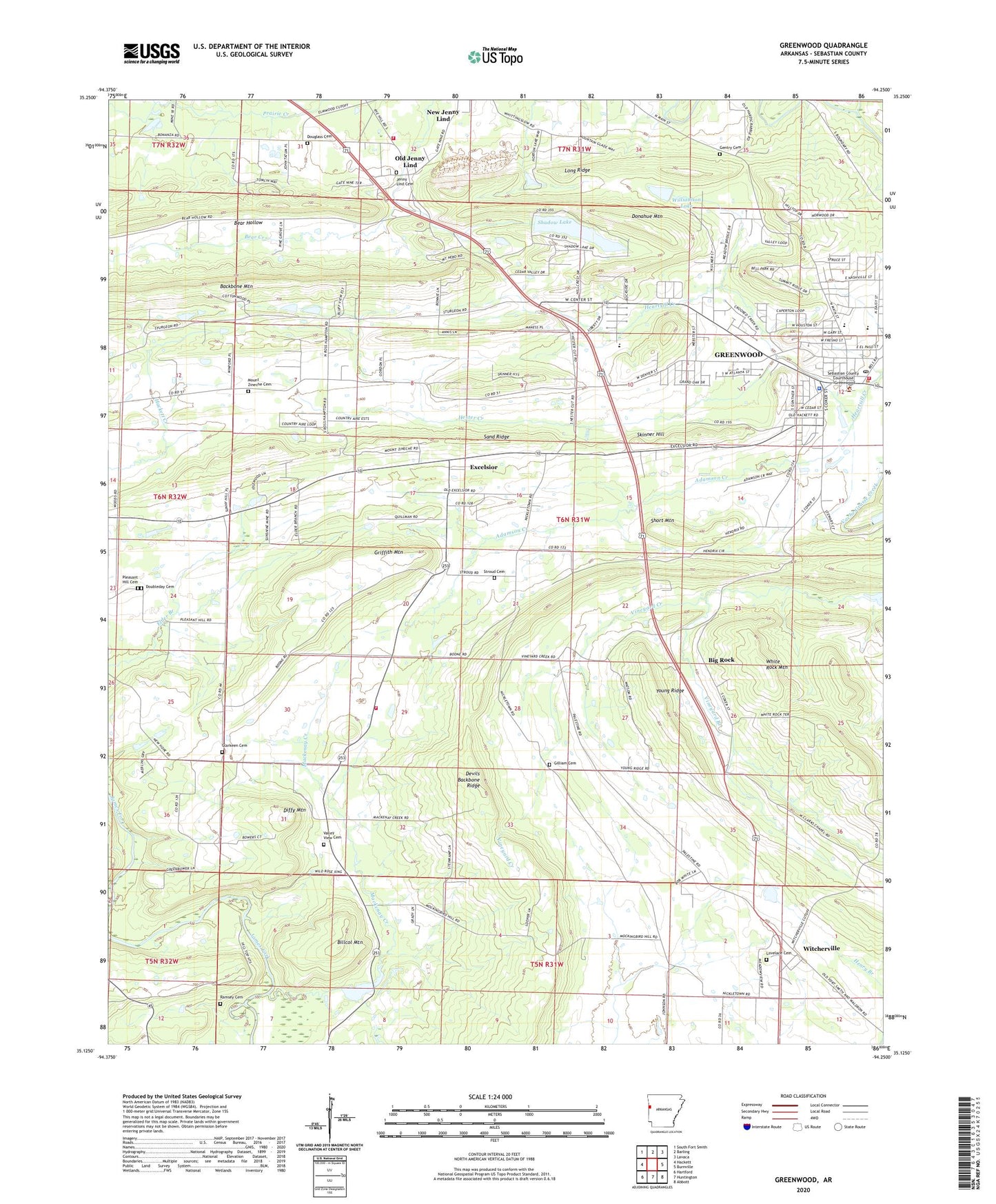
Greenwood Arkansas US Topo Map
Couldn't load pickup availability
2024 topographic map quadrangle Greenwood in the state of Arkansas. Scale: 1:24000. Based on the newly updated USGS 7.5' US Topo map series, this map is in the following counties: Sebastian. The map contains contour data, water features, and other items you are used to seeing on USGS maps, but also has updated roads and other features. This is the next generation of topographic maps. Printed on high-quality waterproof paper with UV fade-resistant inks.
Quads adjacent to this one:
West: Hackett
Northwest: South Fort Smith
North: Barling
Northeast: Lavaca
East: Burnville
Southeast: Abbott
South: Huntington
Southwest: Hartford
This map covers the same area as the classic USGS quad with code o35094b3.
Contains the following named places: Adamson Creek, Backbone Mountain, Bell Park, Big Rock, Billcol Mountain, Bonanza Gas Field, Buckner Park, Devils Backbone Ridge, Diffy Mountain, Donahue Mountain, Doubleday Cemetery, Douglass Cemetery, Excelsior, Excelsior - Mount Zion - Palestine Rural Fire Department, Excelsior Baptist Church, First Baptist Church of Greenwood, Full Gospel Lighthouse, Gentry Cemetery, Gilliam Cemetery, Greenwood, Greenwood Elementary School, Greenwood High School, Greenwood Junior High School, Greenwood Police Department, Greenwood Post Office, Greenwood Reservoir Dam, Greenwood Volunteer Fire Department, Griffith Mountain, Hester Creek, Jenny Lind Baptist Church, Jenny Lind Cemetery, Jenny Lind School, KBBQ-FM (Fort Smith), Kingdom Hall, KVOG-AM (Greenwood), KZKZ-FM (Greenwood), Long Ridge, Lovelace Cemetery, Mackenay Creek, Mount Zineche Cemetery, Mount Zion Baptist Church, New Hope Baptist Church, Old Jenny Lind, Old Town Church, Palestine Baptist Church, Palestine School, Pleasant Hill Cemetery, Pleasant Hill Church, Ramsey Cemetery, Sand Ridge, Sebastian County, Sebastian County Emergency Medical Services Greenwood, Sebastian County Sheriff's Office Greenwood District, Shadow Lake, Shadow Lake Dam, Short Mountain, Skinner Hill, Stroud Cemetery, Towne West Shopping Center, Township 4, Township of Bass Little, Township of Prairie, Township of Rogers, Valley View Cemetery, Valley View Church, Vineyard Branch, Westwood Elementary School, White Rock Mountain, Williamson Lake, Williamson Lake Dam, Witcherville, Young Ridge


