MyTopo
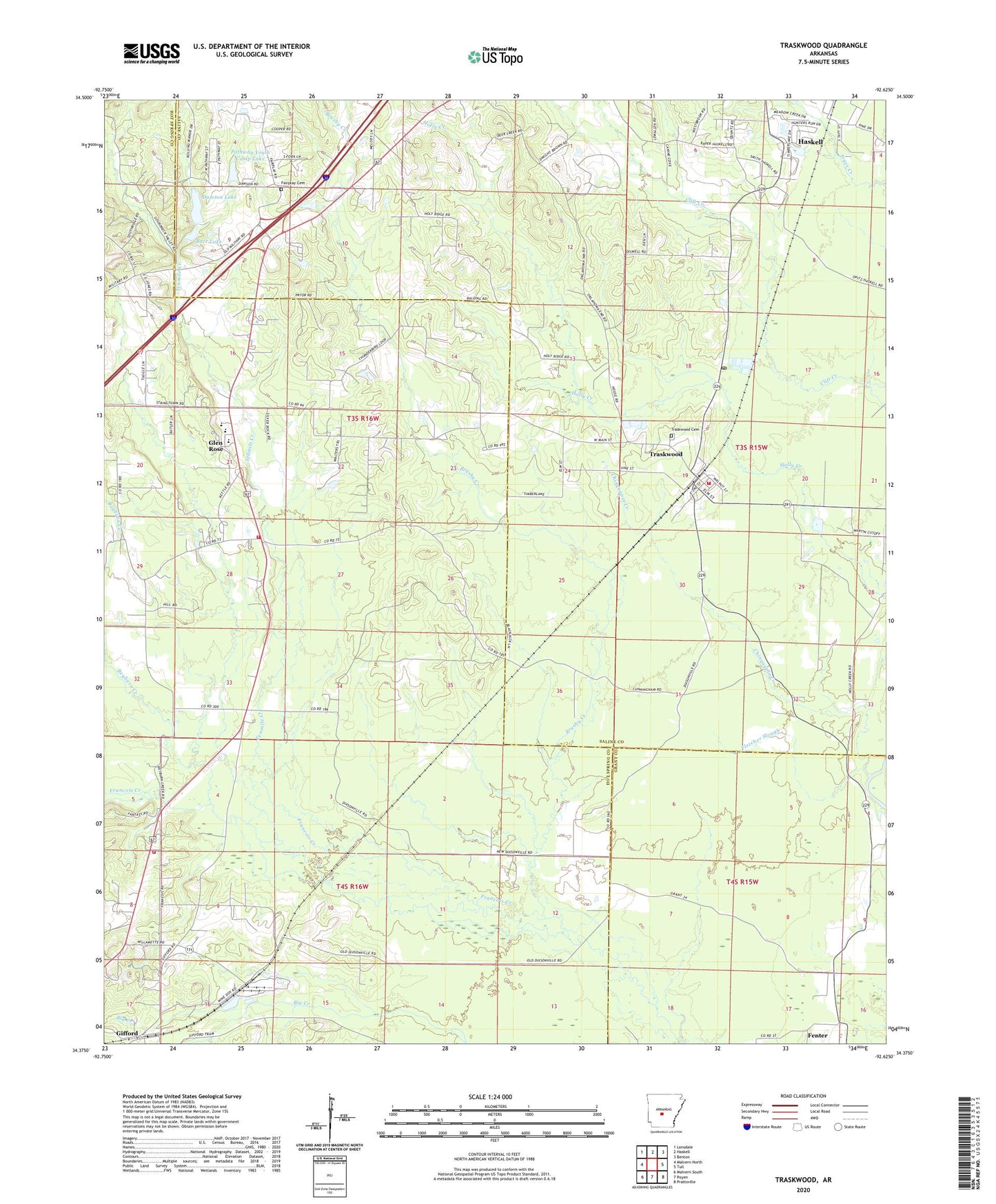
Traskwood Arkansas US Topo Map
Couldn't load pickup availability
2024 topographic map quadrangle Traskwood in the state of Arkansas. Scale: 1:24000. Based on the newly updated USGS 7.5' US Topo map series, this map is in the following counties: Hot Spring, Saline, Grant. The map contains contour data, water features, and other items you are used to seeing on USGS maps, but also has updated roads and other features. This is the next generation of topographic maps. Printed on high-quality waterproof paper with UV fade-resistant inks.
Quads adjacent to this one:
West: Malvern North
Northwest: Lonsdale
North: Haskell
Northeast: Benton
East: Tull
Southeast: Prattsville
South: Poyen
Southwest: Malvern South
This map covers the same area as the classic USGS quad with code o34092d6.
Contains the following named places: Barr Lake, Barr Lake Dam, Brushy Creek, Chinquapin Creek, City of Traskwood, Cunningham, Dawson Lake, Dawson Lake Dam, Fairplay Baptist Church, Fairplay Cemetery, Fenter, Fletcher Slough, Francois Church, Gifford, Gifford School, Glen Rose, Glen Rose Church, Glen Rose Elementary School, Glen Rose High School, Glen Rose Middle School, Glen Rose Volunteer Fire Department, Glen Rose Volunteer Fire Department Gifford Station, Holy Ridge Church, Lake Krislor, Lake Krislor Dam, Ninemile Creek, Opitz, Pathway Youth Camp Lake, Pathway Youth Camp Lake Dam, Reyburn Creek, Summerville Ford, Tenmile Creek, Township of Gifford, Township of Saline, Township of Traskwood, Traskwood, Traskwood Cemetery, Traskwood Post Office, Traskwood Volunteer Fire Station, Wyandotte, Zion Hill Church, ZIP Code: 72167