MyTopo
Tull Arkansas US Topo Map
Couldn't load pickup availability
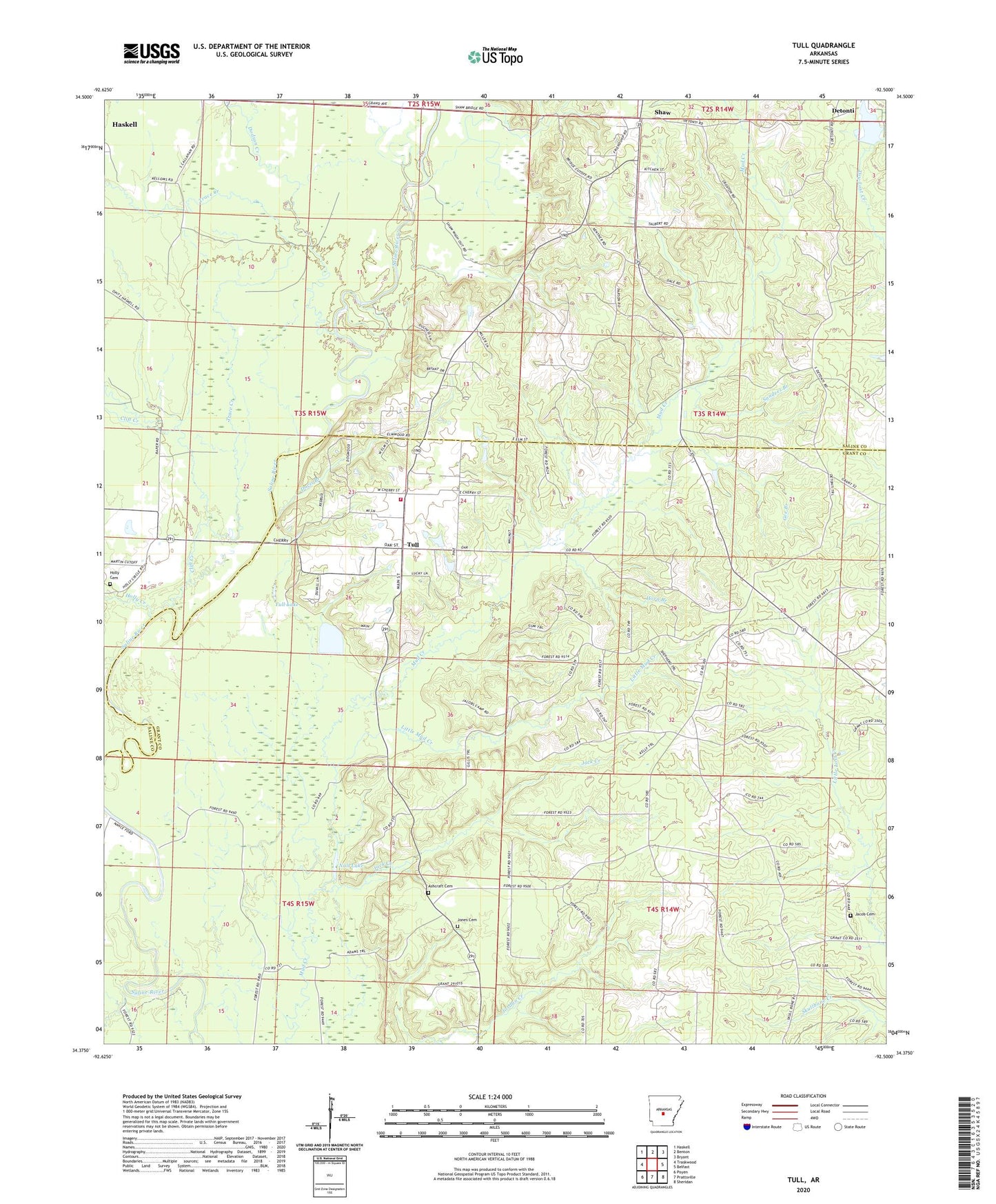
2024 topographic map quadrangle Tull in the state of Arkansas. Scale: 1:24000. Based on the newly updated USGS 7.5' US Topo map series, this map is in the following counties: Grant, Saline. The map contains contour data, water features, and other items you are used to seeing on USGS maps, but also has updated roads and other features. This is the next generation of topographic maps. Printed on high-quality waterproof paper with UV fade-resistant inks.
Quads adjacent to this one:
West: Traskwood
Northwest: Haskell
North: Benton
Northeast: Bryant
East: Belfast
Southeast: Sheridan
South: Prattsville
Southwest: Poyen
This map covers the same area as the classic USGS quad with code o34092d5.
Contains the following named places: Ashcraft Cemetery, Big Branch, Clift Creek, Davis Branch, Detonti, Dodson Creek, Gee Branch, Holly Cemetery, Holly Creek, Horn Branch, Jack Creek, Jacob Cemetery, Jones Cemetery, Little Mud Creek, Nall Lake, Nance Ford, Sanders Branch, Shaw, Town of Tull, Township of Dekalb, Township of Shaw, Trace Creek, Tull, Tull Lake, Tull Volunteer Fire Department, ZIP Code: 72015