MyTopo
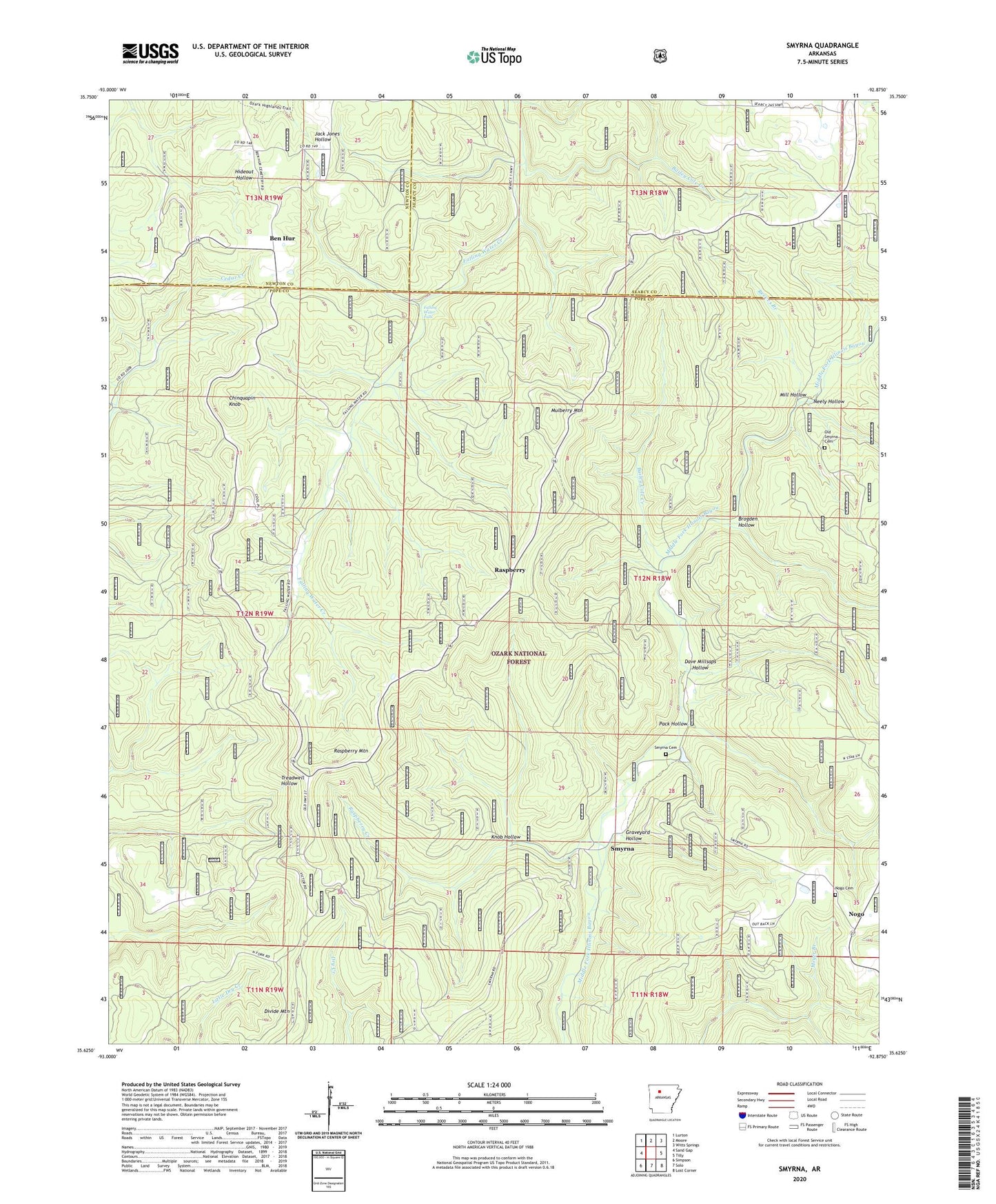
Smyrna Arkansas US Topo Map
Couldn't load pickup availability
Also explore the Smyrna Forest Service Topo of this same quad for updated USFS data
2024 topographic map quadrangle Smyrna in the state of Arkansas. Scale: 1:24000. Based on the newly updated USGS 7.5' US Topo map series, this map is in the following counties: Pope, Searcy, Newton. The map contains contour data, water features, and other items you are used to seeing on USGS maps, but also has updated roads and other features. This is the next generation of topographic maps. Printed on high-quality waterproof paper with UV fade-resistant inks.
Quads adjacent to this one:
West: Sand Gap
Northwest: Lurton
North: Moore
Northeast: Witts Springs
East: Tilly
Southeast: Lost Corner
South: Solo
Southwest: Simpson
This map covers the same area as the classic USGS quad with code o35092f8.
Contains the following named places: Bailey Cole Creek, Ben Hur, Brogden Hollow, Chinquapin Knob, Dave Millsaps Hollow, Falling Water Church, Falling Water Falls, Falling Water School, Graveyard Hollow, Knob Hollow, Mill Hollow, Mulberry Mountain, Neely Hollow, Nogo, Nogo Cemetery, Nogo Church, Old Smyrna Cemetery, Pack Hollow, Raspberry, Raspberry Creek, Raspberry Mountain, Reeves Branch, Smyrna, Smyrna Cemetery, Smyrna Church, Smyrna School, Township of Smyrna, Township of Sulphur, Winrock Farms Lake, Winrock Farms Lake Dam