MyTopo
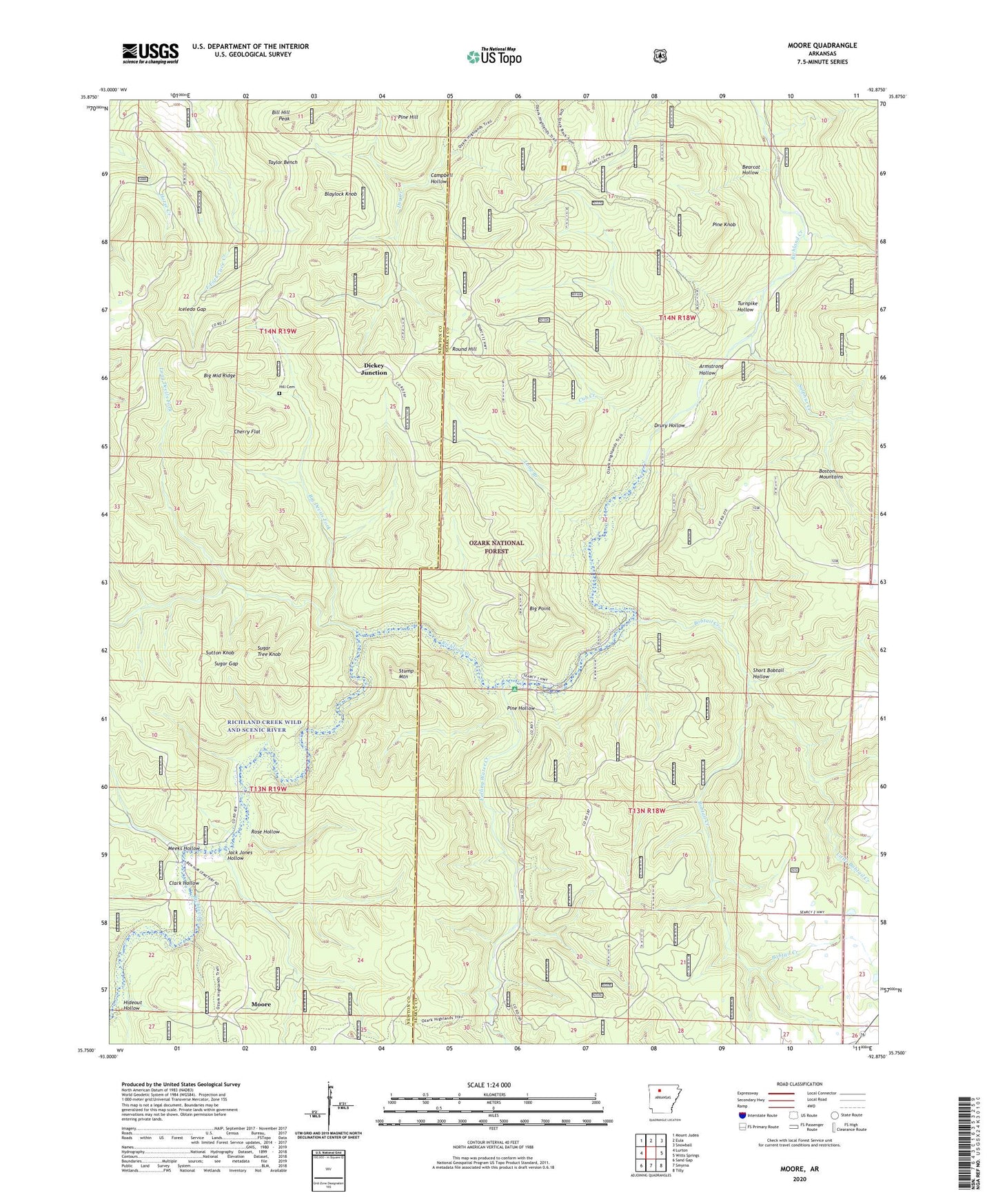
Moore Arkansas US Topo Map
Couldn't load pickup availability
Also explore the Moore Forest Service Topo of this same quad for updated USFS data
2024 topographic map quadrangle Moore in the state of Arkansas. Scale: 1:24000. Based on the newly updated USGS 7.5' US Topo map series, this map is in the following counties: Searcy, Newton. The map contains contour data, water features, and other items you are used to seeing on USGS maps, but also has updated roads and other features. This is the next generation of topographic maps. Printed on high-quality waterproof paper with UV fade-resistant inks.
Quads adjacent to this one:
West: Lurton
Northwest: Mount Judea
North: Eula
Northeast: Snowball
East: Witts Springs
Southeast: Tilly
South: Smyrna
Southwest: Sand Gap
This map covers the same area as the classic USGS quad with code o35092g8.
Contains the following named places: Armstrong Hollow, Bearcat Hollow, Big Devils Fork, Big Middle Ridge, Big Point, Bill Hill Peak, Blaylock Knob, Bobtail Creek, Campbell Hollow, Cherry Flat, Clark Hollow, Cub Creek, Dickey Junction, Drury Hollow, Falling Water Creek, Hideout Hollow, Hideout Trail, Hill Cemetery, Iceledo, Iceledo Gap, Jack Jones Hollow, Leigo, Little Bobtail Creek, Long Branch, Long Devils Fork, Meeks Hollow, Moore, Moore School, Pine Hollow, Pine Knob, Richland Creek Wild and Scenic River, Richland Creek Wilderness, Richland Recreation Area, Rose Hollow, Round Hill, Short Bobtail Hollow, Stump Mountain, Sugar Gap, Sugar Tree Knob, Sulphur Creek, Sutton Knob, Taylor Bench, Township of Jones, Turnpike Hollow, Wasson School, Witts Springs Census Designated Place