MyTopo
Belfast Arkansas US Topo Map
Couldn't load pickup availability
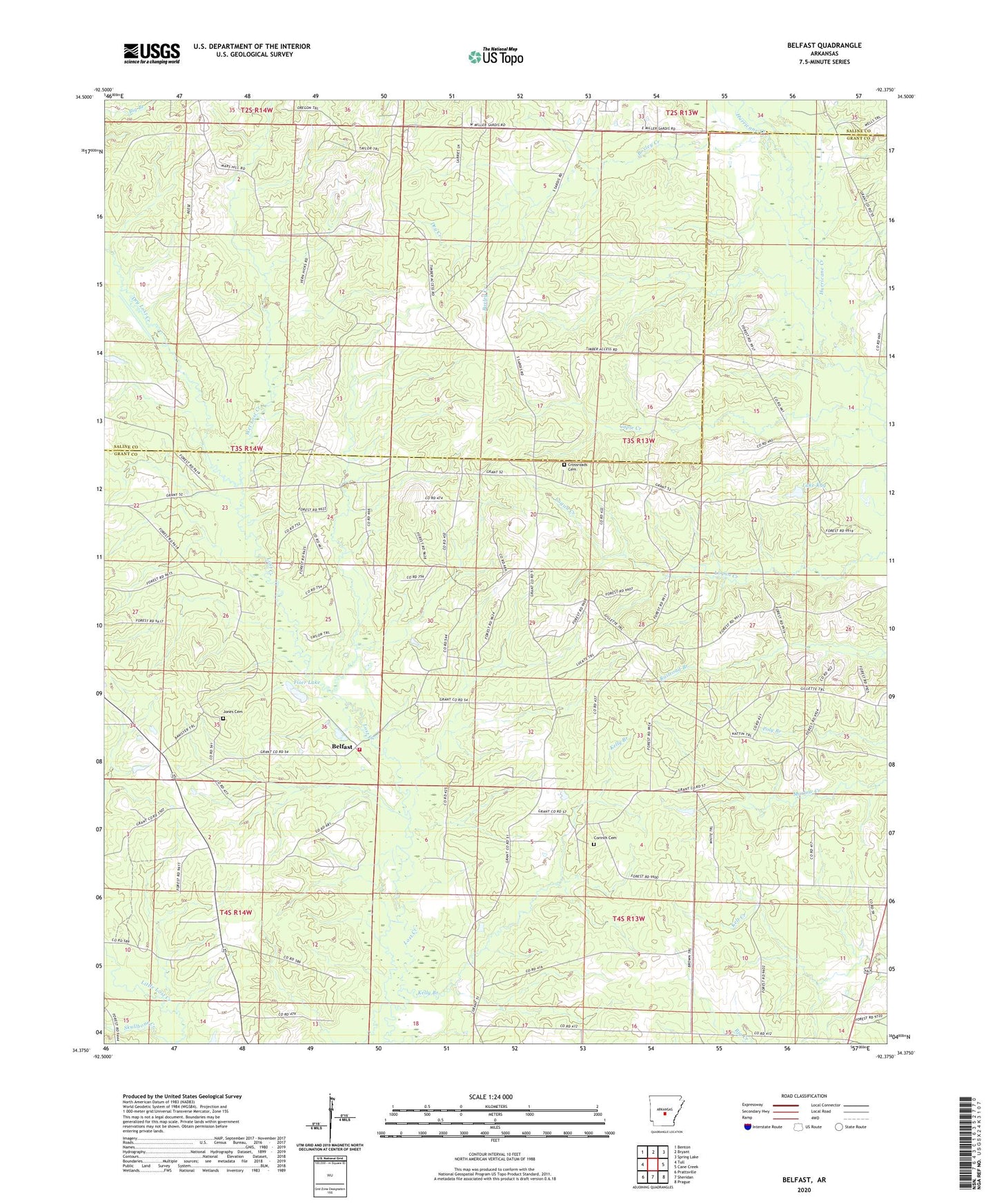
2024 topographic map quadrangle Belfast in the state of Arkansas. Scale: 1:24000. Based on the newly updated USGS 7.5' US Topo map series, this map is in the following counties: Grant, Saline. The map contains contour data, water features, and other items you are used to seeing on USGS maps, but also has updated roads and other features. This is the next generation of topographic maps. Printed on high-quality waterproof paper with UV fade-resistant inks.
Quads adjacent to this one:
West: Tull
Northwest: Benton
North: Bryant
Northeast: Spring Lake
East: Cane Creek
Southeast: Prague
South: Sheridan
Southwest: Prattsville
This map covers the same area as the classic USGS quad with code o34092d4.
Contains the following named places: Beard Branch, Belfast, Belfast Palestine Rural Fire Department, Boxley Creek, Caple Creek, Corinth Cemetery, Corinth Church, Crossroads Cemetery, Dry Creek, Dry Lost Creek, Fiser Lake, Fiser Lake Dam, Jones Cemetery, Lake Kay, Lake Kay Dam, Mars Hill Church, Palestine Church, Skullbone Creek, Southwest Hospital Heliport, Township of Franklin, Township of Smith, Wet Lost Creek