MyTopo
Cane Creek Arkansas US Topo Map
Couldn't load pickup availability
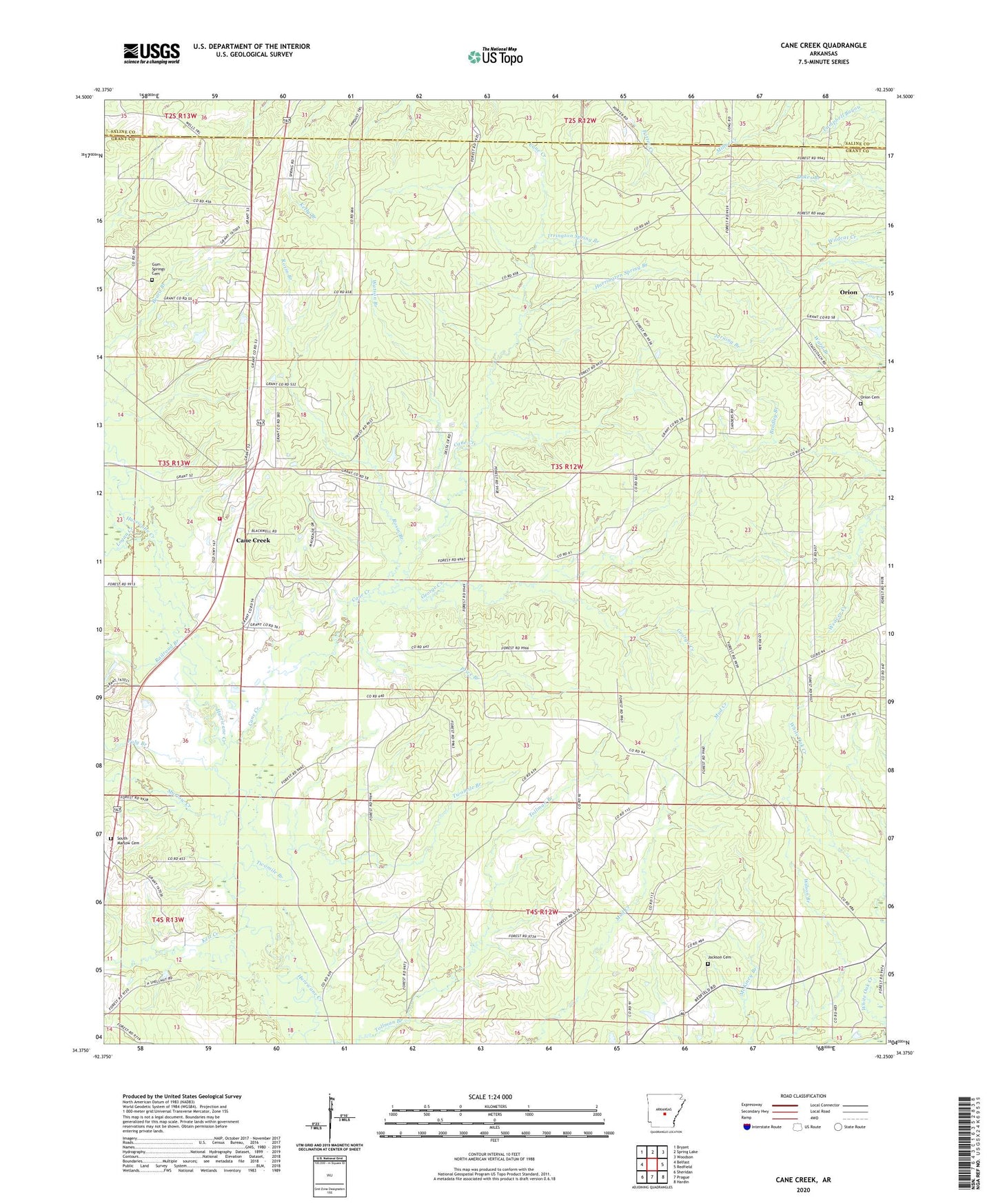
2024 topographic map quadrangle Cane Creek in the state of Arkansas. Scale: 1:24000. Based on the newly updated USGS 7.5' US Topo map series, this map is in the following counties: Grant, Saline. The map contains contour data, water features, and other items you are used to seeing on USGS maps, but also has updated roads and other features. This is the next generation of topographic maps. Printed on high-quality waterproof paper with UV fade-resistant inks.
Quads adjacent to this one:
West: Belfast
Northwest: Bryant
North: Spring Lake
Northeast: Woodson
East: Redfield
Southeast: Hardin
South: Prague
Southwest: Sheridan
This map covers the same area as the classic USGS quad with code o34092d3.
Contains the following named places: Bethel Church, Cane Creek, Cane Creek Volunteer Fire Department, Forest Tower Church, George Creek, Gum Springs Cemetery, Harrington Spring Branch, Ico, Irrington Spring Branch, Jackson Cemetery, Kelt Creek, KXIX-FM (Sheridan), Logan Creek, Marlow Church, Marlow Creek, Obin, Orion, Orion Cemetery, Poly Branch, Price Branch, Railroad Branch, Rosin Branch, South Marlow Cemetery, Township of Simpson, Twomile Branch, Watson Branch