MyTopo
Strong Arkansas US Topo Map
Couldn't load pickup availability
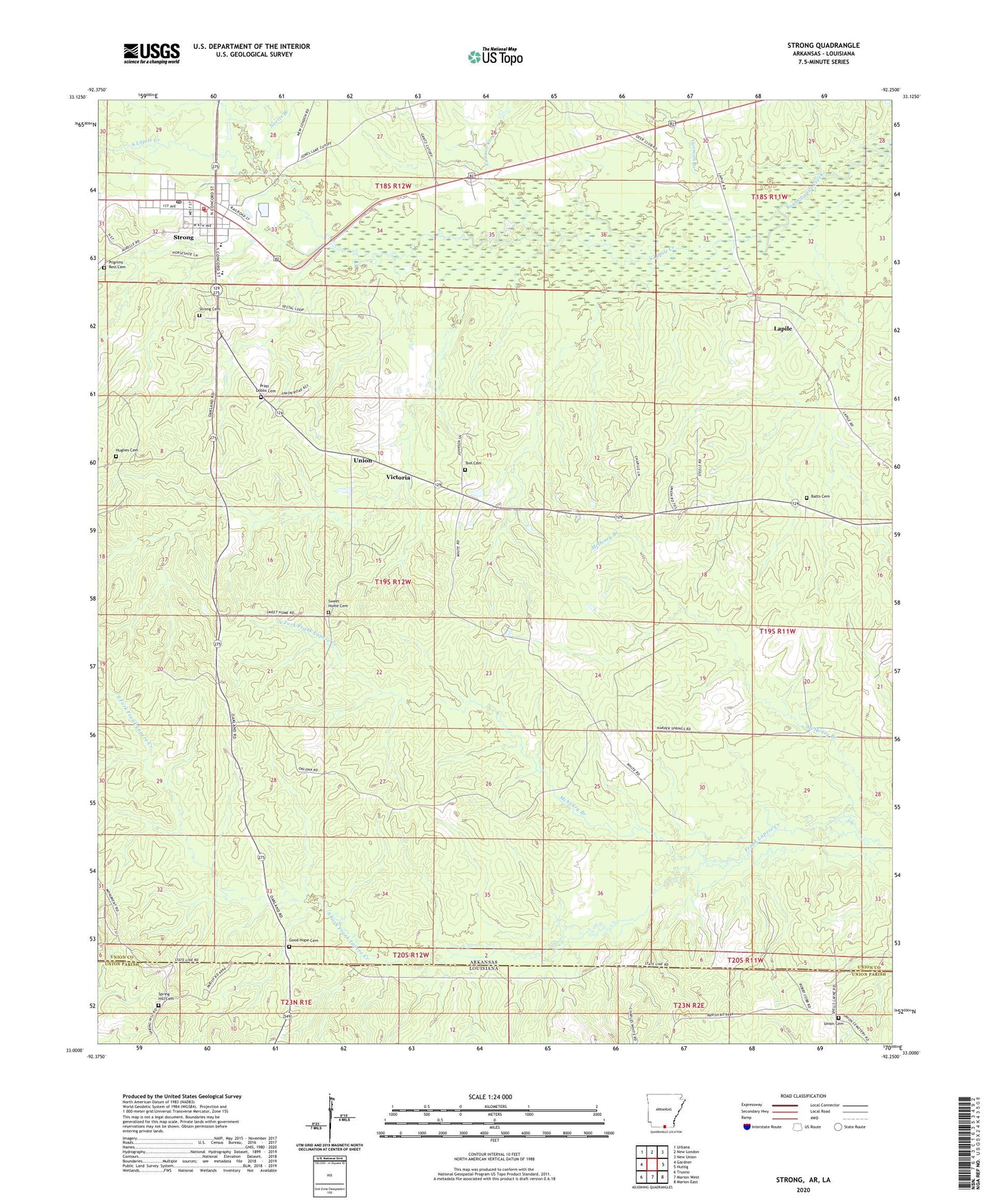
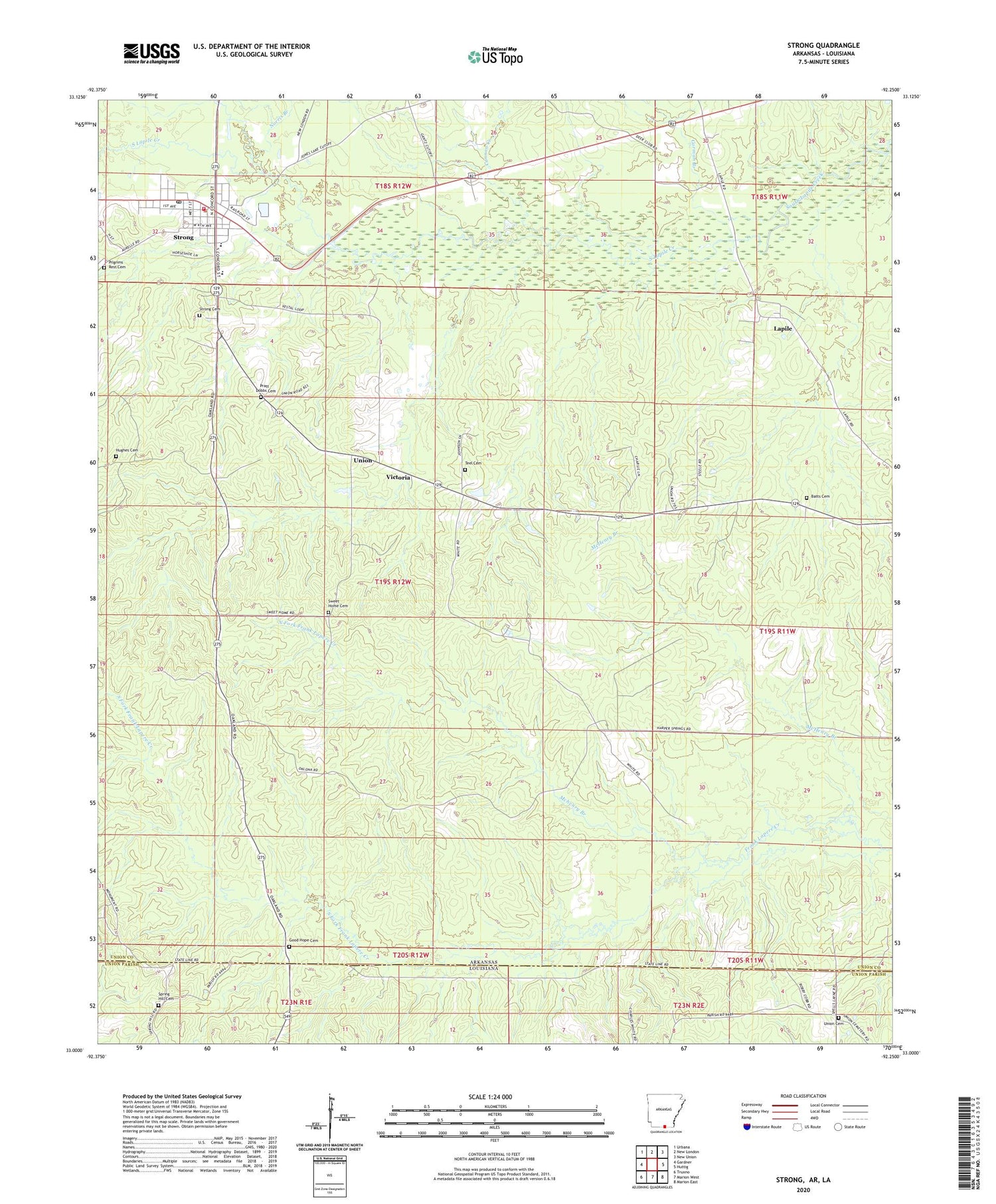
2024 topographic map quadrangle Strong in the states of Arkansas, Louisiana. Scale: 1:24000. Based on the newly updated USGS 7.5' US Topo map series, this map is in the following counties: Union. The map contains contour data, water features, and other items you are used to seeing on USGS maps, but also has updated roads and other features. This is the next generation of topographic maps. Printed on high-quality waterproof paper with UV fade-resistant inks.
Quads adjacent to this one:
West: Gardner
Northwest: Urbana
North: New London
Northeast: New Union
East: Huttig
Southeast: Marion East
South: Marion West
Southwest: Truxno
Contains the following named places: Batts Cemetery, Batts Chapel, Cannon Creek, City of Strong, Donaghey State Park, First Baptist Church, Gardner Strong Elementary School, Good Hope Cemetery, Good Hope Primitive Baptist Church, Gorman Branch, Hughes Cemetery, Lapile, Lapile Methodist Church, New Spring Hill Church, Norris Branch, North Fork Frank Lapere Creek, Pilgrims Rest Cemetery, Pratt - Dobbs Cemetery, South Fork Frank Lapere Creek, Spring Hill Cemetery, Strong, Strong Cemetery, Strong Elementary School, Strong High School, Strong Oil Field, Strong Park, Strong Post Office, Strong Volunteer Fire Department, Sweet Home Cemetery, Teel Cemetery, Township of Lapile, Union, Union Cemetery, Victoria