MyTopo
Woodson Arkansas US Topo Map
Couldn't load pickup availability
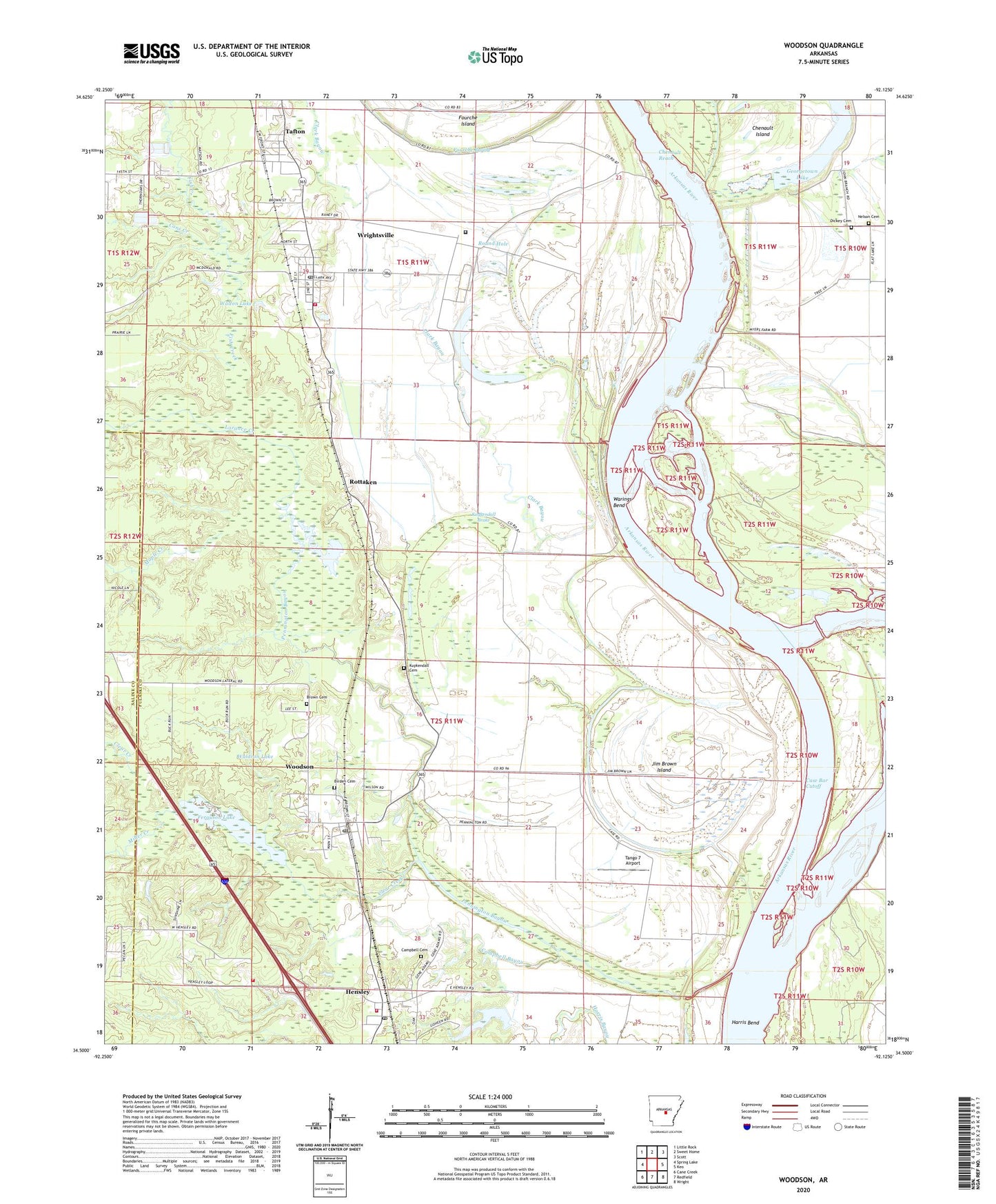
2024 topographic map quadrangle Woodson in the state of Arkansas. Scale: 1:24000. Based on the newly updated USGS 7.5' US Topo map series, this map is in the following counties: Pulaski, Saline. The map contains contour data, water features, and other items you are used to seeing on USGS maps, but also has updated roads and other features. This is the next generation of topographic maps. Printed on high-quality waterproof paper with UV fade-resistant inks.
Quads adjacent to this one:
West: Spring Lake
Northwest: Little Rock
North: Sweet Home
Northeast: Scott
East: Keo
Southeast: Wright
South: Redfield
Southwest: Cane Creek
This map covers the same area as the classic USGS quad with code o34092e2.
Contains the following named places: Arkansas Boys State Industrial School, Arkansas Department of Corrections - Wrightsville, Arkansas Department of Corrections Wrightsville Unit, Big Lake, Birden Cemetery, Brown Cemetery, Campbell Bayou, Campbell Cemetery, Cane Creek, Case Bar Cutoff, Cephus Church, Chenault Island, Chenault Reach, City of Wrightsville, Clark Bayou, Clear Creek, Dickey, Dickey Cemetery, Ferguson Lake, Fish Creek, Georgetown Lake, Gospel Temple Church, Harris Bend, Hensley, Hensley Census Designated Place, Hensley Fire Department Station 1, Hensley Fire Department Station 2, Hensley Post Office, Highway 365 Volunteer Fire Department Station 2, Jackson Memorial Church, Jim Brown Island, KAAY-AM (Little Rock), Kuykendall Brake, Kuykendall Cemetery, Lake Kuykendall, Lake Kuykendall Dam, Little Rock Gillett Levee, Lorance Creek, Maple Creek, Miller Creek, Nelson Cemetery, New Eagle Church, Old Eagle Church, Pennington Bayou, Rottaken, Round Hole, Tafton, Tango 7 Airport, Township of Campbell, Township of Perkins, Virginia Church, Waldron Lake, Waldron Lake Dam, Walton Lake, Walton Lake Dam, Warings Bend, West Hensley Church, Woodson, Woodson Census Designated Place, Woodson Post Office, Wrightsville, Wrightsville Post Office, Wrightsville Public Use Area