MyTopo
Spring Lake Arkansas US Topo Map
Couldn't load pickup availability
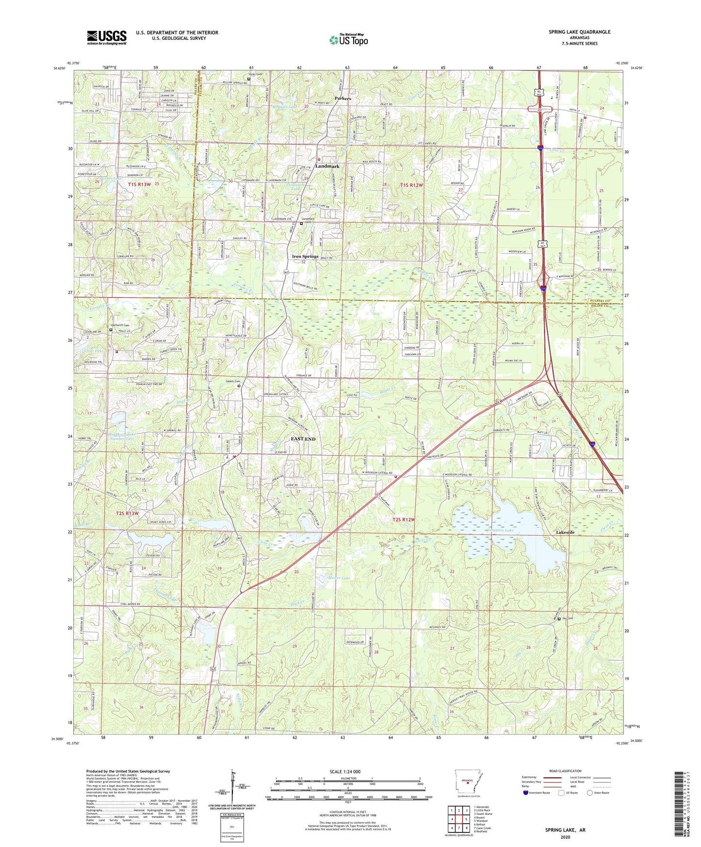
2024 topographic map quadrangle Spring Lake in the state of Arkansas. Scale: 1:24000. Based on the newly updated USGS 7.5' US Topo map series, this map is in the following counties: Saline, Pulaski. The map contains contour data, water features, and other items you are used to seeing on USGS maps, but also has updated roads and other features. This is the next generation of topographic maps. Printed on high-quality waterproof paper with UV fade-resistant inks.
Quads adjacent to this one:
West: Bryant
Northwest: Alexander
North: Little Rock
Northeast: Sweet Home
East: Woodson
Southeast: Redfield
South: Cane Creek
Southwest: Belfast
This map covers the same area as the classic USGS quad with code o34092e3.
Contains the following named places: Altharp, Arch Street Volunteer Fire Department Station 1, Aron Street Church, Bingham, Bloomfield Lake, Bloomfield Lake Dam, Brewer Branch, Carmelite Novitiate, Center Ridge Church, Church of Living God, Clear Lake, Clearlake Dam, Cole Mission, Craigs Mill, Daisy Bates Elementary School, Duck Creek, East End, East End Census Designated Place, East End Church, East End Elementary School, East End Intermediate School, East End School, East End Volunteer Fire Department Station 1, East End Volunteer Fire Department Station 2, East End Volunteer Fire Department Station 3, East Union Church, Eastern Star Club, Ferguson Lake, Ferguson Lake Dam, Freedom Church, Greens Mission, Hester Lake, Hicks Cemetery, Hopf Branch, Iron Springs, Ironton Church, Ivey School, Ivy Chapel, Jay Cemetery, Jay Creek, Kelly Branch, Lakeside, Lakeside Country Club, Landmark, Landmark Branch, Landmark Cemetery, Landmark Census Designated Place, Landmark Church, Landmark Elementary School, Landmark Lake, Landmark Lake Dam, Ledbetter Branch, Lorance Drive Church, Mary Lake, Mary Lake Dam, Mashburn Lake Number One, Mashburn Lake Number One Dam, Mashburn Lake Number Two, Mashburn Lake Number Two Dam, McCright Branch, McQuire Lake, Metropolitan Emergency Medical Service East Bend, Mill Branch, Mills Lake Dam, New Life Church, Olive Hill Church, Parker Lake, Parker Lake Dam, Parkers, Potter Creek, Pratt Road Church, Prides Airport, Quail Creek Volunteer Fire Department, Salem Cemetery, Salem Church, Sandy Ridge School, Shrine Club, Spring Lake, Spring Lake Church, Spring Lake Club, Spring Lake Dam, Sunny Ridge Church, Thompson Branch, Township of Banner, Treadway Branch, Trinity Church, United Church of Christ, Upchurch Cemetery, ZIP Code: 72065