MyTopo
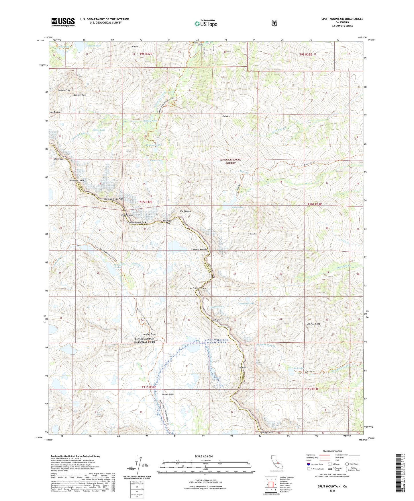
Split Mountain California US Topo Map
Couldn't load pickup availability
Also explore the Split Mountain Forest Service Topo of this same quad for updated USFS data
2021 topographic map quadrangle Split Mountain in the state of California. Scale: 1:24000. Based on the newly updated USGS 7.5' US Topo map series, this map is in the following counties: Inyo, Fresno. The map contains contour data, water features, and other items you are used to seeing on USGS maps, but also has updated roads and other features. This is the next generation of topographic maps. Printed on high-quality waterproof paper with UV fade-resistant inks.
Quads adjacent to this one:
West: North Palisade
Northwest: Mount Thompson
North: Coyote Flat
Northeast: Big Pine
East: Fish Springs
Southeast: Aberdeen
South: Mount Pinchot
Southwest: Marion Peak
This map covers the same area as the classic USGS quad with code o37118a4.
Contains the following named places: Big Pine Creek Campground, Big Pine Creek Number 2 6-011 Dam, Big Pine Creek South Fork Trailhead, Birch Campground, Birch Lake, Birch Mountain, Blue Star Mines, Brainerd Lake, Contact Pass, Disappointment Peak, Elinor Lake, Finger Lake, Kid Mountain, Mather Pass, Middle Palisade, Middle Palisade Glacier, Mount Alice, Mount Bolton Brown, Mount Gayley, Mount Jepson, Mount Prater, Mount Tinemaha, Norman Clyde Glacier, Norman Clyde Peak, North Fork Big Pine Creek, Palisade Crest, Palisade Lakes, Red Lake, Second Lake, South Fork Big Pine Creek, Southfork Pass, Split Mountain, Temple Crag, The Thumb, Third Lake, Tinemaha Lake, Upper Basin, Willow Lake