MyTopo
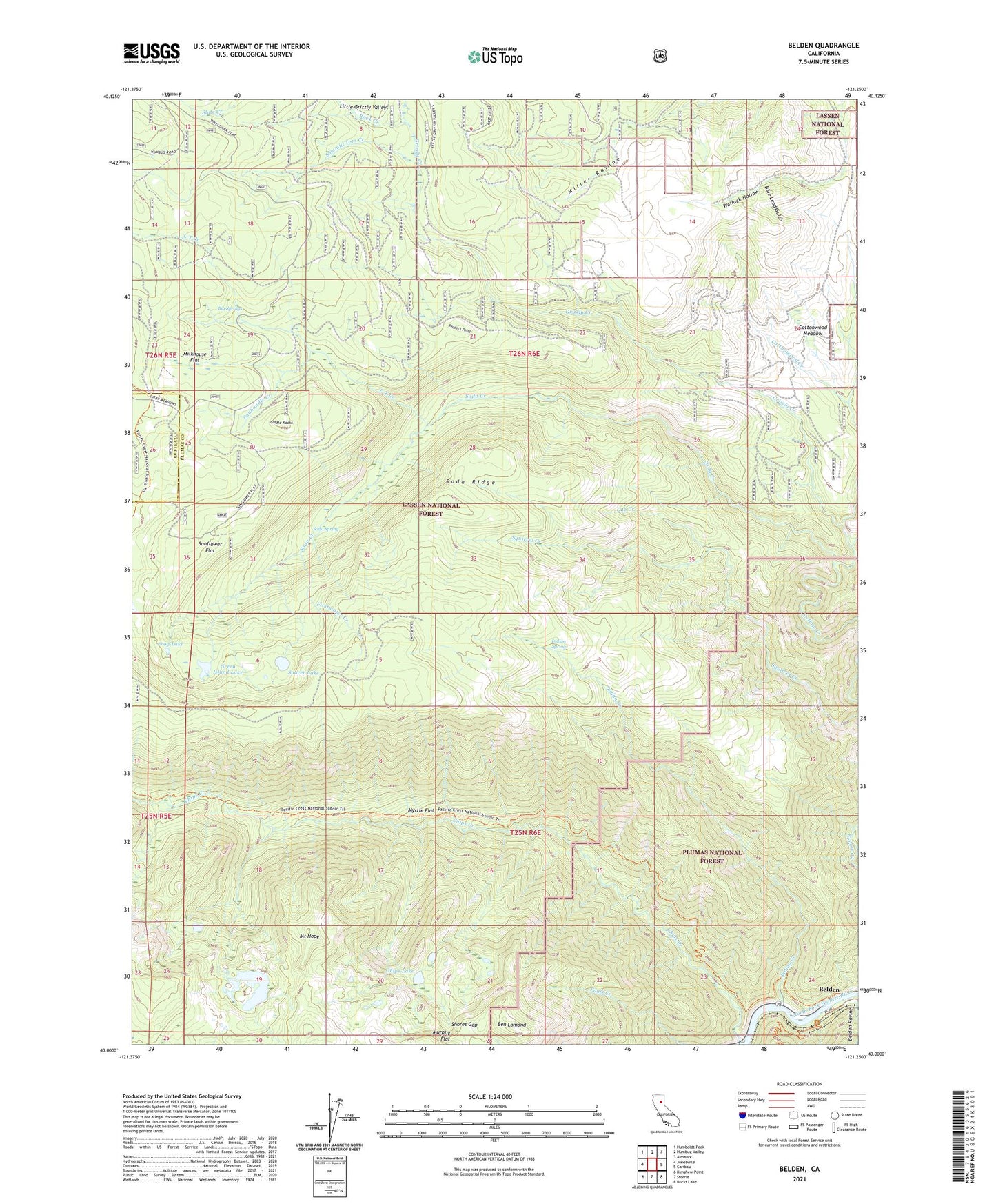
Belden California US Topo Map
Couldn't load pickup availability
Also explore the Belden Forest Service Topo of this same quad for updated USFS data
2021 topographic map quadrangle Belden in the state of California. Scale: 1:24000. Based on the newly updated USGS 7.5' US Topo map series, this map is in the following counties: Plumas, Butte. The map contains contour data, water features, and other items you are used to seeing on USGS maps, but also has updated roads and other features. This is the next generation of topographic maps. Printed on high-quality waterproof paper with UV fade-resistant inks.
Quads adjacent to this one:
West: Jonesville
Northwest: Humboldt Peak
North: Humbug Valley
Northeast: Almanor
East: Caribou
Southeast: Bucks Lake
South: Storrie
Southwest: Kimshew Point
This map covers the same area as the classic USGS quad with code o40121a3.
Contains the following named places: Belden Census Designated Place, Ben Lomond, Big Springs, Blue Lead Gulch, Castle Rocks, Chips Lake, Cottonwood Meadow, Cub Creek, Ebbe Stamp Mill, Firstwater Creek, Frog Lake, Green Island Lake, Grizzly Creek, Indian Creek, Indian Springs, Lott Mine, L-T Creek, Milkhouse Flat, Morris Lake, Morris Mine, Mount Hope, Myrtle Flat, Panhandle Creek, Peacock Point, Rock Creek, Saucer Lake, Sawmill Tom Creek, Shores Gap, Soda Creek, Soda Ridge, Soda Spring, Sunflower Flat, Wallack Hollow, Yellow Creek