MyTopo
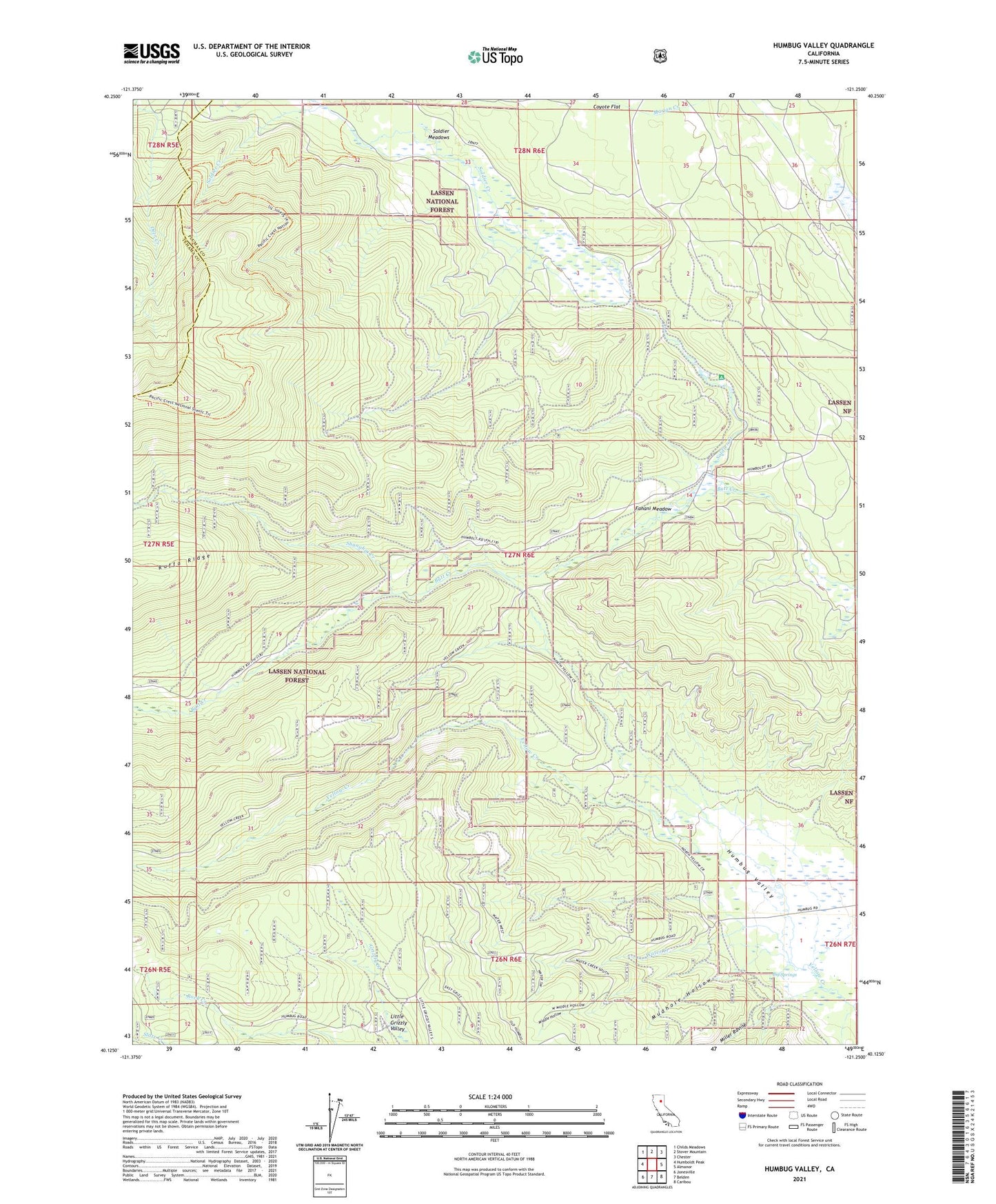
Humbug Valley California US Topo Map
Couldn't load pickup availability
Also explore the Humbug Valley Forest Service Topo of this same quad for updated USFS data
2021 topographic map quadrangle Humbug Valley in the state of California. Scale: 1:24000. Based on the newly updated USGS 7.5' US Topo map series, this map is in the following counties: Plumas, Tehama. The map contains contour data, water features, and other items you are used to seeing on USGS maps, but also has updated roads and other features. This is the next generation of topographic maps. Printed on high-quality waterproof paper with UV fade-resistant inks.
Quads adjacent to this one:
West: Humboldt Peak
Northwest: Childs Meadows
North: Stover Mountain
Northeast: Chester
East: Almanor
Southeast: Caribou
South: Belden
Southwest: Jonesville
This map covers the same area as the classic USGS quad with code o40121b3.
Contains the following named places: Baccala Ranch, Big Springs, Coyote Flat, Fanani Meadow, Humbug Creek, Lemm Ranch, Little Grizzly Campground, Little Grizzly Valley, Middle Hollow, Miller Ravine, Mud Lake, Mudhole Hollow, Shanghai Creek, Slate Creek, Soldier Creek, Soldier Meadows, Soldier Meadows Campground, Water Creek, Yellow Creek Trail