MyTopo
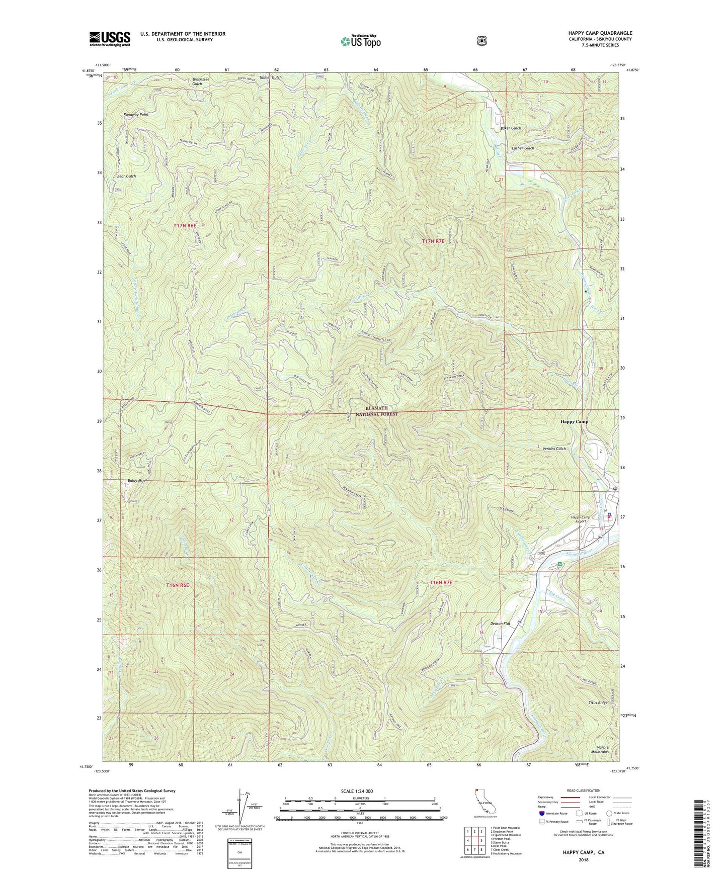
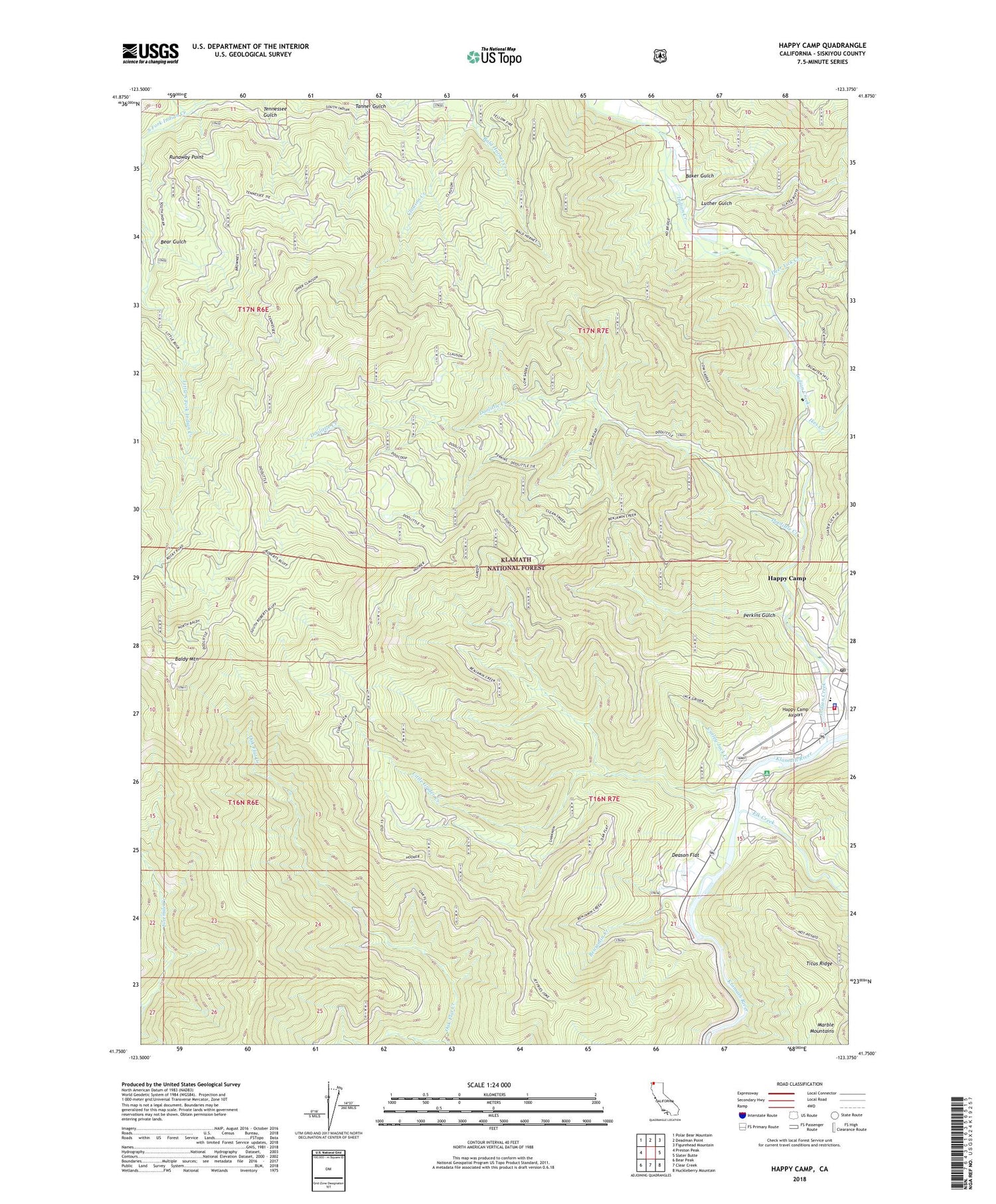
Happy Camp California US Topo Map
Couldn't load pickup availability
Also explore the Happy Camp Forest Service Topo of this same quad for updated USFS data
2022 topographic map quadrangle Happy Camp in the state of California. Scale: 1:24000. Based on the newly updated USGS 7.5' US Topo map series, this map is in the following counties: Siskiyou. The map contains contour data, water features, and other items you are used to seeing on USGS maps, but also has updated roads and other features. This is the next generation of topographic maps. Printed on high-quality waterproof paper with UV fade-resistant inks.
Quads adjacent to this one:
West: Preston Peak
Northwest: Polar Bear Mountain
North: Deadman Point
Northeast: Figurehead Mountain
East: Slater Butte
Southeast: Huckleberry Mountain
South: Clear Creek
Southwest: Bear Peak
This map covers the same area as the classic USGS quad with code o41123g4.
Contains the following named places: Baker Gulch, Baldy Mountain, Baldy Mountain Lookout, Baldy Mountain Ridge, Beans Camp, Bear Gulch, Benjamin Creek, Cole Creek, Curley Jack Campground, Curley Jack Creek, Deason Flat, Deer Lick Creek, Doolittle Creek, Elk Creek, Happy Camp, Happy Camp Airport, Happy Camp Branch Siskiyou County Public Library, Happy Camp Cemetery, Happy Camp Census Designated Place, Happy Camp Elementary School, Happy Camp Fire Protection and Ambulance District, Happy Camp High School, Happy Camp Post Office, Happy Camp Ranger Station, Ikes Creek, Indian Creek, Indian Creek School, Indian Creek Trailer Park, Little Grider Creek, Luther Gulch, Perkins Gulch, Phillips Gulch, Runaway Point, Sheep Camp, Sheep Camp Lookout, Siskiyou County Sheriff's Office Happy Camp, West Fork Little South Fork Indian Creek