MyTopo
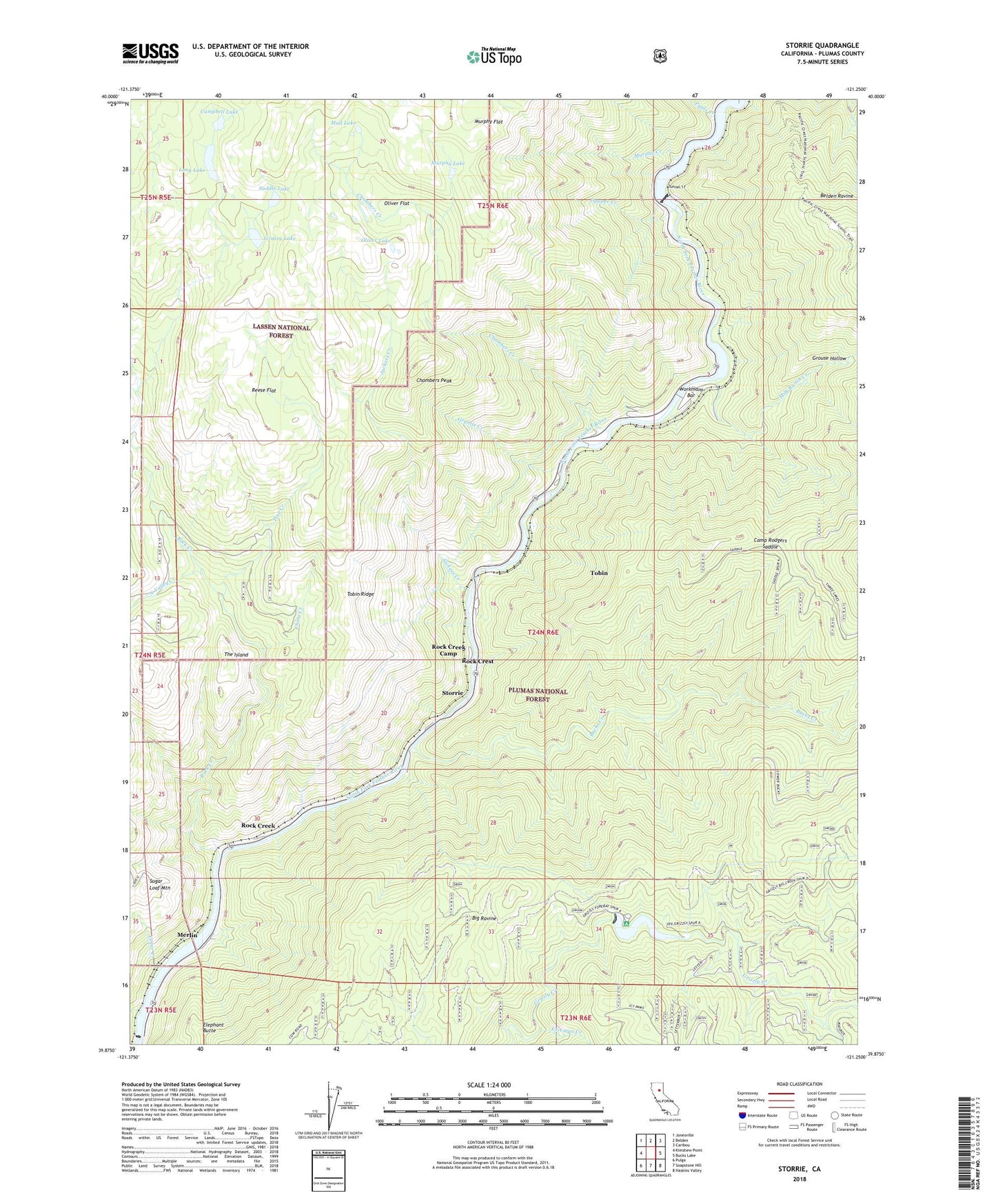
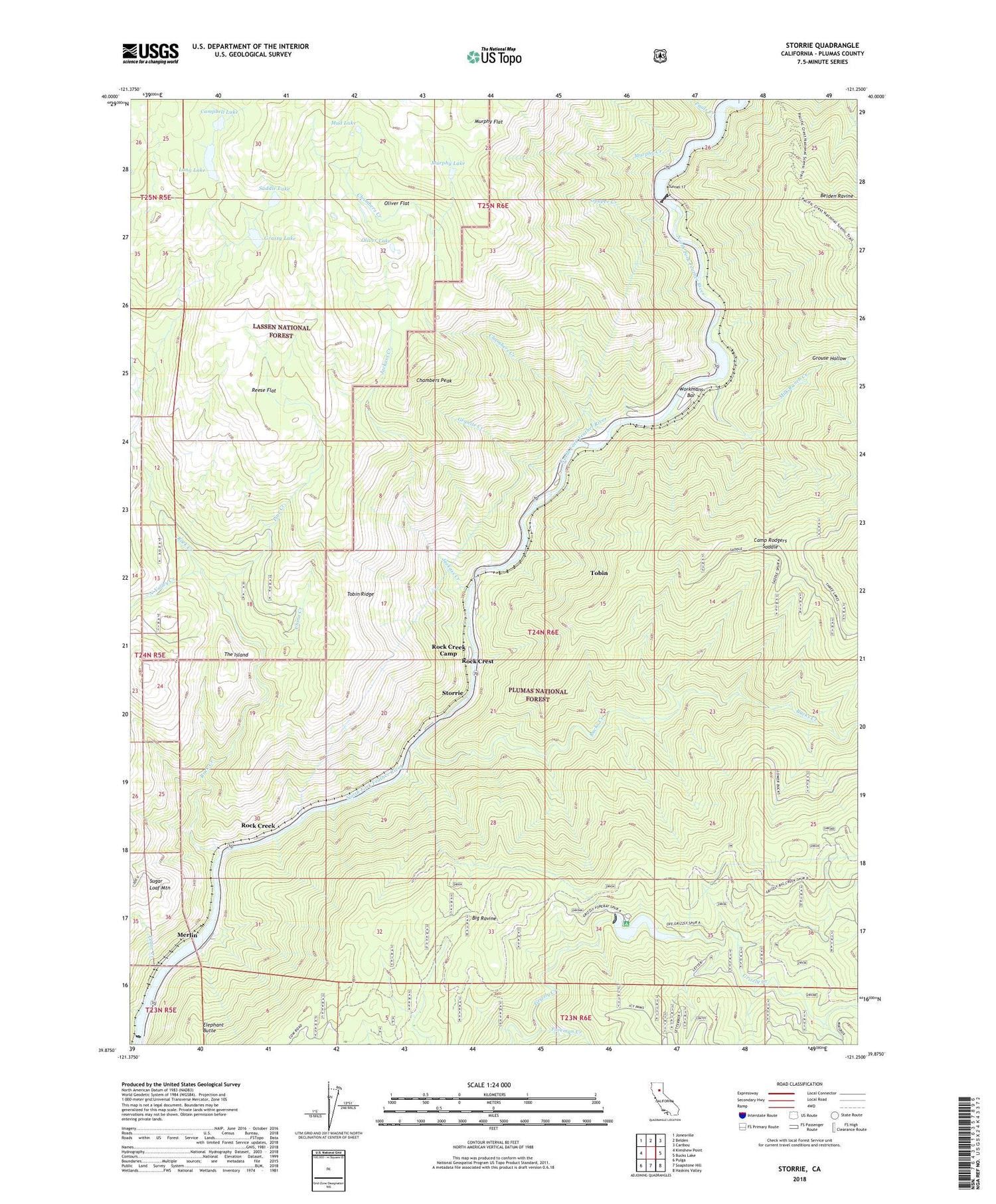
Storrie California US Topo Map
Couldn't load pickup availability
Also explore the Storrie Forest Service Topo of this same quad for updated USFS data
2022 topographic map quadrangle Storrie in the state of California. Scale: 1:24000. Based on the newly updated USGS 7.5' US Topo map series, this map is in the following counties: Plumas. The map contains contour data, water features, and other items you are used to seeing on USGS maps, but also has updated roads and other features. This is the next generation of topographic maps. Printed on high-quality waterproof paper with UV fade-resistant inks.
Quads adjacent to this one:
West: Kimshew Point
Northwest: Jonesville
North: Belden
Northeast: Caribou
East: Bucks Lake
Southeast: Haskins Valley
South: Soapstone Hill
Southwest: Pulga
This map covers the same area as the classic USGS quad with code o39121h3.
Contains the following named places: Bucks Creek, Bucks Creek Powerhouse, Camp Rodgers, Camp Rodgers Saddle, Camp Rogers Post Office, Campbell Lake, Campbells Lakes, Cedar Creek, Chambers Creek, Chambers Peak, China Creek, Chips Creek, Cresta Dam, Elephant Butte, Foreman Creek, Granite Creek, Grassy Lake, Grizzly Forebay, Grizzly Forebay 94-003 Dam, Grizzly Forebay Campgsite, Grouse Hollow, Indian Jim Elementary School, Injun Jim Campground, Jackass Creek, James Lee Campground, Letterbox Creek, Long Lake, Merlin, Milk Ranch Creek, Mud Lake, Murphy Creek, Murphy Flat, Murphy Lake, North Valley Creek, Oliver Flat, Oliver Lake, Opapee Creek, Pauls Creek, Pine Creek, Reese Flat, Rock Creek, Rock Creek Camp, Rock Creek Crossing, Rock Creek Dam, Rock Creek Powerhouse, Rock Creek Reservoir, Rock Crest, Rodgers Flat, Rodgers Flat Heliport, Saddle Lake, Storrie, Storrie Census Designated Place, Sugar Loaf Mountain, Swamp Creek, The Island, Tobin, Tobin Census Designated Place, Tobin Ridge, Tunnel 17, Workmans Bar