MyTopo
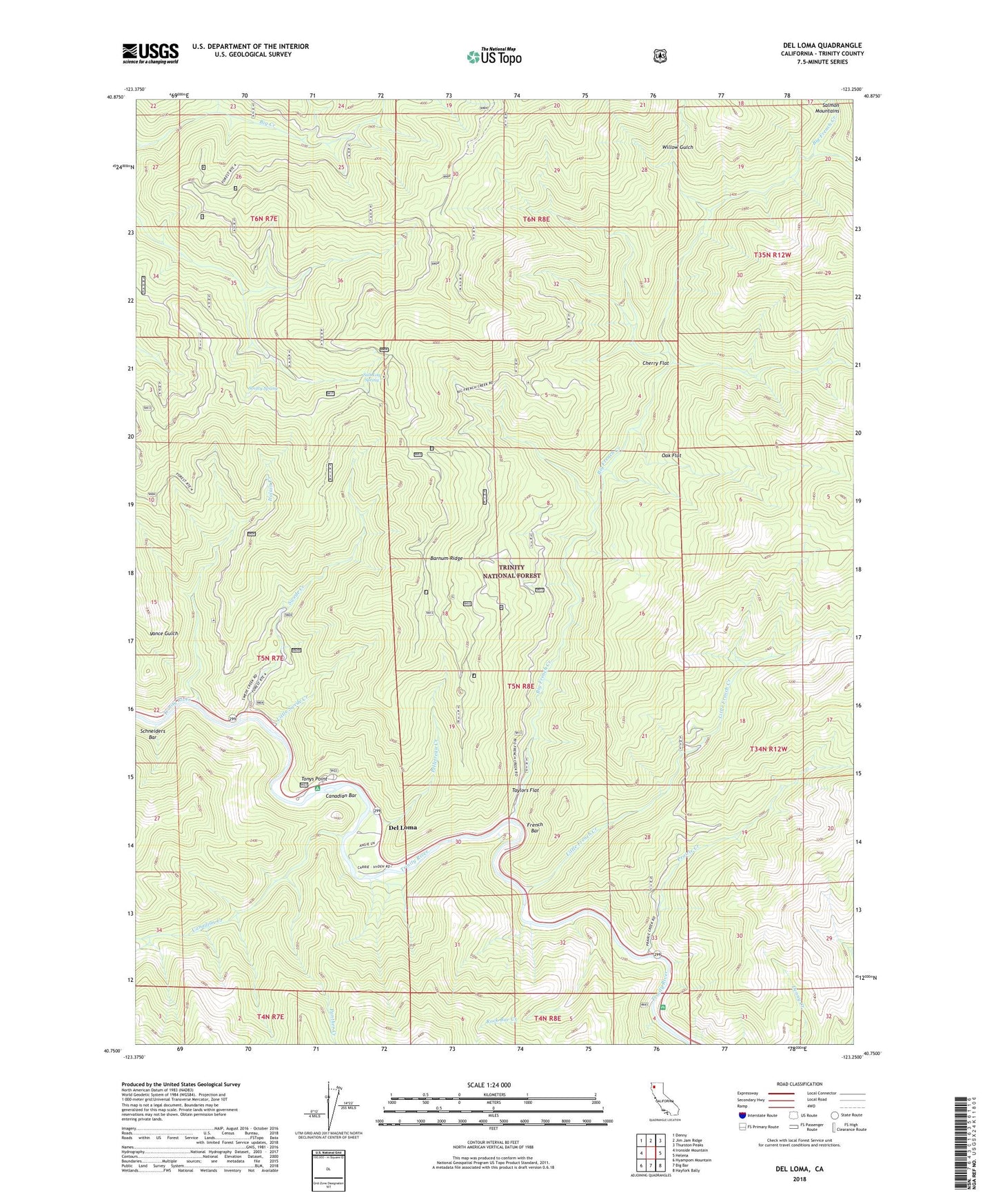
Del Loma California US Topo Map
Couldn't load pickup availability
Also explore the Del Loma Forest Service Topo of this same quad for updated USFS data
2022 topographic map quadrangle Del Loma in the state of California. Scale: 1:24000. Based on the newly updated USGS 7.5' US Topo map series, this map is in the following counties: Trinity. The map contains contour data, water features, and other items you are used to seeing on USGS maps, but also has updated roads and other features. This is the next generation of topographic maps. Printed on high-quality waterproof paper with UV fade-resistant inks.
Quads adjacent to this one:
West: Ironside Mountain
Northwest: Denny
North: Jim Jam Ridge
Northeast: Thurston Peaks
East: Helena
Southeast: Hayfork Bally
South: Big Bar
Southwest: Hyampom Mountain
This map covers the same area as the classic USGS quad with code o40123g3.
Contains the following named places: Barnum Ridge, Big French Creek, Brooks Ranch, Buckhorn Camp, Canadian Bar, Canadian Creek, Cherry Flat, Del Loma, Denny Creek, East Fork Big French Creek, French Bar, Green Mountain Trailhead Parking, Hayden Flat Campground, Hayden Flat Guard Station, Italian Creek, Little French Creek, Little Prairie, Little Swede Creek, Lower Waldorff Ranch, New River Divide Trail, Oak Flat, Panther Creek, Pelletreau Creek, Prairie Creek, Rock Bar Creek, Salt Log Spring, Schneiders Bar, Smitty Spring, Swede Creek, Taylors Flat, Tonys Point, Upper Waldorff Ranch, Whites Bar Creek, Whites Bar Picnic Area, Willow Gulch