
MyTopo
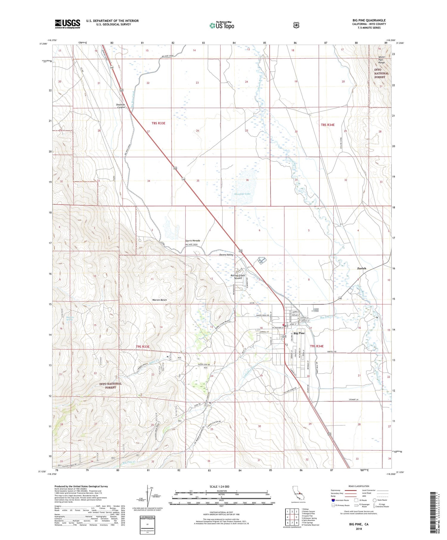
Big Pine California US Topo Map
Couldn't load pickup availability
Also explore the Big Pine Forest Service Topo of this same quad for updated USFS data
2021 topographic map quadrangle Big Pine in the state of California. Scale: 1:24000. Based on the newly updated USGS 7.5' US Topo map series, this map is in the following counties: Inyo. The map contains contour data, water features, and other items you are used to seeing on USGS maps, but also has updated roads and other features. This is the next generation of topographic maps. Printed on high-quality waterproof paper with UV fade-resistant inks.
Quads adjacent to this one:
West: Coyote Flat
Northwest: Bishop
North: Poleta Canyon
Northeast: Westgard Pass
East: Uhlmeyer Spring
Southeast: Tinemaha Reservoir
South: Fish Springs
Southwest: Split Mountain
This map covers the same area as the classic USGS quad with code o37118b3.
Contains the following named places: Baker Creek, Baker Creek Recreation Site, Bakoch Prospect, Big Pine, Big Pine Canal, Big Pine Cemetery, Big Pine Census Designated Place, Big Pine Community United Methodist Church, Big Pine Creek, Big Pine Fire Department, Big Pine High School, Big Pine K - 8 Elementary School, Big Pine Post Office, Big Pine Reservation, Big Pine Spring, Big Pine Triangle County Park, Inyo Camp, Inyo Heights High School, Klondike Lake, Little Pine Creek, Mendenhall Park, Owens Valley Radio Observatory, Owens Valley Ranch, Rolling Green Terrace, Shannon Canyon, Sierra White Quarry, Valley School, Warren Bench, Warren Lake, Zurich


