MyTopo
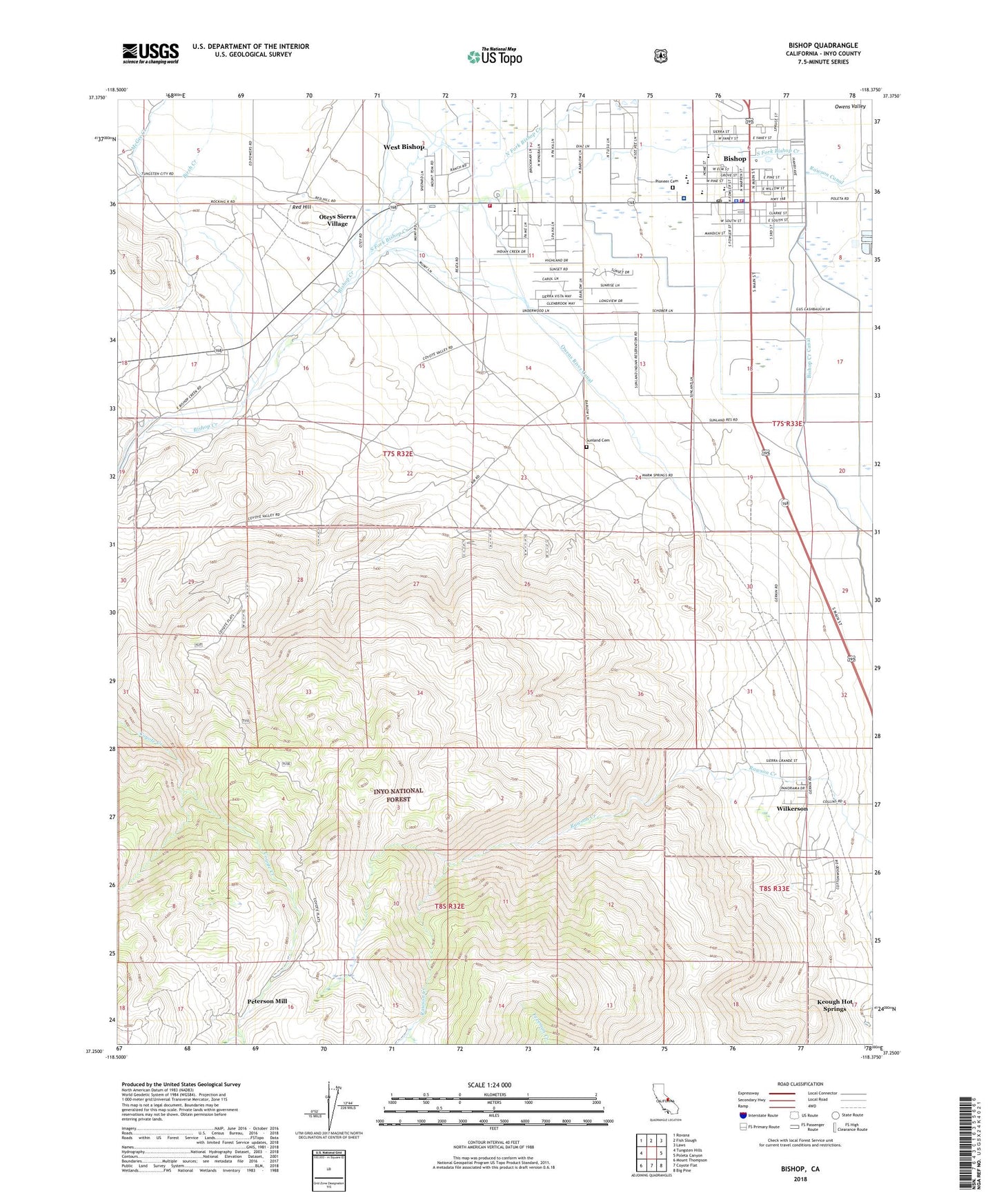
Bishop California US Topo Map
Couldn't load pickup availability
Also explore the Bishop Forest Service Topo of this same quad for updated USFS data
2021 topographic map quadrangle Bishop in the state of California. Scale: 1:24000. Based on the newly updated USGS 7.5' US Topo map series, this map is in the following counties: Inyo. The map contains contour data, water features, and other items you are used to seeing on USGS maps, but also has updated roads and other features. This is the next generation of topographic maps. Printed on high-quality waterproof paper with UV fade-resistant inks.
Quads adjacent to this one:
West: Tungsten Hills
Northwest: Rovana
North: Fish Slough
Northeast: Laws
East: Poleta Canyon
Southeast: Big Pine
South: Coyote Flat
Southwest: Mount Thompson
This map covers the same area as the classic USGS quad with code o37118c4.
Contains the following named places: Bethel Chapel Community Church, Birch Creek, Bishop, Bishop City Hall, Bishop City Park, Bishop Creek, Bishop Creek Canal, Bishop Division, Bishop Fire Department Station 1 Headquarters, Bishop Golf Club, Bishop Mine, Bishop Post Office, Bishop Reservation, Bishop SDA Elementary School, Bishop Trail Park, Bishop Union High School, Bishop Visitors Center, Brown Prospect, Browns Town Recreational Vehicle Park, Calvary Baptist Church, Calvary Christian School, Cerro Coso Community College, Chipmunk Mine, Church of Christ, Church of the Nazarene, City of Bishop, East Fork Coyote Creek, Elm Street Elementary School, First Presbyterian Church, First Southern Baptist Church, First United Methodist Church, Foursquare Gospel Church, Freeman Creek, Genes Mobile Home Park, Grace Lutheran Church, Hilltop Mine, Home Street Middle School, Inyo County Sheriff's Office Bishop, Inyo National Forest Supervisors Ofiice, Irving School, Izaak Walton Park, J Diamond Trailer and Recreational Vehicle Park, KBOV-AM (Bishop), Keough Hot Springs, Kingdom Hall of Jehovahs Witnesses, Lassen College, Morningside Elementary School, Mountain View Mobile and Recreational Vehicle Park, Neighborhood Assembly of God Church, Northern Inyo Hospital, Northern Inyo Hospital Medical Library, Nunsinger Prospect, Oteys Sierra Village, Our Lady of Perpetual Help Catholic Church, Our Saviour Lutheran Church, Owens River Canal, Paiute-Shoshone Indian Cultural Center, Peterson Mill, Pine Street Elementary School, Pioneer Cemetery, Rawson Creek, Red Hill, Rocking K, Rossi Mine, Saint Timothys Episcopal Church, Sand Canyon, Schober Lane Recreation Site, Seventh Day Adventist Church, Shady Rest Trailer and Recreational Vehicle Park, Sierra Trailer Park, South Fork Bishop Creek, Sunland, Sunland Cemetery, Sunland School, Sunrise Mobile Home Park, Symons Emergency Specialties, The Church of Jesus Christ of Latter Day Saints, Tri-County Fairgrounds, United States Forest Service White Mountain Ranger Station, Valley Presbyterian Church, West Bishop, West Bishop Census Designated Place, West Fork Coyote Creek, West Ridge Fire Department Station 2, White Mountain Ranger Station, Wildrose Home, Wilkerson Census Designated Place, Wilkerson Tract, Yaney Mine