MyTopo
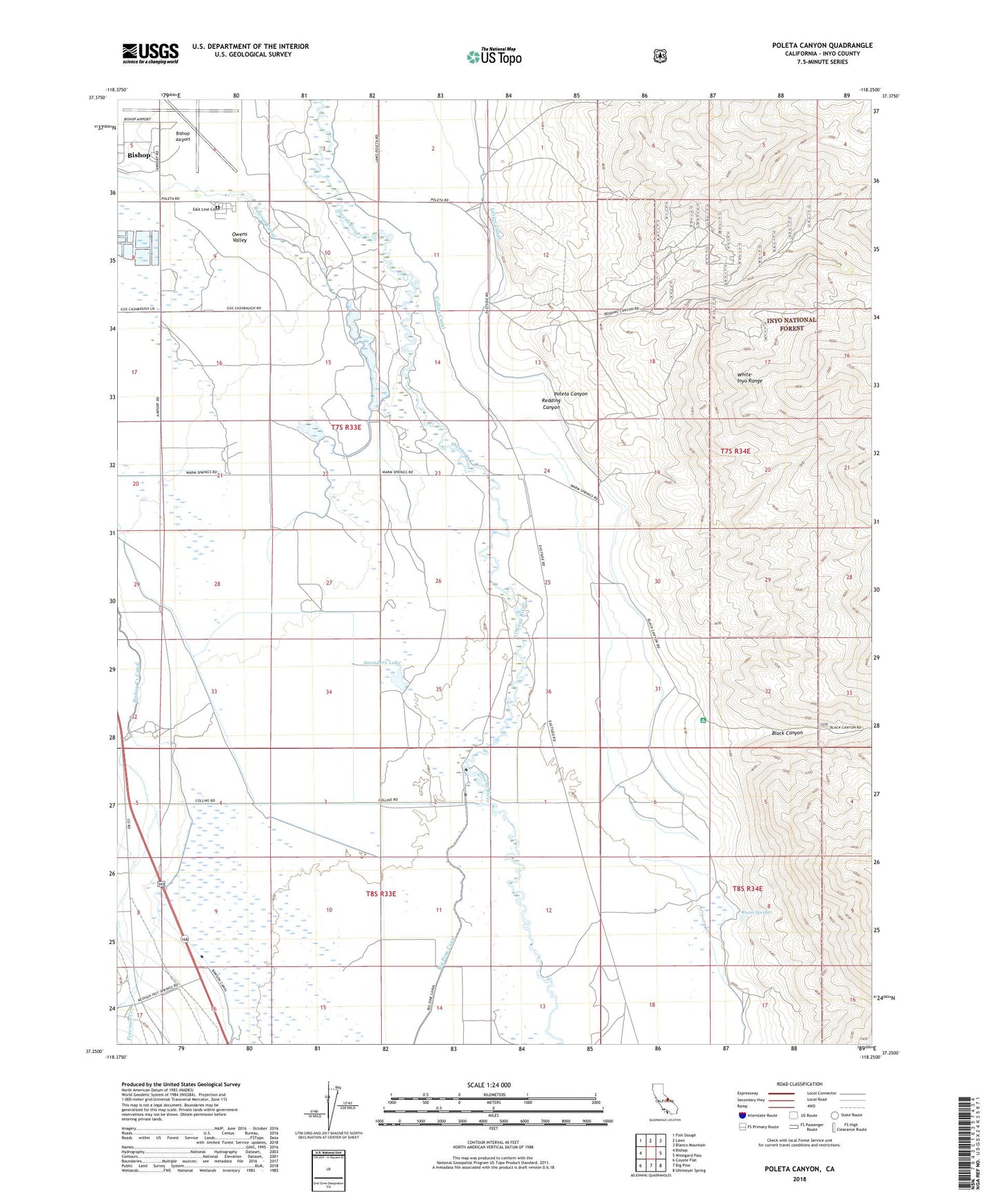
Poleta Canyon California US Topo Map
Couldn't load pickup availability
Also explore the Poleta Canyon Forest Service Topo of this same quad for updated USFS data
2021 topographic map quadrangle Poleta Canyon in the state of California. Scale: 1:24000. Based on the newly updated USGS 7.5' US Topo map series, this map is in the following counties: Inyo. The map contains contour data, water features, and other items you are used to seeing on USGS maps, but also has updated roads and other features. This is the next generation of topographic maps. Printed on high-quality waterproof paper with UV fade-resistant inks.
Quads adjacent to this one:
West: Bishop
Northwest: Fish Slough
North: Laws
Northeast: Blanco Mountain
East: Westgard Pass
Southeast: Uhlmeyer Spring
South: Big Pine
Southwest: Coyote Flat
This map covers the same area as the classic USGS quad with code o37118c3.
Contains the following named places: Bigelow, Bishop Airport, Bishop Army Air Field, Black Canyon, Center School, Collins Canal, East Line Cemetery, Geiger Canal, Inyo County Sheriff Search and Rescue Heliport, Jamieson Pit, Poleta, Poleta Canyon, Poleta Mine, Poleta Picnic Area, Rawson Canal, Redding Canyon, Saunders Lake, Sierra Lifeflight, Warm Springs, Warm Springs School