MyTopo
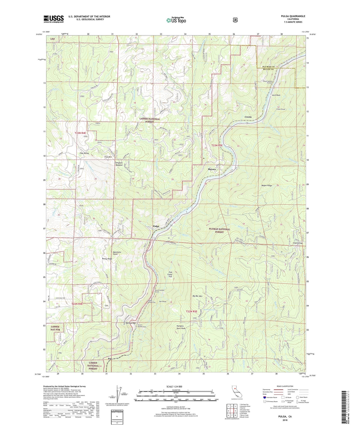
Pulga California US Topo Map
Couldn't load pickup availability
Also explore the Pulga Forest Service Topo of this same quad for updated USFS data
2022 topographic map quadrangle Pulga in the state of California. Scale: 1:24000. Based on the newly updated USGS 7.5' US Topo map series, this map is in the following counties: Butte, Plumas. The map contains contour data, water features, and other items you are used to seeing on USGS maps, but also has updated roads and other features. This is the next generation of topographic maps. Printed on high-quality waterproof paper with UV fade-resistant inks.
Quads adjacent to this one:
West: Paradise East
Northwest: Stirling City
North: Kimshew Point
Northeast: Storrie
East: Soapstone Hill
Southeast: Brush Creek
South: Berry Creek
Southwest: Cherokee
This map covers the same area as the classic USGS quad with code o39121g4.
Contains the following named places: Arch Rock, Bardees Bar, Batchelor Point, Bear Ranch Creek, Big Bar, Big Bar Mountain, Camp Creek, Camp Creek Powerhouse, Campbell Meadow, Cedar Creek, Coyote Gap, Coyote Gap Forest Service Station, Crain Mill, Cresta, Cresta Powerhouse, Cresta Tunnel, Dogwood Creek, Fish Camp Flat, Five Corners, Flea Mountain, Flea Valley, Flea Valley Creek, Heinz Creek, Hibbard Creek, Hungary Hunt Peak, Hutchins Mill, Johnson Cabin, Lockerman Creek, Magee Ridge, Mayaro, Mill Creek, Mill Creek Cal-Transit, Mill Creek Cal-Transit Station, Old Defiance Mill, Pine Cluster Ranch, Poe Dam, Poe Tunnel, Pulga, Rag Dump, Rocky Ridge, Shady Rest Area, Shady Rest Receration Area, South Branch Mill Creek, Tunnel Number Eleven, Tunnel Number Nine, Tunnel Number Ten, Tunnel Number Thirteen, Wyman Spring