
MyTopo
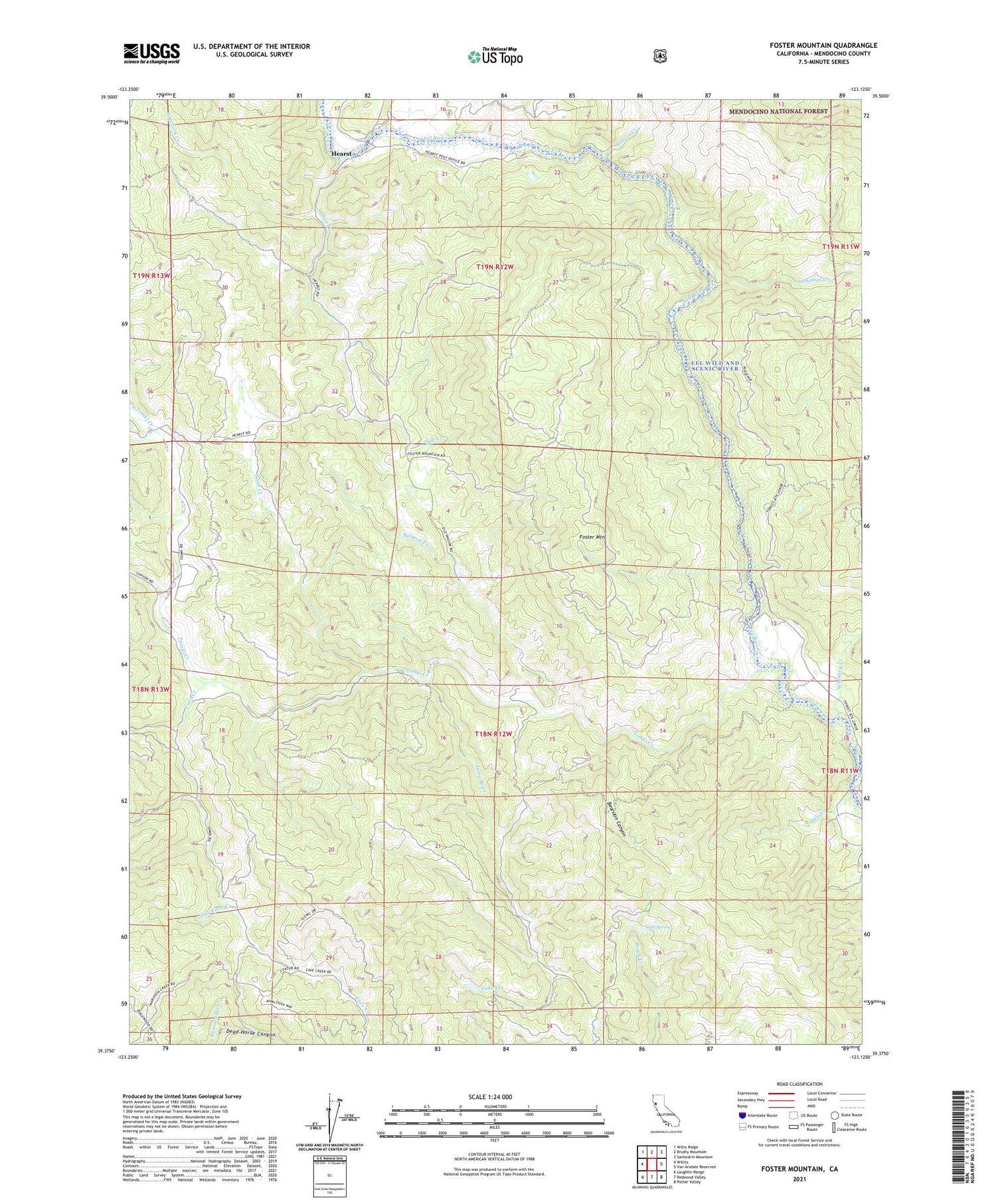
Foster Mountain California US Topo Map
Couldn't load pickup availability
Also explore the Foster Mountain Forest Service Topo of this same quad for updated USFS data
2021 topographic map quadrangle Foster Mountain in the state of California. Scale: 1:24000. Based on the newly updated USGS 7.5' US Topo map series, this map is in the following counties: Mendocino. The map contains contour data, water features, and other items you are used to seeing on USGS maps, but also has updated roads and other features. This is the next generation of topographic maps. Printed on high-quality waterproof paper with UV fade-resistant inks.
Quads adjacent to this one:
West: Willits
Northwest: Willis Ridge
North: Brushy Mountain
Northeast: Sanhedrin Mountain
East: Van Arsdale Reservoir
Southeast: Potter Valley
South: Redwood Valley
Southwest: Laughlin Range
This map covers the same area as the classic USGS quad with code o39123d2.
Contains the following named places: Baker Springs Ranch, Bearskin Canyon, Cave Creek, Dead Horse Canyon, Emandal Resort, Folsom Ranch, Foster Mountain, Garcey Ranch, Garcia Creek, Hale Creek, Hearst, Hearst Post Office, Johnson Ranch, Lake Lee, Lazy Moon Ranch, Little Cave Creek, Long Branch Creek, Long Opening Creek, Marshalls Cabins, Old Fulwider Ranch, Rocktree Creek, Sagehorn Creek, Salmon Creek, Salt Creek, Scott Creek, Soda Spring, Soudan Ranch, Thomas Creek, Todd Ranch, Tomki Creek, Triangle G Ranch, Valleys End Ranch, Whitney Creek


