MyTopo
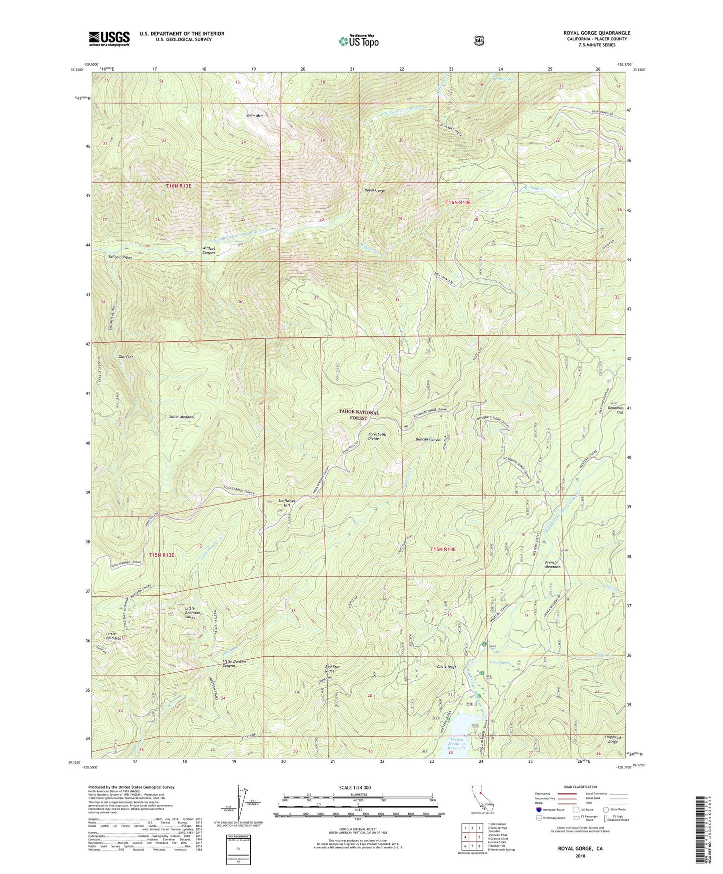
Royal Gorge California US Topo Map
Couldn't load pickup availability
Also explore the Royal Gorge Forest Service Topo of this same quad for updated USFS data
2022 topographic map quadrangle Royal Gorge in the state of California. Scale: 1:24000. Based on the newly updated USGS 7.5' US Topo map series, this map is in the following counties: Placer. The map contains contour data, water features, and other items you are used to seeing on USGS maps, but also has updated roads and other features. This is the next generation of topographic maps. Printed on high-quality waterproof paper with UV fade-resistant inks.
Quads adjacent to this one:
West: Duncan Peak
Northwest: Cisco Grove
North: Soda Springs
Northeast: Norden
East: Granite Chief
Southeast: Wentworth Springs
South: Bunker Hill
Southwest: Greek Store
This map covers the same area as the classic USGS quad with code o39120b4.
Contains the following named places: Ahart Campground, Black Bear Campground, Chalk Bluff, Coyote Group Campground, Coyote Spring, Deadman Flat, Dolly Creek, French Meadows, Gates Cabin, Gates Group Campground, Handy Camp, Heath Spring, Lewis Campground, Little Duncan Canyon, Little Duncan Creek, Little Robinsons Valley, Lost Emigrant Mine, Oak Flat, Palisade Creek, Placer Queen Mine, Red Star Ridge, Rice Creek, Royal Gorge, Royal Gorge River, Sailor Canyon, Sailor Canyon Mine, Sailor Flat Trail, Sailor Meadow, Sailore Flat Trail, Snow Mountain, Sunflower Hill, Tevis Cup Trail, Trinidad Mine, Wabena Creek, Wabena Trail, Walker Mine, Wildcat Canyon, X-Ray Mine