MyTopo
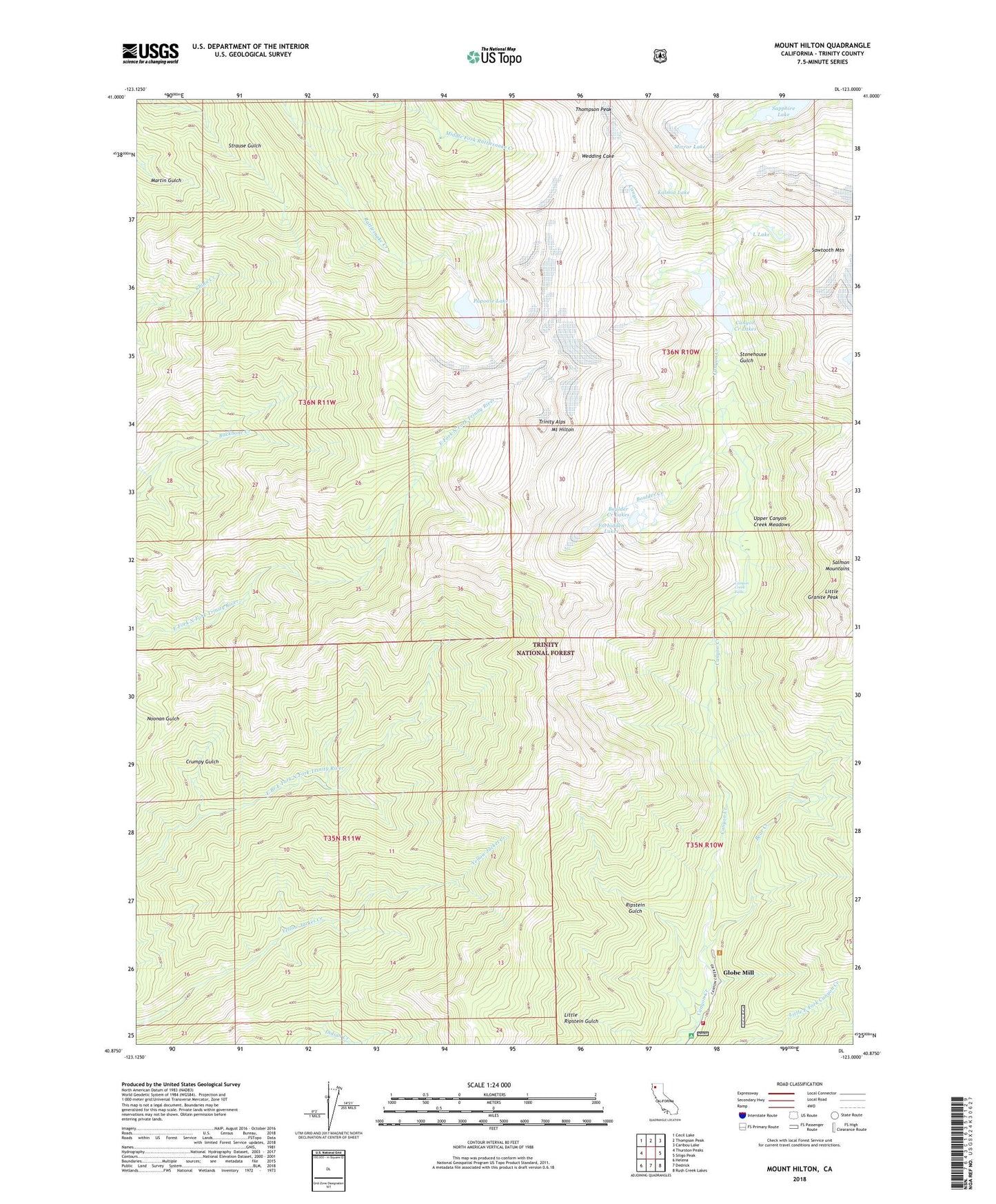
Mount Hilton California US Topo Map
Couldn't load pickup availability
Also explore the Mount Hilton Forest Service Topo of this same quad for updated USFS data
2022 topographic map quadrangle Mount Hilton in the state of California. Scale: 1:24000. Based on the newly updated USGS 7.5' US Topo map series, this map is in the following counties: Trinity. The map contains contour data, water features, and other items you are used to seeing on USGS maps, but also has updated roads and other features. This is the next generation of topographic maps. Printed on high-quality waterproof paper with UV fade-resistant inks.
Quads adjacent to this one:
West: Thurston Peaks
Northwest: Cecil Lake
North: Thompson Peak
Northeast: Caribou Lake
East: Siligo Peak
Southeast: Rush Creek Lakes
South: Dedrick
Southwest: Helena
This map covers the same area as the classic USGS quad with code o40123h1.
Contains the following named places: Alaska Mine, Backbone Ridge, Bear Creek, Bear Valley Meadows, Bear Valley Meadows Camp, Boulder Creek, Boulder Creek Lakes, Canyon Creek Falls, Canyon Creek Lakes, Canyon Creek Trailhead Parking, Chloride Mine, Crumpy Gulch, Enos Camp, Forbidden Lakes, Globe Mill, Junction City Fire Protection District Station 3, Kalmia Lake, L Lake, Little Lake, McClaron Mine, McKay Camp, Mirror Lake, Mount Hilton, Papoose Lake, Ripstein Campground, Ripstein Gulch, Russell Cabin, Sapphire Lake, Sawtooth Mountain, Stonehouse, Stonehouse Gulch, Upper Canyon Creek Meadows, Wedding Cake