MyTopo
Cedar Mountain California US Topo Map
Couldn't load pickup availability
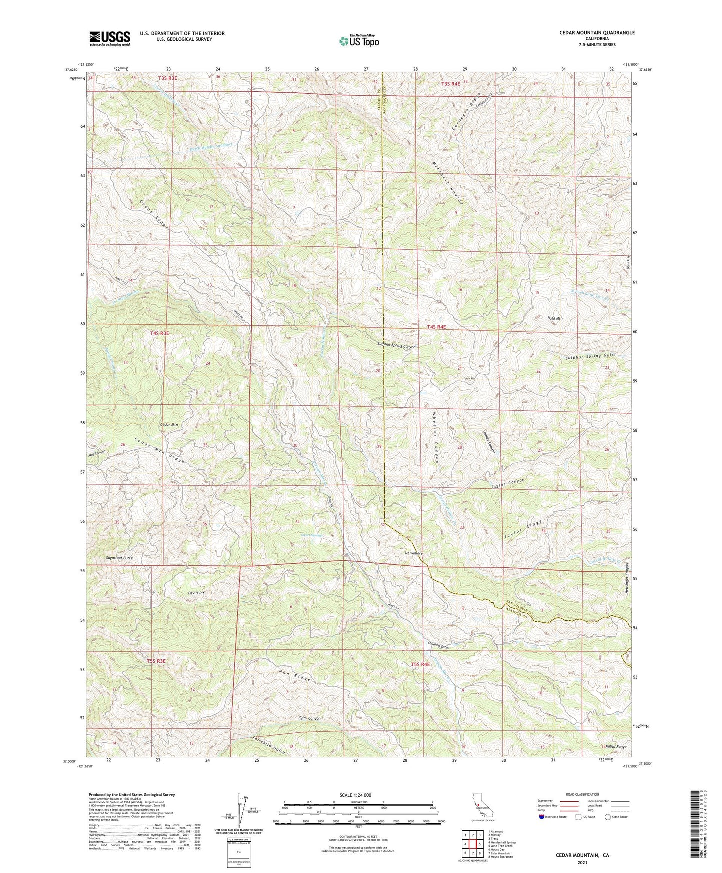
2021 topographic map quadrangle Cedar Mountain in the state of California. Scale: 1:24000. Based on the newly updated USGS 7.5' US Topo map series, this map is in the following counties: Alameda, San Joaquin. The map contains contour data, water features, and other items you are used to seeing on USGS maps, but also has updated roads and other features. This is the next generation of topographic maps. Printed on high-quality waterproof paper with UV fade-resistant inks.
Quads adjacent to this one:
West: Mendenhall Springs
Northwest: Altamont
North: Midway
Northeast: Tracy
East: Lone Tree Creek
Southeast: Mount Boardman
South: Eylar Mountain
Southwest: Mount Day
Contains the following named places: Bald Mountain, Buckeye Club, Callahan Gulch, Carnegie Ridge, Cedar Mountain, Cedar Mountain Ridge, Crane Ridge, Devils Pit, Eagle Mountain, Fairchild Gulch, Fourteenmile House, Halfway House, James Canyon, Mitchell Shaft, Mount Wallace, Pointers Homestead, Rancho Los Mochos, Sugarloaf Butte, Sulphur Spring Canyon, Sweet Springs, Taylor Canyon, Taylor Ridge, Wheeler Canyon, ZIP Code: 94550