MyTopo
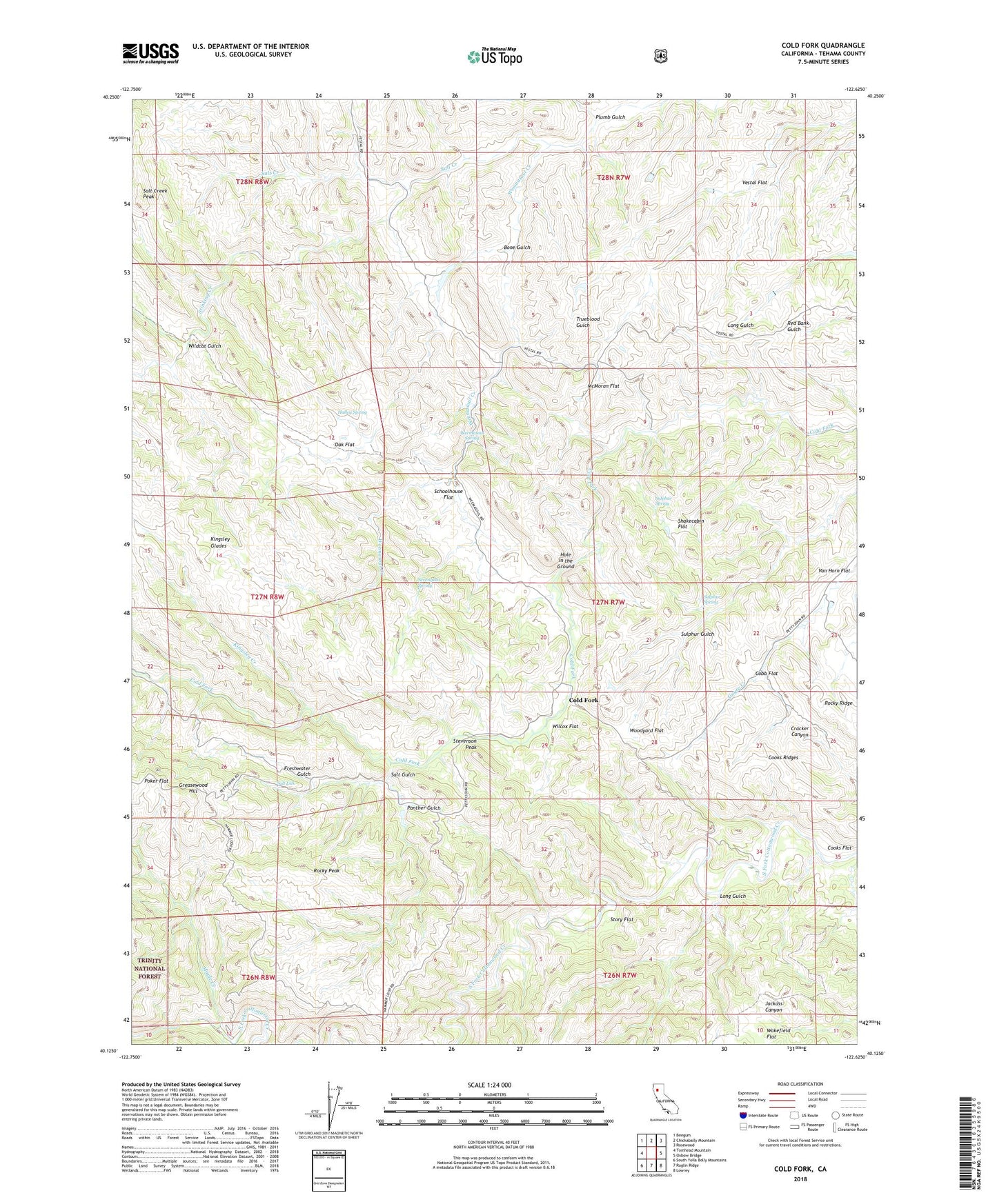
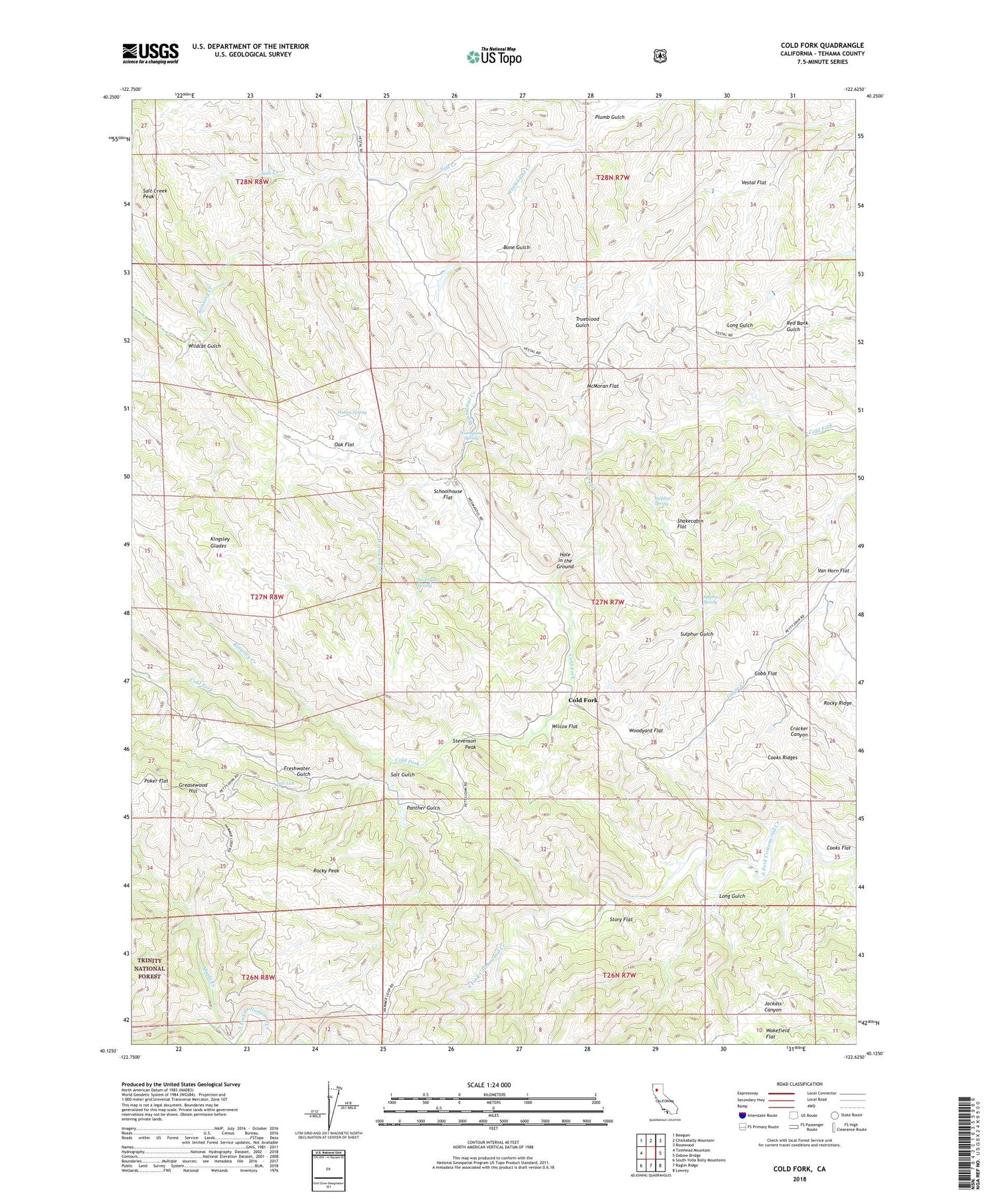
Cold Fork California US Topo Map
Couldn't load pickup availability
Also explore the Cold Fork Forest Service Topo of this same quad for updated USFS data
2022 topographic map quadrangle Cold Fork in the state of California. Scale: 1:24000. Based on the newly updated USGS 7.5' US Topo map series, this map is in the following counties: Tehama. The map contains contour data, water features, and other items you are used to seeing on USGS maps, but also has updated roads and other features. This is the next generation of topographic maps. Printed on high-quality waterproof paper with UV fade-resistant inks.
Quads adjacent to this one:
West: Tomhead Mountain
Northwest: Beegum
North: Chickabally Mountain
Northeast: Rosewood
East: Oxbow Bridge
Southeast: Lowrey
South: Raglin Ridge
Southwest: South Yolla Bolly Mountains
This map covers the same area as the classic USGS quad with code o40122b6.
Contains the following named places: Alford Place, Bayles Place, Bone Gulch, Burrill Homestead, Cobb Flat, Cold Fork, Cooks Flat, Cooks Ridges, El Rancho Rio Frio, Freshwater Gulch, Goat Camp, Greasewood Hill, Halley Grade, Halley Spring, Haven Place, Heitman Place, Hole in the Ground, Kingsley Creek, Kingsley Glades, Lanyan Trail, Long Gulch, Maple Creek, McMoran Flat, Oak Flat, Panther Gulch, Pettyjohn Place, Plumb Gulch, Poker Flat, Rocky Peak, Salt Creek Peak, Salt Gulch, Salt Lick, Schoolhouse Flat, Sevenglass Spring, Shackleford Place, Shakecabin Flat, Skinner Mill Place, Stevenson Peak, Stinking Creek, Story Flat, Sulphur Spring, Van Horn Flat, Vestal Flat, Weemasoul Creek, Weemasoul Spring, Widow Wilson Field, Wilcox Flat, Wildcat Gulch, Woodyard Flat