MyTopo
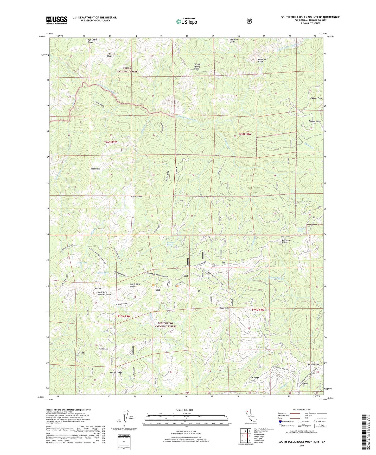
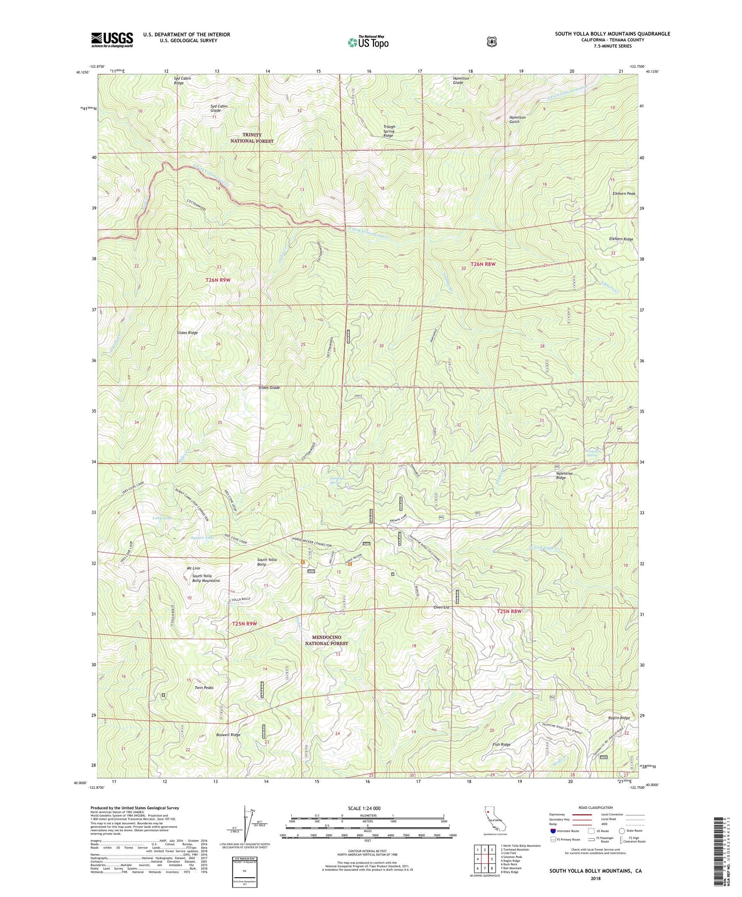
South Yolla Bolly Mountains California US Topo Map
Couldn't load pickup availability
Also explore the South Yolla Bolly Mountains Forest Service Topo of this same quad for updated USFS data
2021 topographic map quadrangle South Yolla Bolly Mountains in the state of California. Scale: 1:24000. Based on the newly updated USGS 7.5' US Topo map series, this map is in the following counties: Tehama. The map contains contour data, water features, and other items you are used to seeing on USGS maps, but also has updated roads and other features. This is the next generation of topographic maps. Printed on high-quality waterproof paper with UV fade-resistant inks.
Quads adjacent to this one:
West: Solomon Peak
Northwest: North Yolla Bolly Mountains
North: Tomhead Mountain
Northeast: Cold Fork
East: Raglin Ridge
Southeast: Riley Ridge
South: Ball Mountain
Southwest: Buck Rock
This map covers the same area as the classic USGS quad with code o40122a7.
Contains the following named places: Boswell Ridge, Browns Camp, Browns Camp Trailhead, Buck Creek, Burnt Camp, Cedar Basin Camp, Elkhorn Creek, Elkhorn Peak, Fish Ridge, Hamilton Glade, Hamilton Gulch, Harding Spring, Harvey Creek, Horsepacker Trailhead, Ideas Cove Traihead, Ides Cove, Long Lake, Mount Linn, Oven Lid, Plum Garden, Pole Corral, Prine Cabin, Raglin Ridge, Slides Creek, Slides Glade, Slides Ridge, South Yolla Bolly Mountains, Square Lake, Sulphur Creek, Syd Cabin Glade, Thunder Camp, Toomes Camp, Trough Spring Ridge, Twin Peaks, Valentine Ridge, Valentine Spring