MyTopo
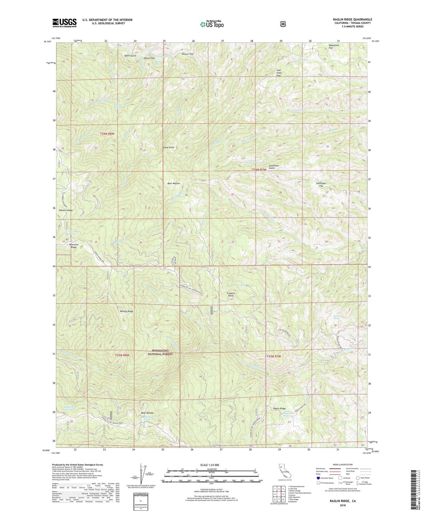
Raglin Ridge California US Topo Map
Couldn't load pickup availability
Also explore the Raglin Ridge Forest Service Topo of this same quad for updated USFS data
2021 topographic map quadrangle Raglin Ridge in the state of California. Scale: 1:24000. Based on the newly updated USGS 7.5' US Topo map series, this map is in the following counties: Tehama. The map contains contour data, water features, and other items you are used to seeing on USGS maps, but also has updated roads and other features. This is the next generation of topographic maps. Printed on high-quality waterproof paper with UV fade-resistant inks.
Quads adjacent to this one:
West: South Yolla Bolly Mountains
Northwest: Tomhead Mountain
North: Cold Fork
Northeast: Oxbow Bridge
East: Lowrey
Southeast: Paskenta
South: Riley Ridge
Southwest: Ball Mountain
This map covers the same area as the classic USGS quad with code o40122a6.
Contains the following named places: Alder Creek, Basin Creek, Bear Wallow, Bear Wallow Spring, Biscuit Flat, Brush Creek, Buck Creek, Copple Place, Dry Lake, Elkhorn Creek, Elkhorn Ridge, Franklin Point, Grau Mine, Hammer Place, Hensley Creek, Hensley Springs, Last Feed Flat, Little Basin Creek, Love Cabin Spring, Mary Ellen Place, North Fork Dry Creek, North Fork Hensley Creek, Pepperwood Spring, Pine Spring, Quail Gulch, Raspberry Camp, Raspberry Camp Spring, Salt Lick Spring, Secret Flat, South Fork Dry Creek, South Fork Hensley Creek, Sulphur Spring, Sunflower Flat, Sunflower Trail, Twin Springs, Wakefield Flat, Watson, West Tehama Division, Whisky Ridge