MyTopo
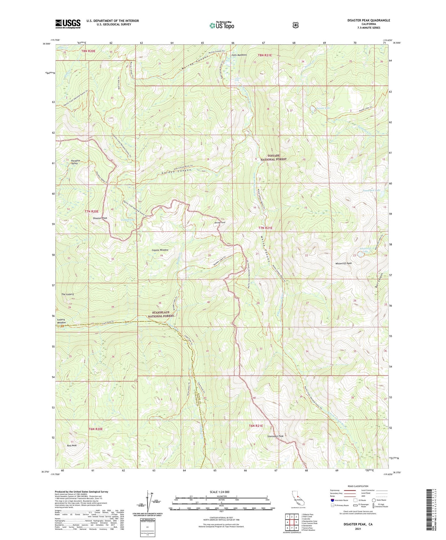
Disaster Peak California US Topo Map
Couldn't load pickup availability
Also explore the Disaster Peak Forest Service Topo of this same quad for updated USFS data
2021 topographic map quadrangle Disaster Peak in the state of California. Scale: 1:24000. Based on the newly updated USGS 7.5' US Topo map series, this map is in the following counties: Alpine, Tuolumne. The map contains contour data, water features, and other items you are used to seeing on USGS maps, but also has updated roads and other features. This is the next generation of topographic maps. Printed on high-quality waterproof paper with UV fade-resistant inks.
Quads adjacent to this one:
West: Dardanelles Cone
Northwest: Ebbetts Pass
North: Wolf Creek
Northeast: Coleville
East: Lost Cannon Peak
Southeast: Pickel Meadow
South: Sonora Pass
Southwest: Dardanelle
This map covers the same area as the classic USGS quad with code o38119d6.
Contains the following named places: Boulder Creek, Boulder Lake, Boulder Peak, Carson Falls, Carson-Iceberg Wilderness, Coyote Meadow, Disaster Peak, Elder Creek, Falls Meadows, Golden Canyon, Golden Lake, Iceberg Meadow, Murray Canyon, Paradise Valley, Poison Lake, Red Peak, Stanislaus Peak, Tamarack Lake, The Iceberg, White Canyon, Whitecliff Lake, Whitecliff Peak