MyTopo
Copperopolis California US Topo Map
Couldn't load pickup availability
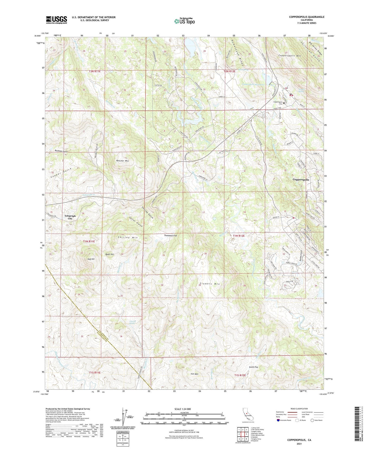
2023 topographic map quadrangle Copperopolis in the state of California. Scale: 1:24000. Based on the newly updated USGS 7.5' US Topo map series, this map is in the following counties: Calaveras, Stanislaus. The map contains contour data, water features, and other items you are used to seeing on USGS maps, but also has updated roads and other features. This is the next generation of topographic maps. Printed on high-quality waterproof paper with UV fade-resistant inks.
Quads adjacent to this one:
West: Bachelor Valley
Northwest: Jenny Lind
North: Salt Spring Valley
Northeast: Angels Camp
East: New Melones Dam
Southeast: Keystone
South: Knights Ferry
Southwest: Oakdale
This map covers the same area as the classic USGS quad with code o37120h6.
Contains the following named places: Big Springs Creek, Boucher Mountain, Churchs Spring, Clover Creek, Collier Mine, Copper Cove Village, Copperopolis, Copperopolis 1024 Dam, Copperopolis Cemetery, Copperopolis Census Designated Place, Copperopolis Elementary School, Copperopolis Fire Protection District Station 1 Headquarters, Copperopolis Fire Protection District Station 2, Copperopolis Mountain, Copperopolis Post Office, Copperopolis Reservoir, Department of Forestry and Fire Protection Copperopolis, Discovery Mine, Empire Mine, Flowers Mountain, Gold Knoll Mine, Gopher Hill Mine, Hicks Spring, Hodson, Hog Hill, Homestead Ridge, Iron Mountain, Keystone Mine, Little Quail Hill Mine, McCarty Creek, McCarty Mine, McNulty Mine, Mountain King 501 Dam, Napoleon Mine, North Keystone Mine, Penny Creek, Pioneer Mine, Quail Hill, Quail Hill Mine, R N Flower 507 Dam, Ramsey Gulch, Rocky Creek, Sailor Gulch, Shirley Mountain, Shirley Queen Mine, Skyrocket Mine, Smith Flat, South Shaft, Star, Tecumseh Mine, Telegraph City, Texas Gulch, Thompson Flat, Turners Spring, Underwood Creek, Union Mine, Wilbur Womble Mine, ZIP Code: 95228