MyTopo
Knights Ferry California US Topo Map
Couldn't load pickup availability
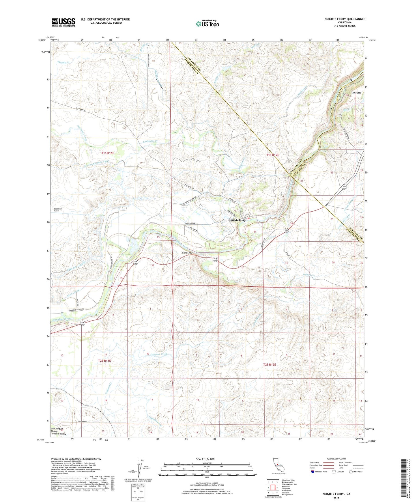
2021 topographic map quadrangle Knights Ferry in the state of California. Scale: 1:24000. Based on the newly updated USGS 7.5' US Topo map series, this map is in the following counties: Stanislaus, Calaveras, Tuolumne. The map contains contour data, water features, and other items you are used to seeing on USGS maps, but also has updated roads and other features. This is the next generation of topographic maps. Printed on high-quality waterproof paper with UV fade-resistant inks.
Quads adjacent to this one:
West: Oakdale
Northwest: Bachelor Valley
North: Copperopolis
Northeast: New Melones Dam
East: Keystone
Southeast: Cooperstown
South: Paulsell
Southwest: Waterford
This map covers the same area as the classic USGS quad with code o37120g6.
Contains the following named places: Arnold, Cape Horn Lateral, Cape Horn Tunnel, Cashman Dam, Goodwin Dam, Knights Ferry, Knights Ferry Census Designated Place, Knights Ferry Elementary School, Knights Ferry Recreation Area, Littlejohns Dam, Lovers Leap, Morrison Siphon Lateral, North Fork Wildcat Creek, North San Joaquin Main Canal, Oak Grove Cemetery, Oakdale Rural Fire Protection District Station 3, Orange Blossom, Orange Blossom Census Designated Place, Orange Blossom School, Owl Creek, Peachys Creek, Smith Creek, South Fork Wildcat Creek, Stanislaus County Sheriff's Office Knights Ferry, Wildcat Creek, Wills Lateral