MyTopo
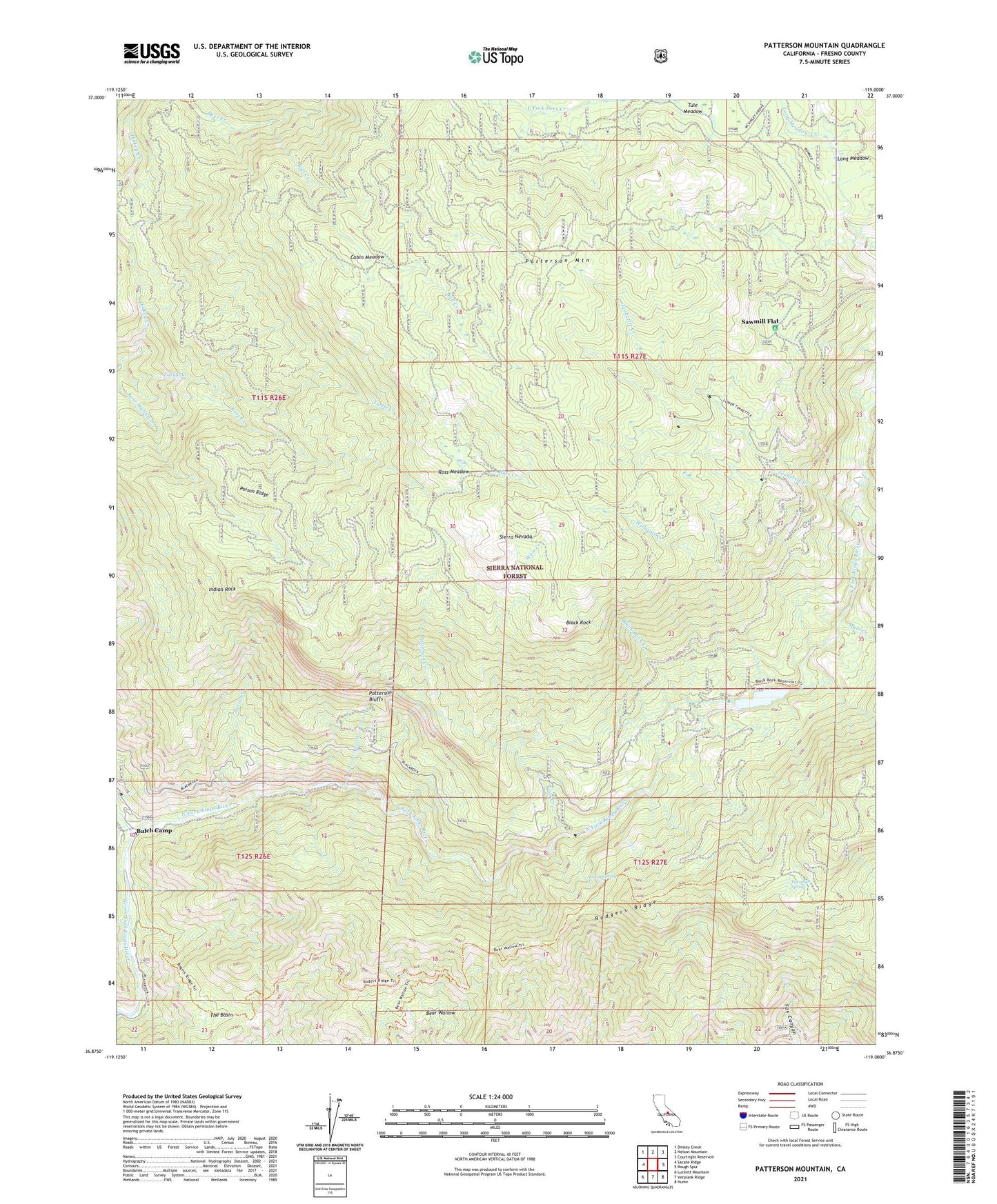
Patterson Mountain California US Topo Map
Couldn't load pickup availability
Also explore the Patterson Mountain Forest Service Topo of this same quad for updated USFS data
2021 topographic map quadrangle Patterson Mountain in the state of California. Scale: 1:24000. Based on the newly updated USGS 7.5' US Topo map series, this map is in the following counties: Fresno. The map contains contour data, water features, and other items you are used to seeing on USGS maps, but also has updated roads and other features. This is the next generation of topographic maps. Printed on high-quality waterproof paper with UV fade-resistant inks.
Quads adjacent to this one:
West: Sacate Ridge
Northwest: Dinkey Creek
North: Nelson Mountain
Northeast: Courtright Reservoir
East: Rough Spur
Southeast: Hume
South: Verplank Ridge
Southwest: Luckett Mountain
This map covers the same area as the classic USGS quad with code o36119h1.
Contains the following named places: Balch Afterbay 95-002 Dam, Balch Camp, Balch Diversion 95-000 Dam, Balch Penstock, Balch Powerhouse, Balch Tunnel, Basin Creek, Bear Wallow, Black Rock, Black Rock Campground, Black Rock Creek, Black Rock Reservoir, Black Rock Station, Bull Creek, Cabin Meadow, Deer Creek, Dinkey Creek, Haas Penstock, Haas Powerhouse, Haas Tunnel, House Meadow Creek, Indian Rock, Long Meadow, Lousy Spring, Mule Creek, Patterson Bluffs, Patterson Creek, Patterson Mountain, Poison Ridge, Rancheria Creek, Ross Crossing Campground, Ross Meadow, Sawmill Flat, Sawmill Flat Campground, Teakettle Creek, Teakettle Experiment Area, The Basin, Turtle Creek, Weir Creek, West Fork Long Meadow Creek, Wiesman Spring, Williams Creek